Property Record
485 State Highway 31 E, Trinidad, TX 75163

NEARBY LISTINGS FOR SALE OR LEASE
Property Detail
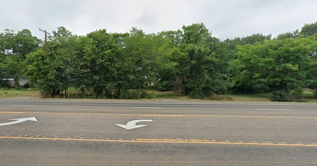
485 State Highway 31 E
Athens, TX
N Addison Sur
0017-2190-0000-81
TR 219 AB 17 N ADDISON SUR, TR 219
Vacantlandnec
Henderson
X
Texas
48349C0275D
0.22 AC
2024
Henderson County
2025
Dallas/Ft Worth
950902
DEMOGRAPHICS near 485 State Highway 31 E
1 Mile
3 Mile
5 Mile
2024 Total Population
483
791
5,419
2029 Population
525
865
6,272
Pop Growth 2024-2029
+ 8.70%
+ 9.36%
+ 15.74%
Average Age
43
43
47
2024 Total Households
197
325
2,313
HH Growth 2024-2029
+ 9.14%
+ 9.23%
+ 16.26%
Median Household Inc
$49,820
$49,890
$57,521
Avg Household Size
2.50
2.40
2.30
2024 Avg HH Vehicles
2.00
2.00
2.00
Median Home Value
$136,111
$142,982
$280,262
Median Year Built
1973
1973
1985
Nearby Places
Map Layers
Map Styles
 Street
 Aerial
- Restaurants
- Banks
- Shops
- Fitness
- Groceries
PUBLIC TRANSPORTATION
AIRPORT
Tyler Pounds Regional
DRIVE
WALK
Distance
Tyler Pounds Regional
49 min
35.5 mi
Freight Ports
Port of Shreveport
DRIVE
WALK
Distance
Port of Shreveport
168 min
144.3 mi
SALE & LEASE HISTORY
LISTING DATE
SALE/LEASE

Apr 24, 2025
For Sale
Nearby Properties
Address
Land Use
TOTAL SIZE
Lot Size
Zoning
Address
Land Use
TOTAL SIZE
Lot Size
Zoning
119,750 SF
37.85 AC
Address
Land Use
TOTAL SIZE
Lot Size
Zoning
40.91 AC
Address
Land Use
TOTAL SIZE
Lot Size
Zoning
8.02 AC
Address
Land Use
TOTAL SIZE
Lot Size
Zoning
43,612 SF
15.43 AC
Address
Land Use
TOTAL SIZE
Lot Size
Zoning
2,254.90 AC
Address
Land Use
TOTAL SIZE
Lot Size
Zoning
1.02 AC
Address
Land Use
TOTAL SIZE
Lot Size
Zoning
49,353 SF
37.85 AC
Address
Land Use
TOTAL SIZE
Lot Size
Zoning
14,475 SF
12.39 AC
Address
Land Use
TOTAL SIZE
Lot Size
Zoning
17.50 AC
Address
Land Use
TOTAL SIZE
Lot Size
Zoning
29,984 SF
7.79 AC
Address
Land Use
TOTAL SIZE
Lot Size
Zoning
47,400 SF
15.33 AC
Address
Land Use
TOTAL SIZE
Lot Size
Zoning
69,056 SF
16.02 AC
Address
Land Use
TOTAL SIZE
Lot Size
Zoning
32,077 SF
0.25 AC
Address
Land Use
TOTAL SIZE
Lot Size
Zoning
83,122 SF
5.42 AC
Address
Land Use
TOTAL SIZE
Lot Size
Zoning
38,975 SF
4.61 AC
Address
Land Use
TOTAL SIZE
Lot Size
Zoning
40,549 SF
9.36 AC
Address
Land Use
TOTAL SIZE
Lot Size
Zoning
28,963 SF
10.11 AC
Address
Land Use
TOTAL SIZE
Lot Size
Zoning
66,395 SF
13.77 AC
Address
Land Use
TOTAL SIZE
Lot Size
Zoning
20,883 SF
4.40 AC
Address
Land Use
TOTAL SIZE
Lot Size
Zoning
22,958 SF
1.94 AC
Address
Land Use
TOTAL SIZE
Lot Size
Zoning
151,225 SF
Address
Land Use
TOTAL SIZE
Lot Size
Zoning
64,650 SF
11.56 AC
Address
Land Use
TOTAL SIZE
Lot Size
Zoning
25,962 SF
4.23 AC
Address
Land Use
TOTAL SIZE
Lot Size
Zoning
17,262 SF
17.41 AC
Address
Land Use
TOTAL SIZE
Lot Size
Zoning
11,381 SF
1.87 AC
Address
Land Use
TOTAL SIZE
Lot Size
Zoning
52,792 SF
22.40 AC
Address
Land Use
TOTAL SIZE
Lot Size
Zoning
47,204 SF
5.61 AC
Address
Land Use
TOTAL SIZE
Lot Size
Zoning
19,505 SF
24.43 AC
Address
Land Use
TOTAL SIZE
Lot Size
Zoning
58,355 SF
7.49 AC
Address
Land Use
TOTAL SIZE
Lot Size
Zoning
46,283 SF
2.67 AC
The World's #1 Commercial Real Estate Marketplace
Connect with us
© 2025 CoStar Group
The information above has been obtained from sources believed reliable. While we do not doubt its accuracy we have not verified it and make no guarantee, warranty or representation about it. It is your responsibility to independently confirm its accuracy and completeness. Any projections, opinions, assumptions, or estimates used are for example only and do not represent the current or future performance of the property. The value of this transaction to you depends on tax and other factors which should be evaluated by your tax, financial, and legal advisors. You and your advisors should conduct a careful, independent investigation of the property to determine to your satisfaction the suitability of the property for your needs.