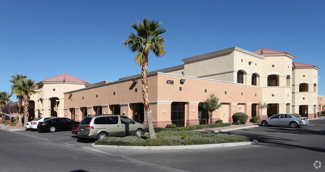
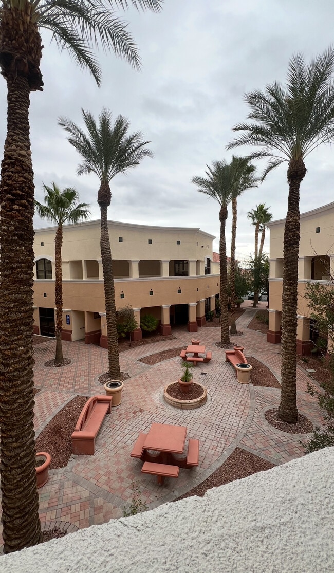
Property Record
4785 S Durango Dr, Las Vegas, NV 89147


Current Lease Availabilities
Property Detail
4785 S Durango Dr
163-20-819-009
DURANGO BUSINESS PARK PLAT BOOK 100 PAGE 73 PT UNNUMBERED LOT
Commercialnec
Clark
CP
Nevada
C and X Area of minimal flood hazard, usually depicted on FIRMs as above the 500-year flood level.
0.69 AC
2026
Southwest Las Vegas
2026
Las Vegas
005813
Las Vegas-Henderson-North Las Vegas, NV
10,006 SF
NEARBY LISTINGS FOR SALE OR LEASE
DEMOGRAPHICS near 4785 S Durango Dr
1 mile
3 mile
5 mile
2025 Total Population
20,897
180,722
396,513
2030 Population
22,164
190,239
418,327
Pop Growth 2025-2030
+ 6.06%
+ 5.27%
+ 5.50%
Average Age
42
41
41
2025 Total Households
8,261
72,122
158,170
HH Growth 2025-2030
+ 6.20%
+ 5.32%
+ 5.46%
Median Household Inc
$90,865
$82,141
$75,970
Avg Household Size
2.50
2.50
2.50
2025 Avg HH Vehicles
2.00
2.00
2.00
Median Home Value
$486,119
$465,014
$470,392
Median Year Built
1998
1999
1997
Nearby Places
Map Layers
Map Styles
 Street
 Aerial
Layers
 Traffic
 Biking
Places
Listings with unknown addresses are not visible on the map
- Restaurants
- Banks
- Shops
- Fitness
- Groceries
PUBLIC TRANSPORTATION
AIRPORT
Harry Reid International
Drive
Walk
Distance
Harry Reid International
16 min
8.8 mi
Boulder City Municipal
Drive
Walk
Distance
Boulder City Municipal
42 min
31.6 mi
Freight Ports
Port of Long Beach
Drive
Walk
Distance
Port of Long Beach
319 min
283.6 mi
Nearby Properties
Address
Land Use
TOTAL SIZE
Lot Size
Zoning
Address
Land Use
TOTAL SIZE
Lot Size
Zoning
552,417 SF
49.39 AC
H1
Address
Land Use
TOTAL SIZE
Lot Size
Zoning
205,752 SF
36.24 AC
C1
Address
Land Use
TOTAL SIZE
Lot Size
Zoning
412,086 SF
33.58 AC
CP
Address
Land Use
TOTAL SIZE
Lot Size
Zoning
174,108 SF
52.16 AC
RU
Address
Land Use
TOTAL SIZE
Lot Size
Zoning
40 AC
PF
Address
Land Use
TOTAL SIZE
Lot Size
Zoning
466,224 SF
11.85 AC
C:C-2
Address
Land Use
TOTAL SIZE
Lot Size
Zoning
Address
Land Use
TOTAL SIZE
Lot Size
Zoning
349,295 SF
25.97 AC
Address
Land Use
TOTAL SIZE
Lot Size
Zoning
Address
Land Use
TOTAL SIZE
Lot Size
Zoning
8,754 SF
17.14 AC
C2
Address
Land Use
TOTAL SIZE
Lot Size
Zoning
9,279 SF
24.36 AC
Address
Land Use
TOTAL SIZE
Lot Size
Zoning
504,632 SF
6.25 AC
Address
Land Use
TOTAL SIZE
Lot Size
Zoning
6,142 SF
13.96 AC
C2
Address
Land Use
TOTAL SIZE
Lot Size
Zoning
151,243 SF
22.93 AC
Address
Land Use
TOTAL SIZE
Lot Size
Zoning
401,023 SF
17.61 AC
R-3
Address
Land Use
TOTAL SIZE
Lot Size
Zoning
4,542 SF
18.72 AC
Address
Land Use
TOTAL SIZE
Lot Size
Zoning
12,349 SF
12.50 AC
Address
Land Use
TOTAL SIZE
Lot Size
Zoning
396,742 SF
17.10 AC
Address
Land Use
TOTAL SIZE
Lot Size
Zoning
Address
Land Use
TOTAL SIZE
Lot Size
Zoning
1,961 SF
4.34 AC
Address
Land Use
TOTAL SIZE
Lot Size
Zoning
398,545 SF
20.40 AC
Address
Land Use
TOTAL SIZE
Lot Size
Zoning
5,374 SF
12.36 AC
Address
Land Use
TOTAL SIZE
Lot Size
Zoning
220,718 SF
3.99 AC
C2
Address
Land Use
TOTAL SIZE
Lot Size
Zoning
43,264 SF
3.56 AC
Address
Land Use
TOTAL SIZE
Lot Size
Zoning
7,302 SF
9.21 AC
Address
Land Use
TOTAL SIZE
Lot Size
Zoning
322,127 SF
9.32 AC
Address
Land Use
TOTAL SIZE
Lot Size
Zoning
4,382 SF
13.65 AC
C2
Address
Land Use
TOTAL SIZE
Lot Size
Zoning
4,446 SF
16.17 AC
Address
Land Use
TOTAL SIZE
Lot Size
Zoning
485,241 SF
13.77 AC
R3
Address
Land Use
TOTAL SIZE
Lot Size
Zoning
230,530 SF
15.20 AC
The World's #1 Commercial Real Estate Marketplace
Connect with us
© 2026 CoStar Group
The information above has been obtained from sources believed reliable. While we do not doubt its accuracy we have not verified it and make no guarantee, warranty or representation about it. It is your responsibility to independently confirm its accuracy and completeness. Any projections, opinions, assumptions, or estimates used are for example only and do not represent the current or future performance of the property. The value of this transaction to you depends on tax and other factors which should be evaluated by your tax, financial, and legal advisors. You and your advisors should conduct a careful, independent investigation of the property to determine to your satisfaction the suitability of the property for your needs.