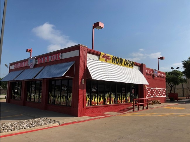
Property Record
480 Grapevine Hwy, Hurst, TX 76054


Property Detail
480 Grapevine Hwy
06620868
NORWOOD NORTH BLOCK 1 TRACT B1
Commercialnec
Tarrant
B and X Area of moderate flood hazard, usually the area between the limits of the 100-year and 500-year floods.
Texas
2024
0.64 AC
2025
Hurst/Euless/Bedford
113611
Dallas/Ft Worth
3,291 SF
Dallas-Fort Worth-Arlington, TX
NEARBY LISTINGS FOR SALE OR LEASE
-
-
-
-
-
-
-
-
No Photo
-
-
-
-
-
-
-
-
-
View all Hurst listings for lease on LoopNet.com
DEMOGRAPHICS near 480 Grapevine Hwy
1 mile
3 mile
5 mile
2025 Total Population
9,327
100,370
286,934
2030 Population
9,691
105,094
300,749
Pop Growth 2025-2030
+ 3.90%
+ 4.71%
+ 4.81%
Average Age
46
42
40
2025 Total Households
3,646
39,871
109,125
HH Growth 2025-2030
+ 4.09%
+ 4.87%
+ 4.99%
Median Household Inc
$114,034
$97,132
$97,934
Avg Household Size
2.50
2.50
2.60
2025 Avg HH Vehicles
2.00
2.00
2.00
Median Home Value
$413,049
$400,895
$392,472
Median Year Built
1985
1983
1986
Nearby Places
Map Layers
Map Styles
 Street
 Aerial
Layers
 Traffic
 Biking
Places
Listings with unknown addresses are not visible on the map
- Restaurants
- Banks
- Shops
- Fitness
- Groceries
PUBLIC TRANSPORTATION
COMMUTER RAIL
Trinity Lakes Station (TRINITY RAILWAY - Dallas Area Rapid Transit (DART))
Drive
Walk
Distance
Trinity Lakes Station (TRINITY RAILWAY - Dallas Area Rapid Transit (DART))
10 min
5.6 mi
Bell Station (TRINITY RAILWAY - Dallas Area Rapid Transit (DART))
Drive
Walk
Distance
Bell Station (TRINITY RAILWAY - Dallas Area Rapid Transit (DART))
13 min
6.2 mi
AIRPORT
Dallas-Fort Worth International
Drive
Walk
Distance
Dallas-Fort Worth International
21 min
12.7 mi
Dallas Love Field
Drive
Walk
Distance
Dallas Love Field
34 min
24.3 mi
Freight Ports
Port of Shreveport
Drive
Walk
Distance
Port of Shreveport
244 min
223.6 mi
SALE & LEASE HISTORY
LISTING DATE
SALE/LEASE

May 22, 2018
For Sale
Mar 12, 2020
For Lease
Feb 02, 2017
For Lease
Nearby Properties
Address
Land Use
TOTAL SIZE
Lot Size
Zoning
Address
Land Use
TOTAL SIZE
Lot Size
Zoning
1,300,314 SF
40.15 AC
Address
Land Use
TOTAL SIZE
Lot Size
Zoning
285,754 SF
69.41 AC
Address
Land Use
TOTAL SIZE
Lot Size
Zoning
356,000 SF
39.44 AC
Address
Land Use
TOTAL SIZE
Lot Size
Zoning
521,150 SF
92.05 AC
Address
Land Use
TOTAL SIZE
Lot Size
Zoning
388,447 SF
9.47 AC
Address
Land Use
TOTAL SIZE
Lot Size
Zoning
348,941 SF
22.25 AC
Address
Land Use
TOTAL SIZE
Lot Size
Zoning
240,154 SF
6.92 AC
Address
Land Use
TOTAL SIZE
Lot Size
Zoning
79,244 SF
54.50 AC
Address
Land Use
TOTAL SIZE
Lot Size
Zoning
236,701 SF
15.96 AC
Address
Land Use
TOTAL SIZE
Lot Size
Zoning
208,238 SF
12.55 AC
Address
Land Use
TOTAL SIZE
Lot Size
Zoning
197,964 SF
4.57 AC
Address
Land Use
TOTAL SIZE
Lot Size
Zoning
235,530 SF
13.21 AC
Address
Land Use
TOTAL SIZE
Lot Size
Zoning
221,591 SF
14.50 AC
Address
Land Use
TOTAL SIZE
Lot Size
Zoning
220,650 SF
3.03 AC
Address
Land Use
TOTAL SIZE
Lot Size
Zoning
161,332 SF
8.56 AC
Address
Land Use
TOTAL SIZE
Lot Size
Zoning
151,023 SF
5.18 AC
Address
Land Use
TOTAL SIZE
Lot Size
Zoning
160,608 SF
8.29 AC
Address
Land Use
TOTAL SIZE
Lot Size
Zoning
199,744 SF
9.99 AC
Address
Land Use
TOTAL SIZE
Lot Size
Zoning
165,762 SF
10.71 AC
Address
Land Use
TOTAL SIZE
Lot Size
Zoning
191,235 SF
10.93 AC
Address
Land Use
TOTAL SIZE
Lot Size
Zoning
158,761 SF
8.91 AC
Address
Land Use
TOTAL SIZE
Lot Size
Zoning
151,550 SF
8.73 AC
Address
Land Use
TOTAL SIZE
Lot Size
Zoning
139,440 SF
5.97 AC
Address
Land Use
TOTAL SIZE
Lot Size
Zoning
90,884 SF
10.85 AC
Address
Land Use
TOTAL SIZE
Lot Size
Zoning
181,988 SF
8.10 AC
Address
Land Use
TOTAL SIZE
Lot Size
Zoning
195,085 SF
8.81 AC
Address
Land Use
TOTAL SIZE
Lot Size
Zoning
112,501 SF
7.87 AC
Address
Land Use
TOTAL SIZE
Lot Size
Zoning
162,898 SF
8.68 AC
Address
Land Use
TOTAL SIZE
Lot Size
Zoning
128,912 SF
7.60 AC
Address
Land Use
TOTAL SIZE
Lot Size
Zoning
161,346 SF
10.28 AC
The World's #1 Commercial Real Estate Marketplace
Connect with us
© 2026 CoStar Group
The information above has been obtained from sources believed reliable. While we do not doubt its accuracy we have not verified it and make no guarantee, warranty or representation about it. It is your responsibility to independently confirm its accuracy and completeness. Any projections, opinions, assumptions, or estimates used are for example only and do not represent the current or future performance of the property. The value of this transaction to you depends on tax and other factors which should be evaluated by your tax, financial, and legal advisors. You and your advisors should conduct a careful, independent investigation of the property to determine to your satisfaction the suitability of the property for your needs.