Property Record
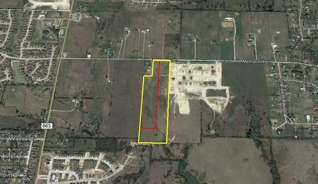
480 Mcalpin Rd, Midlothian, TX 76065

Property Detail
480 Mcalpin Rd
Dallas-Fort Worth-Arlington, TX
525 A HOWELL 24.989 ACRES
231050
ELLIS
Farms
Texas
B and X Area of moderate flood hazard, usually the area between the limits of the 100-year and 500-year floods.
24.99 AC
2024
Ellis County
2025
Dallas/Ft Worth
060801
NEARBY LISTINGS FOR SALE OR LEASE
-
-
View all Midlothian listings for sale on LoopNet.com
DEMOGRAPHICS near 480 Mcalpin Rd
1 mile
3 mile
5 mile
2025 Total Population
1,283
11,794
34,726
2030 Population
1,511
13,843
40,844
Pop Growth 2025-2030
+ 17.77%
+ 17.37%
+ 17.62%
Average Age
39
39
38
2025 Total Households
408
3,793
11,519
HH Growth 2025-2030
+ 17.89%
+ 17.59%
+ 17.85%
Median Household Inc
$175,905
$159,621
$120,571
Avg Household Size
3.20
3.10
3.00
2025 Avg HH Vehicles
3.00
3.00
3.00
Median Home Value
$494,370
$473,242
$456,482
Median Year Built
2008
2008
2008
Nearby Places
Map Layers
Map Styles
 Street
 Aerial
Transit
 Traffic
 Biking
Places
Listings with unknown addresses are not visible on the map
- Restaurants
- Banks
- Shops
- Fitness
- Groceries
SALE & LEASE HISTORY
LISTING DATE
SALE/LEASE

Dec 07, 2017
For Sale
Nearby Properties
Address
Land Use
TOTAL SIZE
Lot Size
Zoning
Address
Land Use
TOTAL SIZE
Lot Size
Zoning
261,401 SF
891.60 AC
Address
Land Use
TOTAL SIZE
Lot Size
Zoning
98,001 SF
14.51 AC
Address
Land Use
TOTAL SIZE
Lot Size
Zoning
90,377 SF
27.54 AC
Address
Land Use
TOTAL SIZE
Lot Size
Zoning
90,000 SF
12.20 AC
Address
Land Use
TOTAL SIZE
Lot Size
Zoning
117,457 SF
11.24 AC
Address
Land Use
TOTAL SIZE
Lot Size
Zoning
756 AC
Address
Land Use
TOTAL SIZE
Lot Size
Zoning
118,641 SF
12.07 AC
Address
Land Use
TOTAL SIZE
Lot Size
Zoning
7,916 SF
97.54 AC
Address
Land Use
TOTAL SIZE
Lot Size
Zoning
55,720 SF
1.83 AC
Address
Land Use
TOTAL SIZE
Lot Size
Zoning
85,530 SF
11.68 AC
Address
Land Use
TOTAL SIZE
Lot Size
Zoning
17,625 SF
2.84 AC
Address
Land Use
TOTAL SIZE
Lot Size
Zoning
20,329 SF
3.47 AC
Address
Land Use
TOTAL SIZE
Lot Size
Zoning
41,627 SF
20.68 AC
Address
Land Use
TOTAL SIZE
Lot Size
Zoning
15,288 SF
1.74 AC
Address
Land Use
TOTAL SIZE
Lot Size
Zoning
14,800 SF
1.77 AC
Address
Land Use
TOTAL SIZE
Lot Size
Zoning
60,559 SF
4.99 AC
Address
Land Use
TOTAL SIZE
Lot Size
Zoning
69,979 SF
14.79 AC
Address
Land Use
TOTAL SIZE
Lot Size
Zoning
10,800 SF
1.30 AC
Address
Land Use
TOTAL SIZE
Lot Size
Zoning
10,010 SF
2.21 AC
Address
Land Use
TOTAL SIZE
Lot Size
Zoning
42,000 SF
10.30 AC
Address
Land Use
TOTAL SIZE
Lot Size
Zoning
12.69 AC
Address
Land Use
TOTAL SIZE
Lot Size
Zoning
5,305 SF
1.73 AC
Address
Land Use
TOTAL SIZE
Lot Size
Zoning
12,400 SF
7.86 AC
Address
Land Use
TOTAL SIZE
Lot Size
Zoning
18.77 AC
Address
Land Use
TOTAL SIZE
Lot Size
Zoning
5,196 SF
1.70 AC
Address
Land Use
TOTAL SIZE
Lot Size
Zoning
748 SF
171.59 AC
Address
Land Use
TOTAL SIZE
Lot Size
Zoning
5,904 SF
1.57 AC
Address
Land Use
TOTAL SIZE
Lot Size
Zoning
5.54 AC
Address
Land Use
TOTAL SIZE
Lot Size
Zoning
7,844 SF
2.94 AC
Address
Land Use
TOTAL SIZE
Lot Size
Zoning
4,257 SF
1.69 AC
The World's #1 Commercial Real Estate Marketplace
Connect with us
© 2026 CoStar Group
The information above has been obtained from sources believed reliable. While we do not doubt its accuracy we have not verified it and make no guarantee, warranty or representation about it. It is your responsibility to independently confirm its accuracy and completeness. Any projections, opinions, assumptions, or estimates used are for example only and do not represent the current or future performance of the property. The value of this transaction to you depends on tax and other factors which should be evaluated by your tax, financial, and legal advisors. You and your advisors should conduct a careful, independent investigation of the property to determine to your satisfaction the suitability of the property for your needs.