Property Record
480 Workman Rd, Chattanooga, TN 37410

NEARBY LISTINGS FOR SALE OR LEASE
Property Detail
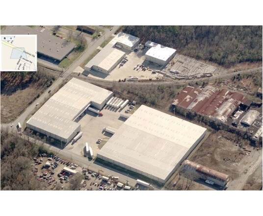
480 Workman Rd
167F-F-009
SW 1/4 SEC 10 TWP 3 R-4W
Warehouse
Hamilton
AE
Tennessee
47065C0456G
2.20 AC
2025
South
2025
Chattanooga
001900
Chattanooga, TN-GA
61,500 SF
DEMOGRAPHICS near 480 Workman Rd
1 mile
3 mile
5 mile
2024 Total Population
4,481
48,717
129,843
2029 Population
4,803
52,040
138,538
Pop Growth 2024-2029
+ 7.19%
+ 6.82%
+ 6.70%
Average Age
36
37
39
2024 Total Households
1,706
19,028
54,078
HH Growth 2024-2029
+ 7.33%
+ 6.96%
+ 7.03%
Median Household Inc
$24,580
$41,625
$45,203
Avg Household Size
2.50
2.50
2.30
2024 Avg HH Vehicles
1.00
2.00
2.00
Median Home Value
$104,455
$177,061
$185,915
Median Year Built
1962
1960
1966
Nearby Places
Map Layers
Map Styles
 Street
 Aerial
Transit
 Traffic
 Biking
Places
Listings with unknown addresses are not visible on the map
- Restaurants
- Banks
- Shops
- Fitness
- Groceries
PUBLIC TRANSPORTATION
AIRPORT
Lovell Field
Drive
Walk
Distance
Lovell Field
21 min
9.2 mi
Nearby Properties
Address
Land Use
TOTAL SIZE
Lot Size
Zoning
Address
Land Use
TOTAL SIZE
Lot Size
Zoning
296,016 SF
13.36 AC
R3
Address
Land Use
TOTAL SIZE
Lot Size
Zoning
182,932 SF
3.67 AC
M1
Address
Land Use
TOTAL SIZE
Lot Size
Zoning
306,411 SF
6.96 AC
Address
Land Use
TOTAL SIZE
Lot Size
Zoning
288,371 SF
9.39 AC
Address
Land Use
TOTAL SIZE
Lot Size
Zoning
Address
Land Use
TOTAL SIZE
Lot Size
Zoning
56,000 SF
5.13 AC
M1
Address
Land Use
TOTAL SIZE
Lot Size
Zoning
86.41 AC
R2
Address
Land Use
TOTAL SIZE
Lot Size
Zoning
262,721 SF
1.55 AC
C3
Address
Land Use
TOTAL SIZE
Lot Size
Zoning
8.42 AC
C3
Address
Land Use
TOTAL SIZE
Lot Size
Zoning
127,128 SF
1.50 AC
C3
Address
Land Use
TOTAL SIZE
Lot Size
Zoning
33.19 AC
M1
Address
Land Use
TOTAL SIZE
Lot Size
Zoning
202,748 SF
25.49 AC
M3
Address
Land Use
TOTAL SIZE
Lot Size
Zoning
1.61 AC
R2
Address
Land Use
TOTAL SIZE
Lot Size
Zoning
57,660 SF
2.67 AC
C3
Address
Land Use
TOTAL SIZE
Lot Size
Zoning
Address
Land Use
TOTAL SIZE
Lot Size
Zoning
458,265 SF
62.80 AC
M1
Address
Land Use
TOTAL SIZE
Lot Size
Zoning
428,595 SF
16.66 AC
M1
Address
Land Use
TOTAL SIZE
Lot Size
Zoning
55,289 SF
9.33 AC
C2
Address
Land Use
TOTAL SIZE
Lot Size
Zoning
76,301 SF
0.89 AC
C3
Address
Land Use
TOTAL SIZE
Lot Size
Zoning
217,754 SF
14.77 AC
M1
Address
Land Use
TOTAL SIZE
Lot Size
Zoning
172,053 SF
8.07 AC
M1
Address
Land Use
TOTAL SIZE
Lot Size
Zoning
25,954 SF
0.77 AC
M1
Address
Land Use
TOTAL SIZE
Lot Size
Zoning
37,044 SF
3.88 AC
UGC
Address
Land Use
TOTAL SIZE
Lot Size
Zoning
35,364 SF
1.16 AC
M1
Address
Land Use
TOTAL SIZE
Lot Size
Zoning
15,344 SF
13.14 AC
R3
Address
Land Use
TOTAL SIZE
Lot Size
Zoning
200,911 SF
13.21 AC
M1
Address
Land Use
TOTAL SIZE
Lot Size
Zoning
89,163 SF
4.11 AC
M1
Address
Land Use
TOTAL SIZE
Lot Size
Zoning
27,000 SF
2.65 AC
UGC
Address
Land Use
TOTAL SIZE
Lot Size
Zoning
170.32 AC
Address
Land Use
TOTAL SIZE
Lot Size
Zoning
55,500 SF
0.81 AC
M1
The World's #1 Commercial Real Estate Marketplace
Connect with us
© 2026 CoStar Group
The information above has been obtained from sources believed reliable. While we do not doubt its accuracy we have not verified it and make no guarantee, warranty or representation about it. It is your responsibility to independently confirm its accuracy and completeness. Any projections, opinions, assumptions, or estimates used are for example only and do not represent the current or future performance of the property. The value of this transaction to you depends on tax and other factors which should be evaluated by your tax, financial, and legal advisors. You and your advisors should conduct a careful, independent investigation of the property to determine to your satisfaction the suitability of the property for your needs.