Property Record
4872 Cecile Ave, Las Vegas, NV 89115


NEARBY LISTINGS FOR SALE OR LEASE
Property Detail
4872 Cecile Ave
Las Vegas-Henderson-North Las Vegas, NV
Marion Indst Park Phase 1
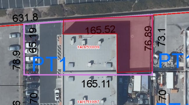
140-17-510-016
MARION INDST PARK PHASE 1 PLAT BOOK 87 PAGE 86 PT LOT 1 BLOCK 2
Shipyard
Clark
X
Nevada
32003C2179F
1
2026
0.27 AC
2026
North Las Vegas
007100
Las Vegas
4,844 SF
DEMOGRAPHICS near 4872 Cecile Ave
1 mile
3 mile
5 mile
2024 Total Population
6,316
161,651
363,211
2029 Population
6,988
172,683
388,343
Pop Growth 2024-2029
+ 10.64%
+ 6.82%
+ 6.92%
Average Age
33
34
35
2024 Total Households
2,179
47,631
113,446
HH Growth 2024-2029
+ 10.69%
+ 6.87%
+ 6.94%
Median Household Inc
$24,032
$42,548
$44,642
Avg Household Size
2.70
3.20
3.10
2024 Avg HH Vehicles
1.00
2.00
2.00
Median Home Value
$66,626
$230,555
$259,022
Median Year Built
1985
1987
1989
Nearby Places
Map Layers
Map Styles
 Street
 Aerial
Transit
 Traffic
 Biking
Places
Listings with unknown addresses are not visible on the map
- Restaurants
- Banks
- Shops
- Fitness
- Groceries
PUBLIC TRANSPORTATION
AIRPORT
Harry Reid International
Drive
Walk
Distance
Harry Reid International
25 min
15.1 mi
Boulder City Municipal
Drive
Walk
Distance
Boulder City Municipal
40 min
26.4 mi
SALE & LEASE HISTORY
LISTING DATE
SALE/LEASE

Sep 23, 2016
For Sale
Oct 01, 2024
For Lease
Jun 26, 2020
For Sale
Aug 12, 2024
For Sale
Nearby Properties
Address
Land Use
TOTAL SIZE
Lot Size
Zoning
Address
Land Use
TOTAL SIZE
Lot Size
Zoning
90.41 AC
Address
Land Use
TOTAL SIZE
Lot Size
Zoning
1,102,891 SF
84.40 AC
Address
Land Use
TOTAL SIZE
Lot Size
Zoning
747,196 SF
40.03 AC
Address
Land Use
TOTAL SIZE
Lot Size
Zoning
15,566 SF
48.39 AC
R4
Address
Land Use
TOTAL SIZE
Lot Size
Zoning
617,670 SF
27.90 AC
M2
Address
Land Use
TOTAL SIZE
Lot Size
Zoning
1,608 SF
30.32 AC
RAPSP
Address
Land Use
TOTAL SIZE
Lot Size
Zoning
546,249 SF
28.58 AC
Address
Land Use
TOTAL SIZE
Lot Size
Zoning
152,520 SF
42.31 AC
M2
Address
Land Use
TOTAL SIZE
Lot Size
Zoning
7.24 AC
PF
Address
Land Use
TOTAL SIZE
Lot Size
Zoning
513,240 SF
24.86 AC
M2
Address
Land Use
TOTAL SIZE
Lot Size
Zoning
342,160 SF
37.72 AC
RT
Address
Land Use
TOTAL SIZE
Lot Size
Zoning
29.35 AC
CV
Address
Land Use
TOTAL SIZE
Lot Size
Zoning
612,680 SF
25.48 AC
M2
Address
Land Use
TOTAL SIZE
Lot Size
Zoning
201,218 SF
36.38 AC
Address
Land Use
TOTAL SIZE
Lot Size
Zoning
20.91 AC
PF
Address
Land Use
TOTAL SIZE
Lot Size
Zoning
1,008 SF
31.47 AC
PF
Address
Land Use
TOTAL SIZE
Lot Size
Zoning
339,280 SF
18.19 AC
Address
Land Use
TOTAL SIZE
Lot Size
Zoning
4,441 SF
11.56 AC
M1
Address
Land Use
TOTAL SIZE
Lot Size
Zoning
374,712 SF
18.88 AC
MD
Address
Land Use
TOTAL SIZE
Lot Size
Zoning
410,685 SF
20.50 AC
M2
Address
Land Use
TOTAL SIZE
Lot Size
Zoning
420,000 SF
21.23 AC
M1
Address
Land Use
TOTAL SIZE
Lot Size
Zoning
282,204 SF
18 AC
MD
Address
Land Use
TOTAL SIZE
Lot Size
Zoning
421,000 SF
19.59 AC
M1
Address
Land Use
TOTAL SIZE
Lot Size
Zoning
300,773 SF
17.24 AC
Address
Land Use
TOTAL SIZE
Lot Size
Zoning
307,997 SF
14.01 AC
Address
Land Use
TOTAL SIZE
Lot Size
Zoning
404,246 SF
17.70 AC
M2
Address
Land Use
TOTAL SIZE
Lot Size
Zoning
7,268 SF
35.78 AC
PSP
The World's #1 Commercial Real Estate Marketplace
Connect with us
© 2026 CoStar Group
The information above has been obtained from sources believed reliable. While we do not doubt its accuracy we have not verified it and make no guarantee, warranty or representation about it. It is your responsibility to independently confirm its accuracy and completeness. Any projections, opinions, assumptions, or estimates used are for example only and do not represent the current or future performance of the property. The value of this transaction to you depends on tax and other factors which should be evaluated by your tax, financial, and legal advisors. You and your advisors should conduct a careful, independent investigation of the property to determine to your satisfaction the suitability of the property for your needs.