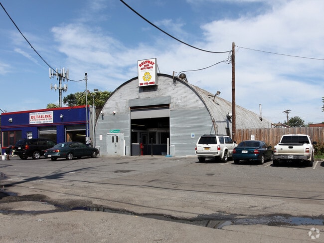
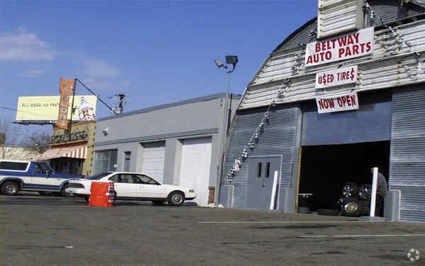
Property Record
4900 Creston St, Hyattsville, MD 20781

NEARBY LISTINGS FOR SALE OR LEASE
Property Detail
4900 Creston St
Washington-Arlington-Alexandria, DC-VA-MD-WV
Pin Oak
02-0111567
BENNINGS RD
Industrialgeneral
Prince George's
X
Maryland
24033C0141E
0.43 AC
2024
Landover/Largo/Captl Hts
2025
Washington, DC
804300
DEMOGRAPHICS near 4900 Creston St
1 Mile
3 Mile
5 Mile
2024 Total Population
7,189
192,533
562,531
2029 Population
6,919
182,961
533,660
Pop Growth 2024-2029
(3.76%)
(4.97%)
(5.13%)
Average Age
40
38
37
2024 Total Households
2,633
70,310
220,057
HH Growth 2024-2029
(3.99%)
(5.65%)
(5.96%)
Median Household Inc
$67,381
$61,813
$77,461
Avg Household Size
2.60
2.60
2.40
2024 Avg HH Vehicles
1.00
1.00
1.00
Median Home Value
$389,343
$378,301
$427,116
Median Year Built
1953
1959
1962
Nearby Places
- Restaurants
- Banks
- Shops
- Fitness
- Groceries
PUBLIC TRANSPORTATION
COMMUTER RAIL
Riverdale (CAMDEN - WASHINGTON - Maryland Area Regional Commuter Trains (The MARC), Camden Line - Maryland Area Regional Commuter Trains (The MARC))
DRIVE
WALK
Distance
Riverdale (CAMDEN - WASHINGTON - Maryland Area Regional Commuter Trains (The MARC), Camden Line - Maryland Area Regional Commuter Trains (The MARC))
8 min
3.5 mi
New Carrollton Marc Nb (PENN - WASHINGTON - Maryland Transit Administration)
DRIVE
WALK
Distance
New Carrollton Marc Nb (PENN - WASHINGTON - Maryland Transit Administration)
10 min
6.2 mi
AIRPORT
Ronald Reagan Washington Ntl
DRIVE
WALK
Distance
Ronald Reagan Washington Ntl
19 min
11.0 mi
Baltimore/Washington International Thurgood Marshall
DRIVE
WALK
Distance
Baltimore/Washington International Thurgood Marshall
40 min
25.8 mi
Washington Dulles International
DRIVE
WALK
Distance
Washington Dulles International
53 min
33.7 mi
Freight Ports
Port of Baltimore
DRIVE
WALK
Distance
Port of Baltimore
50 min
32.4 mi
Nearby Properties
Address
Land Use
TOTAL SIZE
Lot Size
Zoning
Address
Land Use
TOTAL SIZE
Lot Size
Zoning
58,289 SF
418.97 AC
MU-4;PDR-1
Address
Land Use
TOTAL SIZE
Lot Size
Zoning
169.85 AC
R-2;RA-1;U
Address
Land Use
TOTAL SIZE
Lot Size
Zoning
2,985,682 SF
4.33 AC
RSF65
Address
Land Use
TOTAL SIZE
Lot Size
Zoning
236,535 SF
12.54 AC
R-2
Address
Land Use
TOTAL SIZE
Lot Size
Zoning
944,105 SF
23.09 AC
CGO
Address
Land Use
TOTAL SIZE
Lot Size
Zoning
241,725 SF
4.71 AC
MU-7B;PDR-
Address
Land Use
TOTAL SIZE
Lot Size
Zoning
62.03 AC
UNZONED
Address
Land Use
TOTAL SIZE
Lot Size
Zoning
229,238 SF
1.51 AC
MU-7B
Address
Land Use
TOTAL SIZE
Lot Size
Zoning
259,000 SF
1.91 AC
MU-7B
Address
Land Use
TOTAL SIZE
Lot Size
Zoning
821,240 SF
48.32 AC
IH
Address
Land Use
TOTAL SIZE
Lot Size
Zoning
192,440 SF
7.67 AC
R-2;RA-1
Address
Land Use
TOTAL SIZE
Lot Size
Zoning
0.30 AC
PDR-2
Address
Land Use
TOTAL SIZE
Lot Size
Zoning
270,109 SF
17.63 AC
PDR-1;PDR-
Address
Land Use
TOTAL SIZE
Lot Size
Zoning
107,130 SF
2.98 AC
R-2;RA-1
Address
Land Use
TOTAL SIZE
Lot Size
Zoning
419,689 SF
66.84 AC
PDR-1;PDR-
Address
Land Use
TOTAL SIZE
Lot Size
Zoning
132,000 SF
RA-1
Address
Land Use
TOTAL SIZE
Lot Size
Zoning
230,000 SF
4.25 AC
MU-5A;RA-4
Address
Land Use
TOTAL SIZE
Lot Size
Zoning
262,236 SF
15.26 AC
MU-8B
Address
Land Use
TOTAL SIZE
Lot Size
Zoning
379,168 SF
18.94 AC
RMF20
Address
Land Use
TOTAL SIZE
Lot Size
Zoning
181,530 SF
4.72 AC
R-2
Address
Land Use
TOTAL SIZE
Lot Size
Zoning
157,680 SF
0.60 AC
MU-7B
Address
Land Use
TOTAL SIZE
Lot Size
Zoning
25.33 AC
UNZONED
Address
Land Use
TOTAL SIZE
Lot Size
Zoning
10.63 AC
RMF20
Address
Land Use
TOTAL SIZE
Lot Size
Zoning
123,950 SF
4.65 AC
R-2
Address
Land Use
TOTAL SIZE
Lot Size
Zoning
22.19 AC
UNZONED
Address
Land Use
TOTAL SIZE
Lot Size
Zoning
368,038 SF
12.87 AC
IE
Address
Land Use
TOTAL SIZE
Lot Size
Zoning
206,118 SF
0.82 AC
RA-1
Address
Land Use
TOTAL SIZE
Lot Size
Zoning
12,000 SF
1.47 AC
NAC
Address
Land Use
TOTAL SIZE
Lot Size
Zoning
99,269 SF
4.73 AC
RA-1
Address
Land Use
TOTAL SIZE
Lot Size
Zoning
142,636 SF
3.69 AC
RA-1
The World's #1 Commercial Real Estate Marketplace
Connect with us
© 2025 CoStar Group
The information above has been obtained from sources believed reliable. While we do not doubt its accuracy we have not verified it and make no guarantee, warranty or representation about it. It is your responsibility to independently confirm its accuracy and completeness. Any projections, opinions, assumptions, or estimates used are for example only and do not represent the current or future performance of the property. The value of this transaction to you depends on tax and other factors which should be evaluated by your tax, financial, and legal advisors. You and your advisors should conduct a careful, independent investigation of the property to determine to your satisfaction the suitability of the property for your needs.