Property Record
4905 W 60Th Ave, Arvada, CO 80003
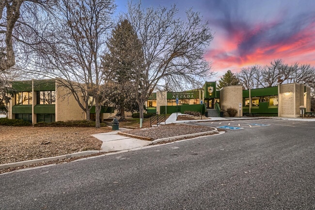

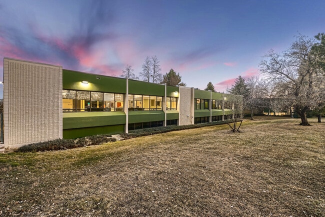
This Property Is For Sale
Property Detail
4905 W 60Th Ave
Denver-Aurora-Centennial, CO
SUB:CREDIT UNION PARK LOT:1
1825-07-2-17-001
Adams
Publicschool
Colorado
0
1
2025
2 AC
009608
Northwest Denver
75,922 SF
Denver
NEARBY LISTINGS FOR SALE OR LEASE
DEMOGRAPHICS near 4905 W 60Th Ave
1 mile
3 mile
5 mile
2025 Total Population
10,177
134,795
387,986
2030 Population
10,291
136,743
396,374
Pop Growth 2025-2030
+ 1.12%
+ 1.45%
+ 2.16%
Average Age
39
40
39
2025 Total Households
3,793
55,139
166,718
HH Growth 2025-2030
+ 1.13%
+ 1.39%
+ 2.24%
Median Household Inc
$85,260
$93,211
$94,908
Avg Household Size
2.60
2.40
2.20
2025 Avg HH Vehicles
2.00
2.00
2.00
Median Home Value
$554,340
$620,046
$612,986
Median Year Built
1979
1968
1976
Nearby Places
Map Layers
Map Styles
 Street
 Aerial
Transit
 Traffic
 Biking
Places
Listings with unknown addresses are not visible on the map
- Restaurants
- Banks
- Shops
- Fitness
- Groceries
PUBLIC TRANSPORTATION
COMMUTER RAIL
60Th & Sheridan - Arvada Gold Strike Station Track 1 (Union Station to Wheat Ridge Ward Station - Regional Transportation District)
Drive
Walk
Distance
60Th & Sheridan - Arvada Gold Strike Station Track 1 (Union Station to Wheat Ridge Ward Station - Regional Transportation District)
2 min
6 min
0.3 mi
Clear Creek - Federal Station Track 1 (Union Station to Wheat Ridge Ward Station - Regional Transportation District)
Drive
Walk
Distance
Clear Creek - Federal Station Track 1 (Union Station to Wheat Ridge Ward Station - Regional Transportation District)
6 min
3.1 mi
AIRPORT
Denver International
Drive
Walk
Distance
Denver International
36 min
27.7 mi
Freight Ports
Tulsa Port Of Catoosa
Drive
Walk
Distance
Tulsa Port Of Catoosa
733 min
713.2 mi
Nearby Properties
Address
Land Use
TOTAL SIZE
Lot Size
Zoning
Address
Land Use
TOTAL SIZE
Lot Size
Zoning
310,267 SF
1.69 AC
C-MX
Address
Land Use
TOTAL SIZE
Lot Size
Zoning
860,132 SF
68.50 AC
R-5
Address
Land Use
TOTAL SIZE
Lot Size
Zoning
138,770 SF
4.64 AC
Address
Land Use
TOTAL SIZE
Lot Size
Zoning
30,316 SF
0.85 AC
U-MS
Address
Land Use
TOTAL SIZE
Lot Size
Zoning
113,385 SF
6.77 AC
Address
Land Use
TOTAL SIZE
Lot Size
Zoning
398,180 SF
33.31 AC
R1C
Address
Land Use
TOTAL SIZE
Lot Size
Zoning
50,372 SF
0.30 AC
U-MS
Address
Land Use
TOTAL SIZE
Lot Size
Zoning
470,539 SF
23.59 AC
Address
Land Use
TOTAL SIZE
Lot Size
Zoning
105,600 SF
1.31 AC
Address
Land Use
TOTAL SIZE
Lot Size
Zoning
390,764 SF
20.19 AC
Address
Land Use
TOTAL SIZE
Lot Size
Zoning
65,336 SF
2.86 AC
Address
Land Use
TOTAL SIZE
Lot Size
Zoning
298,150 SF
24.21 AC
Address
Land Use
TOTAL SIZE
Lot Size
Zoning
283,572 SF
17.76 AC
Address
Land Use
TOTAL SIZE
Lot Size
Zoning
147,009 SF
36.94 AC
I3
Address
Land Use
TOTAL SIZE
Lot Size
Zoning
69,537 SF
4.49 AC
Address
Land Use
TOTAL SIZE
Lot Size
Zoning
6,731 SF
80.77 AC
Address
Land Use
TOTAL SIZE
Lot Size
Zoning
27,921 SF
0.29 AC
C-MX-5
Address
Land Use
TOTAL SIZE
Lot Size
Zoning
51,312 SF
2.17 AC
PUD
Address
Land Use
TOTAL SIZE
Lot Size
Zoning
62,025 SF
2.49 AC
R4
Address
Land Use
TOTAL SIZE
Lot Size
Zoning
157,724 SF
10.07 AC
Address
Land Use
TOTAL SIZE
Lot Size
Zoning
350,400 SF
19.31 AC
Address
Land Use
TOTAL SIZE
Lot Size
Zoning
436,238 SF
13.94 AC
Address
Land Use
TOTAL SIZE
Lot Size
Zoning
30,934 SF
0.31 AC
U-MS
Address
Land Use
TOTAL SIZE
Lot Size
Zoning
281,777 SF
24.89 AC
I2
Address
Land Use
TOTAL SIZE
Lot Size
Zoning
176,800 SF
8.81 AC
I-MX-3
Address
Land Use
TOTAL SIZE
Lot Size
Zoning
176,800 SF
8.72 AC
I-MX-3
Address
Land Use
TOTAL SIZE
Lot Size
Zoning
142,635 SF
6.84 AC
U-SU-B1
Address
Land Use
TOTAL SIZE
Lot Size
Zoning
76,078 SF
6.64 AC
U-SU-C
Address
Land Use
TOTAL SIZE
Lot Size
Zoning
87,567 SF
14.98 AC
R-5
Address
Land Use
TOTAL SIZE
Lot Size
Zoning
115,719 SF
5.93 AC
The World's #1 Commercial Real Estate Marketplace
Connect with us
© 2026 CoStar Group
The information above has been obtained from sources believed reliable. While we do not doubt its accuracy we have not verified it and make no guarantee, warranty or representation about it. It is your responsibility to independently confirm its accuracy and completeness. Any projections, opinions, assumptions, or estimates used are for example only and do not represent the current or future performance of the property. The value of this transaction to you depends on tax and other factors which should be evaluated by your tax, financial, and legal advisors. You and your advisors should conduct a careful, independent investigation of the property to determine to your satisfaction the suitability of the property for your needs.