Property Record
50 High Tech Dr, Rush, NY 14543


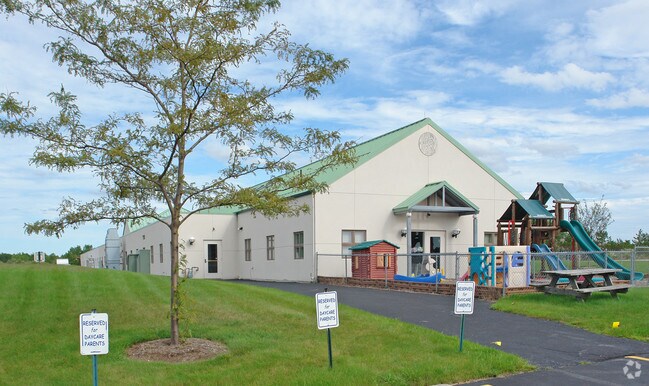
Property Detail
50 High Tech Dr
265000-202-010-0001-022-101
MONROE
Officebuilding
New York
LI
21.110
B and X Area of moderate flood hazard, usually the area between the limits of the 100-year and 500-year floods.
3.07 AC
2025
South Central
2025
Rochester
013300
Rochester, NY
12,104 SF
NEARBY LISTINGS FOR SALE OR LEASE
DEMOGRAPHICS near 50 High Tech Dr
1 mile
3 mile
5 mile
2025 Total Population
1,079
15,557
46,813
2030 Population
1,050
15,530
46,766
Pop Growth 2025-2030
(2.69%)
(0.17%)
(0.10%)
Average Age
43
42
39
2025 Total Households
402
6,086
16,375
HH Growth 2025-2030
(2.74%)
(0.15%)
(0.16%)
Median Household Inc
$143,163
$110,037
$92,144
Avg Household Size
2.70
2.50
2.40
2025 Avg HH Vehicles
2.00
2.00
2.00
Median Home Value
$280,999
$263,078
$243,242
Median Year Built
1980
1989
1977
Nearby Places
Map Layers
Map Styles
 Street
 Aerial
Layers
 Traffic
 Biking
Places
Listings with unknown addresses are not visible on the map
- Restaurants
- Banks
- Shops
- Fitness
- Groceries
PUBLIC TRANSPORTATION
AIRPORT
Frederick Douglass/Greater Rochester International
Drive
Walk
Distance
Frederick Douglass/Greater Rochester International
17 min
9.6 mi
Freight Ports
Albany, NY Port
Drive
Walk
Distance
Albany, NY Port
268 min
228.1 mi
Nearby Properties
Address
Land Use
TOTAL SIZE
Lot Size
Zoning
Address
Land Use
TOTAL SIZE
Lot Size
Zoning
1,200 SF
34.17 AC
02 - SINGL
Address
Land Use
TOTAL SIZE
Lot Size
Zoning
364,000 SF
66.25 AC
06 - INDUS
Address
Land Use
TOTAL SIZE
Lot Size
Zoning
404,630 SF
21.44 AC
06 - INDUS
Address
Land Use
TOTAL SIZE
Lot Size
Zoning
65.37 AC
02 - SINGL
Address
Land Use
TOTAL SIZE
Lot Size
Zoning
4,442 SF
31 AC
02 - SINGL
Address
Land Use
TOTAL SIZE
Lot Size
Zoning
181,876 SF
11.64 AC
07 - MIXED
Address
Land Use
TOTAL SIZE
Lot Size
Zoning
600 SF
446.14 AC
07 - MIXED
Address
Land Use
TOTAL SIZE
Lot Size
Zoning
138,633 SF
16.80 AC
05 - COMME
Address
Land Use
TOTAL SIZE
Lot Size
Zoning
68,569 SF
42 AC
02 - SINGL
Address
Land Use
TOTAL SIZE
Lot Size
Zoning
140,533 SF
63.50 AC
02 - SINGL
Address
Land Use
TOTAL SIZE
Lot Size
Zoning
350,300 SF
34.12 AC
07 - MIXED
Address
Land Use
TOTAL SIZE
Lot Size
Zoning
137,716 SF
13.23 AC
06 - INDUS
Address
Land Use
TOTAL SIZE
Lot Size
Zoning
27.40 AC
R30
Address
Land Use
TOTAL SIZE
Lot Size
Zoning
10,865 SF
10.48 AC
02 - SINGL
Address
Land Use
TOTAL SIZE
Lot Size
Zoning
20,702 SF
113.25 AC
02 - SINGL
Address
Land Use
TOTAL SIZE
Lot Size
Zoning
49,516 SF
22.21 AC
02 - SINGL
Address
Land Use
TOTAL SIZE
Lot Size
Zoning
60,495 SF
12.12 AC
02 - SINGL
Address
Land Use
TOTAL SIZE
Lot Size
Zoning
10,865 SF
8.25 AC
02 - SINGL
Address
Land Use
TOTAL SIZE
Lot Size
Zoning
60,967 SF
12.83 AC
06 - INDUS
Address
Land Use
TOTAL SIZE
Lot Size
Zoning
18,160 SF
4.19 AC
02 - SINGL
Address
Land Use
TOTAL SIZE
Lot Size
Zoning
44,824 SF
28.28 AC
02 - SINGL
Address
Land Use
TOTAL SIZE
Lot Size
Zoning
9,932 SF
9.91 AC
02 - SINGL
Address
Land Use
TOTAL SIZE
Lot Size
Zoning
29,700 SF
5.06 AC
06 - INDUS
Address
Land Use
TOTAL SIZE
Lot Size
Zoning
9,472 SF
10 AC
02 - SINGL
Address
Land Use
TOTAL SIZE
Lot Size
Zoning
58,990 SF
6.44 AC
06 - INDUS
Address
Land Use
TOTAL SIZE
Lot Size
Zoning
70,838 SF
14.40 AC
R30
Address
Land Use
TOTAL SIZE
Lot Size
Zoning
45,052 SF
6.78 AC
06 - INDUS
Address
Land Use
TOTAL SIZE
Lot Size
Zoning
75,456 SF
6.68 AC
06 - INDUS
Address
Land Use
TOTAL SIZE
Lot Size
Zoning
90,245 SF
10.16 AC
03 - MULTI
Address
Land Use
TOTAL SIZE
Lot Size
Zoning
47,322 SF
9.35 AC
06 - INDUS
The World's #1 Commercial Real Estate Marketplace
Connect with us
© 2026 CoStar Group
The information above has been obtained from sources believed reliable. While we do not doubt its accuracy we have not verified it and make no guarantee, warranty or representation about it. It is your responsibility to independently confirm its accuracy and completeness. Any projections, opinions, assumptions, or estimates used are for example only and do not represent the current or future performance of the property. The value of this transaction to you depends on tax and other factors which should be evaluated by your tax, financial, and legal advisors. You and your advisors should conduct a careful, independent investigation of the property to determine to your satisfaction the suitability of the property for your needs.