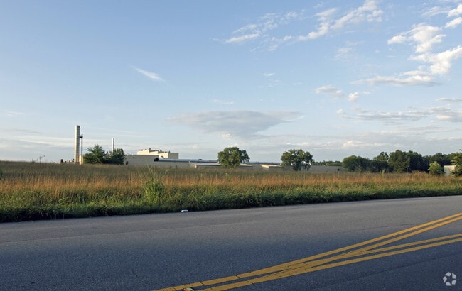
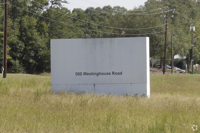
Property Record
500 Westinghouse Rd, Pendleton, SC 29670

Property Detail
500 Westinghouse Rd
063-00-06-001
CP 086/398 F000 D000 LEBANON RD 94.59 AC
Realpropertynec
Anderson
AE The base floodplain where base flood elevations are provided. AE Zones are now used on new format FIRMs instead of A1-A30 Zones.
South Carolina
0
94.59 AC
2025
Outlying Anderson Co
010702
Greenville/Spartanburg
254,000 SF
Greenville-Anderson-Greer, SC
NEARBY LISTINGS FOR SALE OR LEASE
DEMOGRAPHICS near 500 Westinghouse Rd
1 mile
3 mile
5 mile
2025 Total Population
2,724
9,285
31,687
2030 Population
2,861
9,827
32,999
Pop Growth 2025-2030
+ 5.03%
+ 5.84%
+ 4.14%
Average Age
39
40
36
2025 Total Households
1,215
3,816
11,579
HH Growth 2025-2030
+ 5.35%
+ 6.55%
+ 4.90%
Median Household Inc
$65,431
$70,235
$60,923
Avg Household Size
2.20
2.30
2.30
2025 Avg HH Vehicles
2.00
2.00
2.00
Median Home Value
$217,871
$250,920
$287,819
Median Year Built
1991
1989
1992
Nearby Places
Map Layers
Map Styles
 Street
 Aerial
Transit
 Traffic
 Biking
Places
Listings with unknown addresses are not visible on the map
- Restaurants
- Banks
- Shops
- Fitness
- Groceries
PUBLIC TRANSPORTATION
COMMUTER RAIL
Drive
Walk
Distance
12 min
5.8 mi
AIRPORT
Greenville Spartanburg International
Drive
Walk
Distance
Greenville Spartanburg International
62 min
46.0 mi
Nearby Properties
Address
Land Use
TOTAL SIZE
Lot Size
Zoning
Address
Land Use
TOTAL SIZE
Lot Size
Zoning
6,000 SF
0.99 AC
Address
Land Use
TOTAL SIZE
Lot Size
Zoning
2,764 SF
17.46 AC
Address
Land Use
TOTAL SIZE
Lot Size
Zoning
11.42 AC
Address
Land Use
TOTAL SIZE
Lot Size
Zoning
5,484.32 AC
Address
Land Use
TOTAL SIZE
Lot Size
Zoning
75,260 SF
2.20 AC
Address
Land Use
TOTAL SIZE
Lot Size
Zoning
6,500 SF
7.41 AC
Address
Land Use
TOTAL SIZE
Lot Size
Zoning
1.52 AC
Address
Land Use
TOTAL SIZE
Lot Size
Zoning
20,000 SF
14.18 AC
Address
Land Use
TOTAL SIZE
Lot Size
Zoning
14,706 SF
8.48 AC
Address
Land Use
TOTAL SIZE
Lot Size
Zoning
27.50 AC
Address
Land Use
TOTAL SIZE
Lot Size
Zoning
69,208 SF
10.68 AC
Address
Land Use
TOTAL SIZE
Lot Size
Zoning
132.18 AC
Address
Land Use
TOTAL SIZE
Lot Size
Zoning
14.58 AC
R 20 SINGL
Address
Land Use
TOTAL SIZE
Lot Size
Zoning
1,530 SF
30.62 AC
Address
Land Use
TOTAL SIZE
Lot Size
Zoning
5,839 SF
5.45 AC
Address
Land Use
TOTAL SIZE
Lot Size
Zoning
3,730 SF
1.98 AC
Address
Land Use
TOTAL SIZE
Lot Size
Zoning
Address
Land Use
TOTAL SIZE
Lot Size
Zoning
9,600 SF
1.79 AC
Address
Land Use
TOTAL SIZE
Lot Size
Zoning
10,054 SF
1.20 AC
Address
Land Use
TOTAL SIZE
Lot Size
Zoning
1.60 AC
Address
Land Use
TOTAL SIZE
Lot Size
Zoning
6,779 SF
3.82 AC
Address
Land Use
TOTAL SIZE
Lot Size
Zoning
Address
Land Use
TOTAL SIZE
Lot Size
Zoning
14.15 AC
R 20 SINGL
Address
Land Use
TOTAL SIZE
Lot Size
Zoning
7,314 SF
114.43 AC
Address
Land Use
TOTAL SIZE
Lot Size
Zoning
3,471 SF
1 AC
Address
Land Use
TOTAL SIZE
Lot Size
Zoning
3,902 SF
0.98 AC
Address
Land Use
TOTAL SIZE
Lot Size
Zoning
2.56 AC
R 20 SINGL
The World's #1 Commercial Real Estate Marketplace
Connect with us
© 2026 CoStar Group
The information above has been obtained from sources believed reliable. While we do not doubt its accuracy we have not verified it and make no guarantee, warranty or representation about it. It is your responsibility to independently confirm its accuracy and completeness. Any projections, opinions, assumptions, or estimates used are for example only and do not represent the current or future performance of the property. The value of this transaction to you depends on tax and other factors which should be evaluated by your tax, financial, and legal advisors. You and your advisors should conduct a careful, independent investigation of the property to determine to your satisfaction the suitability of the property for your needs.