Property Record
5000 E Gowan Rd, Las Vegas, NV 89115
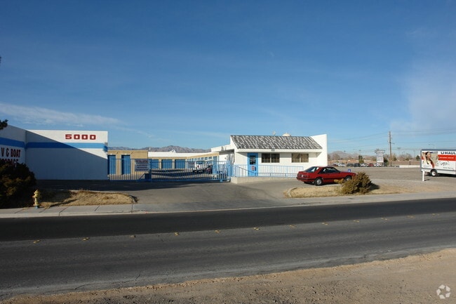


Property Detail
5000 E Gowan Rd
140-08-601-018
PT SE4 NE4 SEC 08 20 62
Publicstorage
Clark
C2
Nevada
2026
6.10 AC
2026
North Las Vegas
004712
Las Vegas
36,400 SF
Las Vegas-Henderson-North Las Vegas, NV
NEARBY LISTINGS FOR SALE OR LEASE
DEMOGRAPHICS near 5000 E Gowan Rd
1 mile
3 mile
5 mile
2025 Total Population
14,902
117,629
328,364
2030 Population
15,789
122,853
343,882
Pop Growth 2025-2030
+ 5.95%
+ 4.44%
+ 4.73%
Average Age
33
34
35
2025 Total Households
5,025
35,581
99,314
HH Growth 2025-2030
+ 6.11%
+ 4.44%
+ 4.79%
Median Household Inc
$42,114
$55,213
$59,040
Avg Household Size
2.90
3.20
3.20
2025 Avg HH Vehicles
1.00
2.00
2.00
Median Home Value
$242,810
$298,815
$339,057
Median Year Built
1986
1990
1992
Nearby Places
Map Layers
Map Styles
 Street
 Aerial
Transit
 Traffic
 Biking
Places
Listings with unknown addresses are not visible on the map
- Restaurants
- Banks
- Shops
- Fitness
- Groceries
PUBLIC TRANSPORTATION
AIRPORT
Harry Reid International
Drive
Walk
Distance
Harry Reid International
25 min
15.6 mi
Boulder City Municipal
Drive
Walk
Distance
Boulder City Municipal
40 min
26.9 mi
Freight Ports
Port of Long Beach
Drive
Walk
Distance
Port of Long Beach
327 min
291.2 mi
SALE & LEASE HISTORY
LISTING DATE
SALE/LEASE

Sep 19, 2022
For Sale
Nearby Properties
Address
Land Use
TOTAL SIZE
Lot Size
Zoning
Address
Land Use
TOTAL SIZE
Lot Size
Zoning
90.41 AC
Address
Land Use
TOTAL SIZE
Lot Size
Zoning
688,360 SF
63.10 AC
M1
Address
Land Use
TOTAL SIZE
Lot Size
Zoning
1,102,891 SF
84.40 AC
Address
Land Use
TOTAL SIZE
Lot Size
Zoning
798,660 SF
37.86 AC
M2
Address
Land Use
TOTAL SIZE
Lot Size
Zoning
813,120 SF
38.20 AC
Address
Land Use
TOTAL SIZE
Lot Size
Zoning
588,286 SF
33.26 AC
Address
Land Use
TOTAL SIZE
Lot Size
Zoning
747,196 SF
40.03 AC
Address
Land Use
TOTAL SIZE
Lot Size
Zoning
632,224 SF
31.23 AC
Address
Land Use
TOTAL SIZE
Lot Size
Zoning
681,792 SF
29.65 AC
Address
Land Use
TOTAL SIZE
Lot Size
Zoning
677,768 SF
31.52 AC
Address
Land Use
TOTAL SIZE
Lot Size
Zoning
696,064 SF
29.08 AC
Address
Land Use
TOTAL SIZE
Lot Size
Zoning
621,824 SF
32.27 AC
Address
Land Use
TOTAL SIZE
Lot Size
Zoning
15,566 SF
48.39 AC
R4
Address
Land Use
TOTAL SIZE
Lot Size
Zoning
570,810 SF
29.73 AC
Address
Land Use
TOTAL SIZE
Lot Size
Zoning
617,670 SF
27.90 AC
M2
Address
Land Use
TOTAL SIZE
Lot Size
Zoning
720,000 SF
25.07 AC
Address
Land Use
TOTAL SIZE
Lot Size
Zoning
625,804 SF
27.23 AC
Address
Land Use
TOTAL SIZE
Lot Size
Zoning
546,249 SF
28.58 AC
Address
Land Use
TOTAL SIZE
Lot Size
Zoning
152,520 SF
42.31 AC
M2
Address
Land Use
TOTAL SIZE
Lot Size
Zoning
7.24 AC
PF
Address
Land Use
TOTAL SIZE
Lot Size
Zoning
399,093 SF
21.25 AC
M2
Address
Land Use
TOTAL SIZE
Lot Size
Zoning
376,264 SF
19 AC
Address
Land Use
TOTAL SIZE
Lot Size
Zoning
513,240 SF
24.86 AC
M2
Address
Land Use
TOTAL SIZE
Lot Size
Zoning
350,494 SF
18.86 AC
RU
Address
Land Use
TOTAL SIZE
Lot Size
Zoning
338,650 SF
18.14 AC
M2
Address
Land Use
TOTAL SIZE
Lot Size
Zoning
342,160 SF
37.72 AC
RT
Address
Land Use
TOTAL SIZE
Lot Size
Zoning
182,885 SF
28.22 AC
Address
Land Use
TOTAL SIZE
Lot Size
Zoning
612,680 SF
25.48 AC
M2
The World's #1 Commercial Real Estate Marketplace
Connect with us
© 2026 CoStar Group
The information above has been obtained from sources believed reliable. While we do not doubt its accuracy we have not verified it and make no guarantee, warranty or representation about it. It is your responsibility to independently confirm its accuracy and completeness. Any projections, opinions, assumptions, or estimates used are for example only and do not represent the current or future performance of the property. The value of this transaction to you depends on tax and other factors which should be evaluated by your tax, financial, and legal advisors. You and your advisors should conduct a careful, independent investigation of the property to determine to your satisfaction the suitability of the property for your needs.