Property Record
501 Fairway Dr, Deerfield Beach, FL 33441


NEARBY LISTINGS FOR SALE OR LEASE
Property Detail
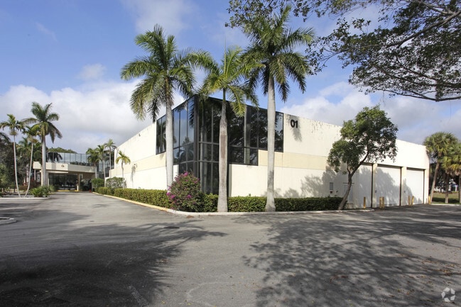
501 Fairway Dr
Fort Lauderdale-Pompano Beach-Deerfield Beach, FL
L.C.L. Plat 113-49 B
47-42-36-14-0060
L.C.L. PLAT 113-49 B PARCEL G
Warehouse
Broward
X
Florida
12011C0178J
c
2024
2.09 AC
2025
Northeast Broward
010307
South Florida
46,467 SF
DEMOGRAPHICS near 501 Fairway Dr
1 Mile
3 Mile
5 Mile
2024 Total Population
11,116
152,627
289,651
2029 Population
11,029
157,233
297,015
Pop Growth 2024-2029
(0.78%)
+ 3.02%
+ 2.54%
Average Age
41
46
45
2024 Total Households
4,491
69,428
122,871
HH Growth 2024-2029
(1.31%)
+ 3.24%
+ 2.84%
Median Household Inc
$49,166
$58,238
$65,918
Avg Household Size
2.30
2.10
2.20
2024 Avg HH Vehicles
2.00
1.00
2.00
Median Home Value
$443,455
$352,383
$386,246
Median Year Built
1979
1980
1980
Nearby Places
Map Layers
Map Styles
 Street
 Aerial
- Restaurants
- Banks
- Shops
- Fitness
- Groceries
PUBLIC TRANSPORTATION
COMMUTER RAIL
Deerfield Beach (Tri-County Commuter - South Florida Regional Transportation Authority (Tri-Rail))
DRIVE
WALK
Distance
Deerfield Beach (Tri-County Commuter - South Florida Regional Transportation Authority (Tri-Rail))
6 min
1.8 mi
DRIVE
WALK
Distance
11 min
4.2 mi
AIRPORT
Fort Lauderdale/Hollywood International
DRIVE
WALK
Distance
Fort Lauderdale/Hollywood International
31 min
21.5 mi
Palm Beach International
DRIVE
WALK
Distance
Palm Beach International
40 min
29.5 mi
Freight Ports
Port Everglades
DRIVE
WALK
Distance
Port Everglades
29 min
20.5 mi
Nearby Properties
Address
Land Use
TOTAL SIZE
Lot Size
Zoning
Address
Land Use
TOTAL SIZE
Lot Size
Zoning
824,107 SF
39.08 AC
CITY CG
Address
Land Use
TOTAL SIZE
Lot Size
Zoning
1,481,767 SF
34.49 AC
R-5
Address
Land Use
TOTAL SIZE
Lot Size
Zoning
501,966 SF
5.82 AC
R1D/DDRI
Address
Land Use
TOTAL SIZE
Lot Size
Zoning
505,418 SF
1.98 AC
DDRI
Address
Land Use
TOTAL SIZE
Lot Size
Zoning
547,946 SF
13.89 AC
DDRI
Address
Land Use
TOTAL SIZE
Lot Size
Zoning
691,385 SF
9.12 AC
DDRI
Address
Land Use
TOTAL SIZE
Lot Size
Zoning
388,471 SF
12.42 AC
R5A-PUD
Address
Land Use
TOTAL SIZE
Lot Size
Zoning
680,226 SF
42.13 AC
RM-15
Address
Land Use
TOTAL SIZE
Lot Size
Zoning
605,126 SF
39.63 AC
I
Address
Land Use
TOTAL SIZE
Lot Size
Zoning
823,639 SF
60.73 AC
PID
Address
Land Use
TOTAL SIZE
Lot Size
Zoning
1,166,083 SF
74.07 AC
I
Address
Land Use
TOTAL SIZE
Lot Size
Zoning
760,812 SF
23.60 AC
MC
Address
Land Use
TOTAL SIZE
Lot Size
Zoning
399,917 SF
27.20 AC
AR
Address
Land Use
TOTAL SIZE
Lot Size
Zoning
267,063 SF
2.33 AC
DDRI
Address
Land Use
TOTAL SIZE
Lot Size
Zoning
350,010 SF
8.36 AC
R-3-B
Address
Land Use
TOTAL SIZE
Lot Size
Zoning
275,784 SF
2.27 AC
DDRI
Address
Land Use
TOTAL SIZE
Lot Size
Zoning
377,672 SF
35.64 AC
PL
Address
Land Use
TOTAL SIZE
Lot Size
Zoning
240,841 SF
2.08 AC
DDRI
Address
Land Use
TOTAL SIZE
Lot Size
Zoning
242,023 SF
15.38 AC
RS
Address
Land Use
TOTAL SIZE
Lot Size
Zoning
285,335 SF
8.56 AC
RM-45
Address
Land Use
TOTAL SIZE
Lot Size
Zoning
230,420 SF
2.64 AC
DDRI
Address
Land Use
TOTAL SIZE
Lot Size
Zoning
352,250 SF
9.93 AC
CITY CHO
Address
Land Use
TOTAL SIZE
Lot Size
Zoning
20,602 SF
181.05 AC
PL
Address
Land Use
TOTAL SIZE
Lot Size
Zoning
299,038 SF
11.78 AC
POI*
Address
Land Use
TOTAL SIZE
Lot Size
Zoning
392,222 SF
5.33 AC
RPUD
Address
Land Use
TOTAL SIZE
Lot Size
Zoning
240,047 SF
12.13 AC
RS
Address
Land Use
TOTAL SIZE
Lot Size
Zoning
344,341 SF
1.86 AC
DDRI
Address
Land Use
TOTAL SIZE
Lot Size
Zoning
246,122 SF
6.92 AC
TOD
Address
Land Use
TOTAL SIZE
Lot Size
Zoning
272,750 SF
19.59 AC
AR
Address
Land Use
TOTAL SIZE
Lot Size
Zoning
271,199 SF
14.79 AC
AR
The World's #1 Commercial Real Estate Marketplace
Connect with us
© 2025 CoStar Group
The information above has been obtained from sources believed reliable. While we do not doubt its accuracy we have not verified it and make no guarantee, warranty or representation about it. It is your responsibility to independently confirm its accuracy and completeness. Any projections, opinions, assumptions, or estimates used are for example only and do not represent the current or future performance of the property. The value of this transaction to you depends on tax and other factors which should be evaluated by your tax, financial, and legal advisors. You and your advisors should conduct a careful, independent investigation of the property to determine to your satisfaction the suitability of the property for your needs.