Property Record
501 N 900 E, Provo, UT 84606
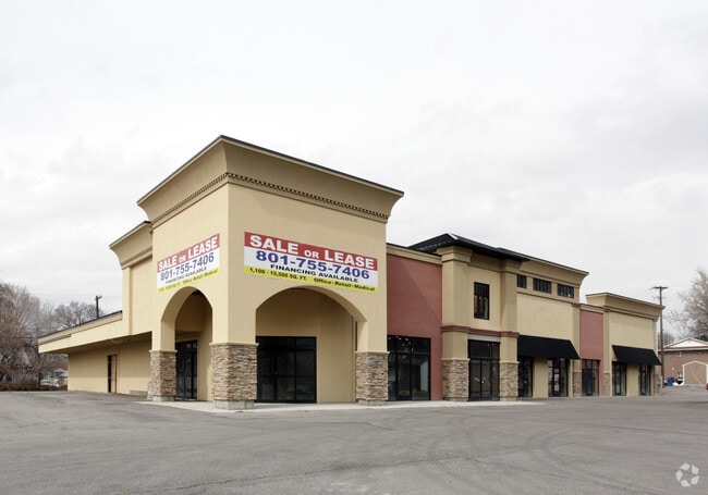


Property Detail
501 N 900 E
Provo-Orem-Lehi, UT
COM N 548.01 FT & W 1868.98 FT FR E 1/4 COR. SEC. 6, T7S, R3E, SLB&M.; S 89 DEG 37 29 E 117.05 FT; N 0 DEG 22 32 E 125.5 FT; S 89 DEG 37 32 E 25 FT; S 0 DEG 22 32 W 287.57 FT; S 84 DEG 34 57 E 101.2 FT; S 0 DEG 9 41 W 78.18 FT; N 89 DEG 27 21 W 242.7
22-014-0083
Utah
Officebuilding
Utah
2024
1.07 AC
2025
Utah County
001802
Salt Lake City
15,632 SF
NEARBY LISTINGS FOR SALE OR LEASE
DEMOGRAPHICS near 501 N 900 E
1 mile
3 mile
5 mile
2024 Total Population
43,268
123,346
186,386
2029 Population
47,972
135,867
204,922
Pop Growth 2024-2029
+ 10.87%
+ 10.15%
+ 9.94%
Average Age
25
29
31
2024 Total Households
12,491
38,273
57,144
HH Growth 2024-2029
+ 12.72%
+ 11.39%
+ 11.02%
Median Household Inc
$47,847
$61,882
$71,989
Avg Household Size
2.80
2.90
3.00
2024 Avg HH Vehicles
2.00
2.00
2.00
Median Home Value
$499,678
$496,036
$518,393
Median Year Built
1983
1986
1988
Nearby Places
Map Layers
Map Styles
 Street
 Aerial
Transit
 Traffic
 Biking
Places
Listings with unknown addresses are not visible on the map
- Restaurants
- Banks
- Shops
- Fitness
- Groceries
PUBLIC TRANSPORTATION
COMMUTER RAIL
Drive
Walk
Distance
5 min
2.0 mi
Drive
Walk
Distance
5 min
2.2 mi
AIRPORT
Provo Municipal
Drive
Walk
Distance
Provo Municipal
13 min
6.4 mi
Nearby Properties
Address
Land Use
TOTAL SIZE
Lot Size
Zoning
Address
Land Use
TOTAL SIZE
Lot Size
Zoning
1,744,846 SF
19.25 AC
Address
Land Use
TOTAL SIZE
Lot Size
Zoning
442,598 SF
22.94 AC
Address
Land Use
TOTAL SIZE
Lot Size
Zoning
347,829 SF
5.26 AC
Address
Land Use
TOTAL SIZE
Lot Size
Zoning
222,763 SF
10.71 AC
Address
Land Use
TOTAL SIZE
Lot Size
Zoning
366,509 SF
2.83 AC
Address
Land Use
TOTAL SIZE
Lot Size
Zoning
138,990 SF
2.87 AC
Address
Land Use
TOTAL SIZE
Lot Size
Zoning
297,467 SF
16.87 AC
Address
Land Use
TOTAL SIZE
Lot Size
Zoning
371,881 SF
4.91 AC
Address
Land Use
TOTAL SIZE
Lot Size
Zoning
323,674 SF
13.81 AC
Address
Land Use
TOTAL SIZE
Lot Size
Zoning
245,657 SF
5.60 AC
Address
Land Use
TOTAL SIZE
Lot Size
Zoning
107,840 SF
0.98 AC
Address
Land Use
TOTAL SIZE
Lot Size
Zoning
222,848 SF
11.14 AC
Address
Land Use
TOTAL SIZE
Lot Size
Zoning
266,387 SF
1.76 AC
Address
Land Use
TOTAL SIZE
Lot Size
Zoning
174,883 SF
17.42 AC
Address
Land Use
TOTAL SIZE
Lot Size
Zoning
269,652 SF
3.65 AC
Address
Land Use
TOTAL SIZE
Lot Size
Zoning
155,726 SF
13.64 AC
Address
Land Use
TOTAL SIZE
Lot Size
Zoning
300,810 SF
7.32 AC
Address
Land Use
TOTAL SIZE
Lot Size
Zoning
208,492 SF
12.49 AC
Address
Land Use
TOTAL SIZE
Lot Size
Zoning
176,127 SF
9.29 AC
Address
Land Use
TOTAL SIZE
Lot Size
Zoning
233,451 SF
1.73 AC
Address
Land Use
TOTAL SIZE
Lot Size
Zoning
206,778 SF
5.11 AC
Address
Land Use
TOTAL SIZE
Lot Size
Zoning
9,326 SF
5.19 AC
Address
Land Use
TOTAL SIZE
Lot Size
Zoning
124,986 SF
8.67 AC
Address
Land Use
TOTAL SIZE
Lot Size
Zoning
124,183 SF
4.28 AC
Address
Land Use
TOTAL SIZE
Lot Size
Zoning
195,248 SF
13.20 AC
Address
Land Use
TOTAL SIZE
Lot Size
Zoning
170,907 SF
1.18 AC
Address
Land Use
TOTAL SIZE
Lot Size
Zoning
1 SF
0.62 AC
Address
Land Use
TOTAL SIZE
Lot Size
Zoning
265,411 SF
19.28 AC
Address
Land Use
TOTAL SIZE
Lot Size
Zoning
106,191 SF
2.26 AC
Address
Land Use
TOTAL SIZE
Lot Size
Zoning
213,512 SF
1.24 AC
The World's #1 Commercial Real Estate Marketplace
Connect with us
© 2026 CoStar Group
The information above has been obtained from sources believed reliable. While we do not doubt its accuracy we have not verified it and make no guarantee, warranty or representation about it. It is your responsibility to independently confirm its accuracy and completeness. Any projections, opinions, assumptions, or estimates used are for example only and do not represent the current or future performance of the property. The value of this transaction to you depends on tax and other factors which should be evaluated by your tax, financial, and legal advisors. You and your advisors should conduct a careful, independent investigation of the property to determine to your satisfaction the suitability of the property for your needs.