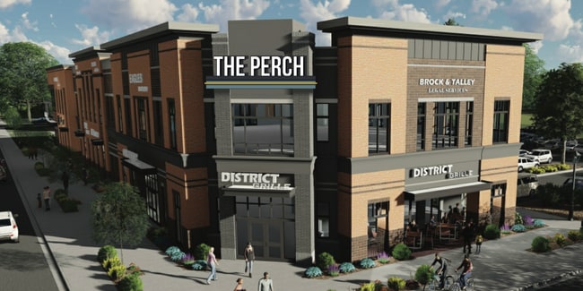
Property Record
520 Cherry Rd, Rock Hill, SC 29732


Current Lease Availabilities
Property Detail
520 Cherry Rd
6290107008
(2.569AC) CHERRY & COLLEGE AVE
Commercialnec
York
OI
South Carolina
B and X Area of moderate flood hazard, usually the area between the limits of the 100-year and 500-year floods.
2.57 AC
2025
York County
2025
Charlotte
060102
Charlotte-Concord-Gastonia, NC-SC
23,152 SF
NEARBY LISTINGS FOR SALE OR LEASE
DEMOGRAPHICS near 520 Cherry Rd
1 mile
3 mile
5 mile
2025 Total Population
10,074
62,003
102,608
2030 Population
10,659
65,204
107,956
Pop Growth 2025-2030
+ 5.81%
+ 5.16%
+ 5.21%
Average Age
35
39
40
2025 Total Households
3,726
25,468
41,377
HH Growth 2025-2030
+ 7.57%
+ 5.44%
+ 5.36%
Median Household Inc
$51,936
$58,171
$67,981
Avg Household Size
2.10
2.30
2.40
2025 Avg HH Vehicles
2.00
2.00
2.00
Median Home Value
$311,546
$282,078
$326,747
Median Year Built
1977
1988
1994
Nearby Places
Map Layers
Map Styles
 Street
 Aerial
Layers
 Traffic
 Biking
Places
Listings with unknown addresses are not visible on the map
- Restaurants
- Banks
- Shops
- Fitness
- Groceries
PUBLIC TRANSPORTATION
AIRPORT
Charlotte/Douglas International
Drive
Walk
Distance
Charlotte/Douglas International
38 min
22.5 mi
Concord-Padgett Regional
Drive
Walk
Distance
Concord-Padgett Regional
56 min
39.5 mi
Nearby Properties
Address
Land Use
TOTAL SIZE
Lot Size
Zoning
Address
Land Use
TOTAL SIZE
Lot Size
Zoning
18,192 SF
17.98 AC
MF15
Address
Land Use
TOTAL SIZE
Lot Size
Zoning
13,486 SF
14.27 AC
GC
Address
Land Use
TOTAL SIZE
Lot Size
Zoning
13,556 SF
10.86 AC
MF15
Address
Land Use
TOTAL SIZE
Lot Size
Zoning
267,338 SF
Address
Land Use
TOTAL SIZE
Lot Size
Zoning
215.20 AC
UD
Address
Land Use
TOTAL SIZE
Lot Size
Zoning
5,380 SF
5.69 AC
MF15
Address
Land Use
TOTAL SIZE
Lot Size
Zoning
8,512 SF
7.73 AC
MF15
Address
Land Use
TOTAL SIZE
Lot Size
Zoning
45,426 SF
6 AC
MF15
Address
Land Use
TOTAL SIZE
Lot Size
Zoning
24,164 SF
9.50 AC
GC
Address
Land Use
TOTAL SIZE
Lot Size
Zoning
28,848 SF
1.04 AC
PUD
Address
Land Use
TOTAL SIZE
Lot Size
Zoning
252,312 SF
1.25 AC
Address
Land Use
TOTAL SIZE
Lot Size
Zoning
10,232 SF
4.50 AC
MF15
Address
Land Use
TOTAL SIZE
Lot Size
Zoning
28,660 SF
19.95 AC
OI
Address
Land Use
TOTAL SIZE
Lot Size
Zoning
554,100 SF
21.58 AC
OI
Address
Land Use
TOTAL SIZE
Lot Size
Zoning
40,532 SF
9.96 AC
SF5
Address
Land Use
TOTAL SIZE
Lot Size
Zoning
163,085 SF
6.84 AC
Address
Land Use
TOTAL SIZE
Lot Size
Zoning
113,490 SF
7 AC
Address
Land Use
TOTAL SIZE
Lot Size
Zoning
84,995 SF
5.09 AC
DTWN
Address
Land Use
TOTAL SIZE
Lot Size
Zoning
225,936 SF
2.87 AC
Address
Land Use
TOTAL SIZE
Lot Size
Zoning
22,278 SF
4.92 AC
Address
Land Use
TOTAL SIZE
Lot Size
Zoning
98,813 SF
3.34 AC
Address
Land Use
TOTAL SIZE
Lot Size
Zoning
28,956 SF
17.89 AC
MF15
Address
Land Use
TOTAL SIZE
Lot Size
Zoning
14,178 SF
1.81 AC
OI
Address
Land Use
TOTAL SIZE
Lot Size
Zoning
22 AC
OI
Address
Land Use
TOTAL SIZE
Lot Size
Zoning
127,028 SF
1.28 AC
Address
Land Use
TOTAL SIZE
Lot Size
Zoning
342,804 SF
23.99 AC
NMU
Address
Land Use
TOTAL SIZE
Lot Size
Zoning
38,000 SF
4.28 AC
LC
Address
Land Use
TOTAL SIZE
Lot Size
Zoning
23,898 SF
19.65 AC
OI
Address
Land Use
TOTAL SIZE
Lot Size
Zoning
12,960 SF
16.25 AC
GC
Address
Land Use
TOTAL SIZE
Lot Size
Zoning
207,492 SF
6.66 AC
IH
The World's #1 Commercial Real Estate Marketplace
Connect with us
© 2026 CoStar Group
The information above has been obtained from sources believed reliable. While we do not doubt its accuracy we have not verified it and make no guarantee, warranty or representation about it. It is your responsibility to independently confirm its accuracy and completeness. Any projections, opinions, assumptions, or estimates used are for example only and do not represent the current or future performance of the property. The value of this transaction to you depends on tax and other factors which should be evaluated by your tax, financial, and legal advisors. You and your advisors should conduct a careful, independent investigation of the property to determine to your satisfaction the suitability of the property for your needs.