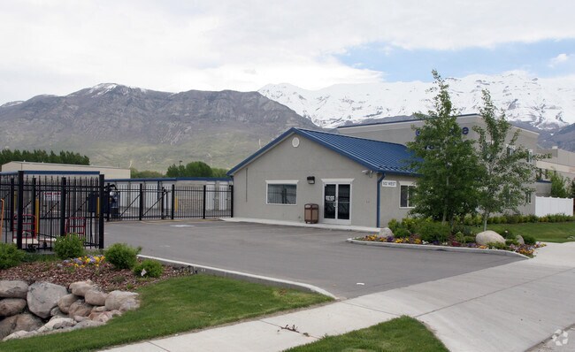
Property Record
502 W 700 S, Pleasant Grove, UT 84062


NEARBY LISTINGS FOR SALE OR LEASE
Property Detail
502 W 700 S
Provo-Orem, UT
COM S 43.33 FT & E 1765.59 FT FR W 1/4 COR. SEC. 29, T5S, R2E, SLB&M.; S 89 DEG 31 24 W 249.21 FT; N 0 DEG 28 18 E 670.37 FT; N 89 DEG 35 18 E 247.93 FT; S 0 DEG 21 45 W 670.07 FT TO BEG. AREA 3.824 AC.
14-051-0009
Utah
Commercialnec
Utah
2024
3.82 AC
2025
Utah County
000511
Salt Lake City
88,813 SF
DEMOGRAPHICS near 502 W 700 S
1 Mile
3 Mile
5 Mile
2024 Total Population
12,751
73,367
177,891
2029 Population
14,948
85,536
207,619
Pop Growth 2024-2029
+ 17.23%
+ 16.59%
+ 16.71%
Average Age
32
33
32
2024 Total Households
4,379
22,017
52,647
HH Growth 2024-2029
+ 17.58%
+ 17.04%
+ 17.20%
Median Household Inc
$65,267
$84,561
$87,857
Avg Household Size
2.90
3.30
3.30
2024 Avg HH Vehicles
2.00
2.00
2.00
Median Home Value
$358,879
$446,490
$456,336
Median Year Built
2004
1998
1998
Nearby Places
Map Layers
Map Styles
 Street
 Aerial
- Restaurants
- Banks
- Shops
- Fitness
- Groceries
PUBLIC TRANSPORTATION
COMMUTER RAIL
Vineyard Station (FrontRunner - Utah Transit Authority (UTA))
DRIVE
WALK
Distance
Vineyard Station (FrontRunner - Utah Transit Authority (UTA))
8 min
4.3 mi
American Fork Station (FrontRunner - Utah Transit Authority (UTA))
DRIVE
WALK
Distance
American Fork Station (FrontRunner - Utah Transit Authority (UTA))
12 min
6.4 mi
AIRPORT
Provo Municipal
DRIVE
WALK
Distance
Provo Municipal
20 min
13.0 mi
Freight Ports
Port of Stockton
DRIVE
WALK
Distance
Port of Stockton
748 min
729.7 mi
Nearby Properties
Address
Land Use
TOTAL SIZE
Lot Size
Zoning
Address
Land Use
TOTAL SIZE
Lot Size
Zoning
587,192 SF
48.27 AC
Address
Land Use
TOTAL SIZE
Lot Size
Zoning
296,420 SF
19.66 AC
Address
Land Use
TOTAL SIZE
Lot Size
Zoning
287,823 SF
8.96 AC
Address
Land Use
TOTAL SIZE
Lot Size
Zoning
201,081 SF
17.96 AC
Address
Land Use
TOTAL SIZE
Lot Size
Zoning
400,684 SF
10.39 AC
Address
Land Use
TOTAL SIZE
Lot Size
Zoning
322,826 SF
9.53 AC
Address
Land Use
TOTAL SIZE
Lot Size
Zoning
21,510 SF
6.66 AC
Address
Land Use
TOTAL SIZE
Lot Size
Zoning
291,932 SF
8.10 AC
Address
Land Use
TOTAL SIZE
Lot Size
Zoning
194,977 SF
8.18 AC
Address
Land Use
TOTAL SIZE
Lot Size
Zoning
233,302 SF
15.03 AC
Address
Land Use
TOTAL SIZE
Lot Size
Zoning
230,702 SF
11.85 AC
Address
Land Use
TOTAL SIZE
Lot Size
Zoning
171,905 SF
6.62 AC
Address
Land Use
TOTAL SIZE
Lot Size
Zoning
327,092 SF
14.61 AC
Address
Land Use
TOTAL SIZE
Lot Size
Zoning
144,310 SF
6.85 AC
Address
Land Use
TOTAL SIZE
Lot Size
Zoning
146,939 SF
36.63 AC
Address
Land Use
TOTAL SIZE
Lot Size
Zoning
144,456 SF
5.55 AC
Address
Land Use
TOTAL SIZE
Lot Size
Zoning
333,724 SF
13.12 AC
Address
Land Use
TOTAL SIZE
Lot Size
Zoning
268,989 SF
12.78 AC
Address
Land Use
TOTAL SIZE
Lot Size
Zoning
8.99 AC
Address
Land Use
TOTAL SIZE
Lot Size
Zoning
Address
Land Use
TOTAL SIZE
Lot Size
Zoning
154,800 SF
9.14 AC
Address
Land Use
TOTAL SIZE
Lot Size
Zoning
364,248 SF
22.77 AC
Address
Land Use
TOTAL SIZE
Lot Size
Zoning
269,768 SF
14.94 AC
Address
Land Use
TOTAL SIZE
Lot Size
Zoning
194,852 SF
10.03 AC
Address
Land Use
TOTAL SIZE
Lot Size
Zoning
213,863 SF
11.71 AC
Address
Land Use
TOTAL SIZE
Lot Size
Zoning
141,635 SF
10.58 AC
Address
Land Use
TOTAL SIZE
Lot Size
Zoning
212,466 SF
25.89 AC
Address
Land Use
TOTAL SIZE
Lot Size
Zoning
182,338 SF
7.97 AC
Address
Land Use
TOTAL SIZE
Lot Size
Zoning
153,790 SF
12.07 AC
Address
Land Use
TOTAL SIZE
Lot Size
Zoning
200,016 SF
8.82 AC
The World's #1 Commercial Real Estate Marketplace
Connect with us
© 2025 CoStar Group
The information above has been obtained from sources believed reliable. While we do not doubt its accuracy we have not verified it and make no guarantee, warranty or representation about it. It is your responsibility to independently confirm its accuracy and completeness. Any projections, opinions, assumptions, or estimates used are for example only and do not represent the current or future performance of the property. The value of this transaction to you depends on tax and other factors which should be evaluated by your tax, financial, and legal advisors. You and your advisors should conduct a careful, independent investigation of the property to determine to your satisfaction the suitability of the property for your needs.