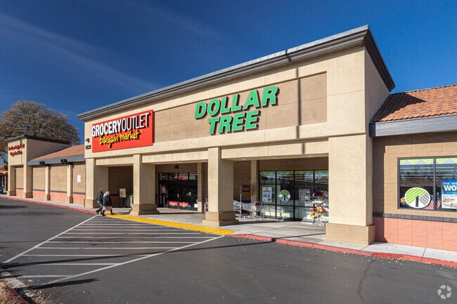
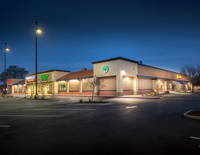
Property Record
5025 Marconi Ave, Carmichael, CA 95608


Save to a Folder
{{folder.Name}}
{{folder.ListingIds.length}} Properties
{{folder.ListingIds.length}} Property
Create a New Folder
Current Lease Availabilities
Property Detail
5025 Marconi Ave
271-0142-035
LOT 25, GREENWOOD, EXC THE E 200 OF THE S 200. CONTG 3.48 NAC M/L.
Supermarket
SACRAMENTO
SC
California
B and X Area of moderate flood hazard, usually the area between the limits of the 100-year and 500-year floods.
25
2024
3.48 AC
2025
Arden/Watt/Howe
005904
Sacramento
44,202 SF
Sacramento-Roseville-Folsom, CA
NEARBY LISTINGS FOR SALE OR LEASE
DEMOGRAPHICS near 5025 Marconi Ave
1 mile
3 mile
5 mile
2025 Total Population
22,444
130,439
378,337
2030 Population
22,629
131,483
382,395
Pop Growth 2025-2030
+ 0.82%
+ 0.80%
+ 1.07%
Average Age
41
42
40
2025 Total Households
8,778
51,383
146,273
HH Growth 2025-2030
+ 0.84%
+ 0.82%
+ 1.09%
Median Household Inc
$79,147
$84,399
$79,612
Avg Household Size
2.40
2.40
2.50
2025 Avg HH Vehicles
2.00
2.00
2.00
Median Home Value
$594,484
$599,044
$479,204
Median Year Built
1971
1968
1971
Nearby Places
Map Layers
Map Styles
 Street
 Aerial
Layers
 Traffic
 Biking
Places
Listings with unknown addresses are not visible on the map
- Restaurants
- Banks
- Shops
- Fitness
- Groceries
PUBLIC TRANSPORTATION
AIRPORT
Sacramento International
Drive
Walk
Distance
Sacramento International
29 min
19.3 mi
Nearby Properties
Address
Land Use
TOTAL SIZE
Lot Size
Zoning
Address
Land Use
TOTAL SIZE
Lot Size
Zoning
512,630 SF
37.68 AC
SPA (NPA)
Address
Land Use
TOTAL SIZE
Lot Size
Zoning
420,421 SF
25.39 AC
BP
Address
Land Use
TOTAL SIZE
Lot Size
Zoning
1,281 SF
0.42 AC
RD-20
Address
Land Use
TOTAL SIZE
Lot Size
Zoning
152,000 SF
12.88 AC
SPA
Address
Land Use
TOTAL SIZE
Lot Size
Zoning
145,334 SF
8.84 AC
RD-20
Address
Land Use
TOTAL SIZE
Lot Size
Zoning
278,877 SF
13.17 AC
RD-30
Address
Land Use
TOTAL SIZE
Lot Size
Zoning
75,700 SF
4.02 AC
RD-40
Address
Land Use
TOTAL SIZE
Lot Size
Zoning
136,483 SF
3.77 AC
BP
Address
Land Use
TOTAL SIZE
Lot Size
Zoning
169,618 SF
10.44 AC
RD-4
Address
Land Use
TOTAL SIZE
Lot Size
Zoning
138,263 SF
9.92 AC
SC
Address
Land Use
TOTAL SIZE
Lot Size
Zoning
140,102 SF
3.30 AC
RD-20
Address
Land Use
TOTAL SIZE
Lot Size
Zoning
89,098 SF
4.93 AC
RD-40
Address
Land Use
TOTAL SIZE
Lot Size
Zoning
148,576 SF
4.84 AC
RD-30
Address
Land Use
TOTAL SIZE
Lot Size
Zoning
43,183 SF
12.35 AC
H F
Address
Land Use
TOTAL SIZE
Lot Size
Zoning
101,301 SF
9.35 AC
SC
Address
Land Use
TOTAL SIZE
Lot Size
Zoning
72,119 SF
2.38 AC
BP (NPA)
Address
Land Use
TOTAL SIZE
Lot Size
Zoning
1,484 SF
4.94 AC
RD-20
Address
Land Use
TOTAL SIZE
Lot Size
Zoning
185,550 SF
8.67 AC
SC
Address
Land Use
TOTAL SIZE
Lot Size
Zoning
90,972 SF
2.36 AC
RD-40
Address
Land Use
TOTAL SIZE
Lot Size
Zoning
100,162 SF
7.42 AC
SC LC
Address
Land Use
TOTAL SIZE
Lot Size
Zoning
135,053 SF
6.66 AC
LC SC RD-4
Address
Land Use
TOTAL SIZE
Lot Size
Zoning
110,533 SF
4.17 AC
RD-5 RD-40
Address
Land Use
TOTAL SIZE
Lot Size
Zoning
166,300 SF
8.04 AC
RD-40 RD-2
Address
Land Use
TOTAL SIZE
Lot Size
Zoning
100,234 SF
5.93 AC
RD 30
Address
Land Use
TOTAL SIZE
Lot Size
Zoning
145,200 SF
5.39 AC
SC
Address
Land Use
TOTAL SIZE
Lot Size
Zoning
103,414 SF
5.01 AC
RD-30
Address
Land Use
TOTAL SIZE
Lot Size
Zoning
100,462 SF
5.02 AC
RD-30
Address
Land Use
TOTAL SIZE
Lot Size
Zoning
250,003 SF
11.91 AC
SC
Address
Land Use
TOTAL SIZE
Lot Size
Zoning
120,568 SF
5.64 AC
RD-30
Address
Land Use
TOTAL SIZE
Lot Size
Zoning
60,582 SF
3.55 AC
RD-20
The World's #1 Commercial Real Estate Marketplace
Connect with us
© 2026 CoStar Group
The information above has been obtained from sources believed reliable. While we do not doubt its accuracy we have not verified it and make no guarantee, warranty or representation about it. It is your responsibility to independently confirm its accuracy and completeness. Any projections, opinions, assumptions, or estimates used are for example only and do not represent the current or future performance of the property. The value of this transaction to you depends on tax and other factors which should be evaluated by your tax, financial, and legal advisors. You and your advisors should conduct a careful, independent investigation of the property to determine to your satisfaction the suitability of the property for your needs.