Property Record
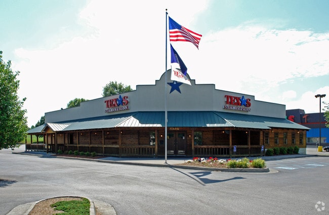
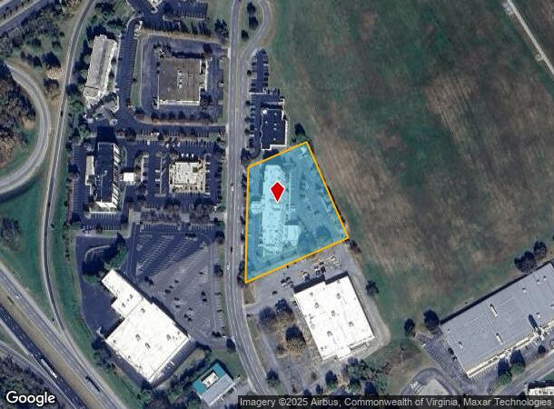
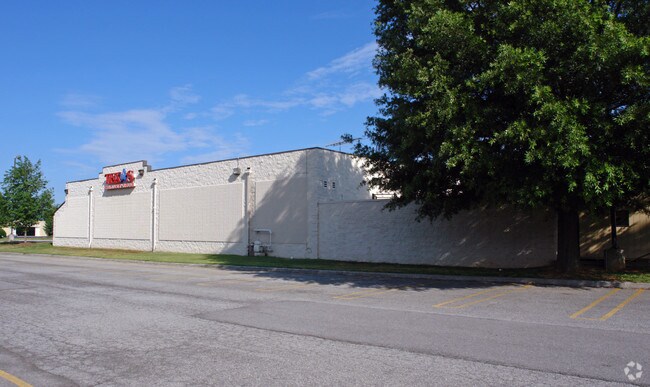
5033 Valley View Blvd Nw, Roanoke, VA 24012
NEARBY LISTINGS FOR SALE OR LEASE
Property Detail
5033 Valley View Blvd Nw
2490116
Combination Plat For Dsa Roanoke Llc Bei
Multipleuses
PARCEL 7B-1A BARRENS
X
Roanoke City
51161C0161G
Virginia
2025
2.49 AC
2025
Northeast Roanoke
000300
Roanoke
71,590 SF
Roanoke, VA
DEMOGRAPHICS near 5033 Valley View Blvd Nw
1 Mile
3 Mile
5 Mile
2024 Total Population
6,765
68,998
135,958
2029 Population
6,631
67,864
134,316
Pop Growth 2024-2029
(1.98%)
(1.64%)
(1.21%)
Average Age
38
40
40
2024 Total Households
2,837
29,221
58,965
HH Growth 2024-2029
(1.90%)
(1.63%)
(1.24%)
Median Household Inc
$42,004
$46,525
$52,880
Avg Household Size
2.30
2.30
2.20
2024 Avg HH Vehicles
2.00
2.00
2.00
Median Home Value
$143,535
$157,793
$179,314
Median Year Built
1969
1963
1964
Nearby Places
Map Layers
Map Styles
 Street
 Aerial
- Restaurants
- Banks
- Shops
- Fitness
- Groceries
PUBLIC TRANSPORTATION
COMMUTER RAIL
Roanoke (Northeast Regional - Amtrak)
DRIVE
WALK
Distance
Roanoke (Northeast Regional - Amtrak)
9 min
4.4 mi
AIRPORT
Roanoke/Blacksburg Regional (Woodrum Field)
DRIVE
WALK
Distance
Roanoke/Blacksburg Regional (Woodrum Field)
7 min
2.5 mi
Freight Ports
Virginia Port Authority - Richmond
DRIVE
WALK
Distance
Virginia Port Authority - Richmond
219 min
190.3 mi
Nearby Properties
Address
Land Use
TOTAL SIZE
Lot Size
Zoning
Address
Land Use
TOTAL SIZE
Lot Size
Zoning
8,930 SF
604.76 AC
AD
Address
Land Use
TOTAL SIZE
Lot Size
Zoning
3,850 SF
60.20 AC
INPUD
Address
Land Use
TOTAL SIZE
Lot Size
Zoning
437,578 SF
14.74 AC
CLS
Address
Land Use
TOTAL SIZE
Lot Size
Zoning
96,620 SF
26.84 AC
D
Address
Land Use
TOTAL SIZE
Lot Size
Zoning
87,406 SF
1.15 AC
D
Address
Land Use
TOTAL SIZE
Lot Size
Zoning
219,494 SF
12.01 AC
CLS
Address
Land Use
TOTAL SIZE
Lot Size
Zoning
262,715 SF
5.09 AC
D
Address
Land Use
TOTAL SIZE
Lot Size
Zoning
49,887 SF
2.28 AC
C1
Address
Land Use
TOTAL SIZE
Lot Size
Zoning
1.25 AC
D
Address
Land Use
TOTAL SIZE
Lot Size
Zoning
81,500 SF
0.63 AC
D
Address
Land Use
TOTAL SIZE
Lot Size
Zoning
12,220 SF
5.09 AC
D
Address
Land Use
TOTAL SIZE
Lot Size
Zoning
150,151 SF
0.84 AC
D
Address
Land Use
TOTAL SIZE
Lot Size
Zoning
141,056 SF
2.49 AC
D
Address
Land Use
TOTAL SIZE
Lot Size
Zoning
67,486 SF
3.99 AC
RMF
Address
Land Use
TOTAL SIZE
Lot Size
Zoning
73,575 SF
2.52 AC
D
Address
Land Use
TOTAL SIZE
Lot Size
Zoning
238,125 SF
0.37 AC
D
Address
Land Use
TOTAL SIZE
Lot Size
Zoning
160,537 SF
11.08 AC
I-1
Address
Land Use
TOTAL SIZE
Lot Size
Zoning
67,903 SF
11.96 AC
I2
Address
Land Use
TOTAL SIZE
Lot Size
Zoning
92,235 SF
0.49 AC
D
Address
Land Use
TOTAL SIZE
Lot Size
Zoning
609,211 SF
41.01 AC
I1C
Address
Land Use
TOTAL SIZE
Lot Size
Zoning
206,978 SF
19.45 AC
CLS
Address
Land Use
TOTAL SIZE
Lot Size
Zoning
331,365 SF
61.27 AC
I-2
Address
Land Use
TOTAL SIZE
Lot Size
Zoning
10,704 SF
12.76 AC
D
Address
Land Use
TOTAL SIZE
Lot Size
Zoning
10,878 SF
10.34 AC
RMF
Address
Land Use
TOTAL SIZE
Lot Size
Zoning
96,650 SF
0.84 AC
D
Address
Land Use
TOTAL SIZE
Lot Size
Zoning
207,812 SF
22.62 AC
CLS
Address
Land Use
TOTAL SIZE
Lot Size
Zoning
123,651 SF
29.38 AC
R2S
Address
Land Use
TOTAL SIZE
Lot Size
Zoning
164,753 SF
5.45 AC
INPUD
Address
Land Use
TOTAL SIZE
Lot Size
Zoning
71,238 SF
3.62 AC
CLS
Address
Land Use
TOTAL SIZE
Lot Size
Zoning
52,748 SF
0.55 AC
D
The World's #1 Commercial Real Estate Marketplace
Connect with us
© 2026 CoStar Group
The information above has been obtained from sources believed reliable. While we do not doubt its accuracy we have not verified it and make no guarantee, warranty or representation about it. It is your responsibility to independently confirm its accuracy and completeness. Any projections, opinions, assumptions, or estimates used are for example only and do not represent the current or future performance of the property. The value of this transaction to you depends on tax and other factors which should be evaluated by your tax, financial, and legal advisors. You and your advisors should conduct a careful, independent investigation of the property to determine to your satisfaction the suitability of the property for your needs.