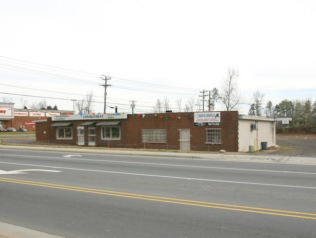
Property Record
5040 Beatties Ford Rd, Charlotte, NC 28216

NEARBY LISTINGS FOR SALE OR LEASE
Property Detail
5040 Beatties Ford Rd
041-221-03
M332-100
Commercialnec
Mecklenburg
X
North Carolina
3710454700K
3
2024
1.71 AC
2025
North
005406
Charlotte
14,917 SF
Charlotte-Concord-Gastonia, NC-SC
DEMOGRAPHICS near 5040 Beatties Ford Rd
1 Mile
3 Mile
5 Mile
2024 Total Population
5,342
59,366
171,118
2029 Population
5,657
62,673
181,620
Pop Growth 2024-2029
+ 5.90%
+ 5.57%
+ 6.14%
Average Age
37
36
36
2024 Total Households
1,860
21,459
66,360
HH Growth 2024-2029
+ 5.91%
+ 5.56%
+ 6.24%
Median Household Inc
$47,999
$52,605
$57,401
Avg Household Size
2.60
2.60
2.50
2024 Avg HH Vehicles
2.00
2.00
2.00
Median Home Value
$201,786
$202,264
$229,117
Median Year Built
1994
1997
1996
Nearby Places
Map Layers
Map Styles
 Street
 Aerial
- Restaurants
- Banks
- Shops
- Fitness
- Groceries
PUBLIC TRANSPORTATION
COMMUTER RAIL
DRIVE
WALK
Distance
12 min
7.2 mi
AIRPORT
Concord-Padgett Regional
DRIVE
WALK
Distance
Concord-Padgett Regional
20 min
12.9 mi
Charlotte/Douglas International
DRIVE
WALK
Distance
Charlotte/Douglas International
22 min
12.9 mi
Nearby Properties
Address
Land Use
TOTAL SIZE
Lot Size
Zoning
Address
Land Use
TOTAL SIZE
Lot Size
Zoning
641,285 SF
43.18 AC
I-1
Address
Land Use
TOTAL SIZE
Lot Size
Zoning
318,829 SF
26.68 AC
MX1INNOV
Address
Land Use
TOTAL SIZE
Lot Size
Zoning
308,793 SF
47.41 AC
R5
Address
Land Use
TOTAL SIZE
Lot Size
Zoning
322,507 SF
25.95 AC
I1
Address
Land Use
TOTAL SIZE
Lot Size
Zoning
295,520 SF
23.13 AC
R12MFCD
Address
Land Use
TOTAL SIZE
Lot Size
Zoning
263,035 SF
10.42 AC
CC
Address
Land Use
TOTAL SIZE
Lot Size
Zoning
294,175 SF
20.23 AC
R12MFCD
Address
Land Use
TOTAL SIZE
Lot Size
Zoning
490,844 SF
40.50 AC
I-2(CD)
Address
Land Use
TOTAL SIZE
Lot Size
Zoning
304,185 SF
14.32 AC
UR-3(CD)
Address
Land Use
TOTAL SIZE
Lot Size
Zoning
187,636 SF
16.56 AC
R17MFCD
Address
Land Use
TOTAL SIZE
Lot Size
Zoning
209,748 SF
12.38 AC
MX1INNOV
Address
Land Use
TOTAL SIZE
Lot Size
Zoning
634,939 SF
42.26 AC
I1CD
Address
Land Use
TOTAL SIZE
Lot Size
Zoning
322,342 SF
19.64 AC
R12MFCD
Address
Land Use
TOTAL SIZE
Lot Size
Zoning
129,017 SF
7.27 AC
CC
Address
Land Use
TOTAL SIZE
Lot Size
Zoning
134,925 SF
13.68 AC
CC
Address
Land Use
TOTAL SIZE
Lot Size
Zoning
195,448 SF
23.10 AC
R12MFCD
Address
Land Use
TOTAL SIZE
Lot Size
Zoning
180,625 SF
12.60 AC
Address
Land Use
TOTAL SIZE
Lot Size
Zoning
348,081 SF
17.20 AC
I-2(CD)
Address
Land Use
TOTAL SIZE
Lot Size
Zoning
174,118 SF
10.92 AC
R17MFCD
Address
Land Use
TOTAL SIZE
Lot Size
Zoning
627,355 SF
45.41 AC
I2
Address
Land Use
TOTAL SIZE
Lot Size
Zoning
381,151 SF
21.40 AC
I-1
Address
Land Use
TOTAL SIZE
Lot Size
Zoning
136,783 SF
7.85 AC
I-1
Address
Land Use
TOTAL SIZE
Lot Size
Zoning
174,768 SF
9.28 AC
INST(CD)
Address
Land Use
TOTAL SIZE
Lot Size
Zoning
429,864 SF
35.57 AC
I1
Address
Land Use
TOTAL SIZE
Lot Size
Zoning
130,812 SF
7.85 AC
I-1
Address
Land Use
TOTAL SIZE
Lot Size
Zoning
122,994 SF
6.50 AC
CC
Address
Land Use
TOTAL SIZE
Lot Size
Zoning
215,728 SF
13.32 AC
INST(CD)
Address
Land Use
TOTAL SIZE
Lot Size
Zoning
15,869 SF
517.12 AC
R4
Address
Land Use
TOTAL SIZE
Lot Size
Zoning
302,264 SF
16.23 AC
I-1
Address
Land Use
TOTAL SIZE
Lot Size
Zoning
121,428 SF
12.63 AC
CC
The World's #1 Commercial Real Estate Marketplace
Connect with us
© 2026 CoStar Group
The information above has been obtained from sources believed reliable. While we do not doubt its accuracy we have not verified it and make no guarantee, warranty or representation about it. It is your responsibility to independently confirm its accuracy and completeness. Any projections, opinions, assumptions, or estimates used are for example only and do not represent the current or future performance of the property. The value of this transaction to you depends on tax and other factors which should be evaluated by your tax, financial, and legal advisors. You and your advisors should conduct a careful, independent investigation of the property to determine to your satisfaction the suitability of the property for your needs.