Property Record
5075 Vasquez Blvd, Denver, CO 80216


NEARBY LISTINGS FOR SALE OR LEASE
Property Detail
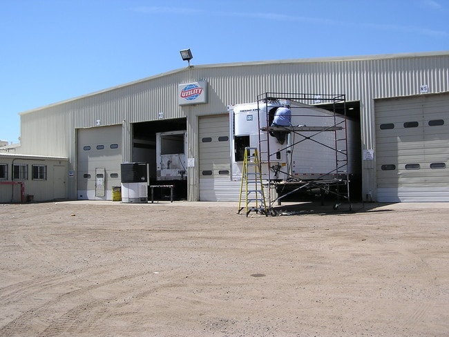
5075 Vasquez Blvd
2134-00-160
T3 R68 S13 SE/4 PT BEG 487.43 FT W OF COR OF S LI E 52ND AVE & WLY LI N VASQUEZ BV S 368.19 TPOB S 263.12FT E 100FT SLY 124.9FT SWLY 340.67FT W 224.03 FT N 667.90FT E 331.04FT POB
Warehouse
Denver
X
Colorado
0800460087H
5.31 AC
2024
Upper North Central
2025
Denver
003502
Denver-Aurora-Centennial, CO
24,179 SF
DEMOGRAPHICS near 5075 Vasquez Blvd
1 mile
3 mile
5 mile
2024 Total Population
4,033
75,007
364,062
2029 Population
4,038
76,087
371,825
Pop Growth 2024-2029
+ 0.12%
+ 1.44%
+ 2.13%
Average Age
35
36
37
2024 Total Households
1,153
28,245
164,324
HH Growth 2024-2029
0.00%
+ 1.39%
+ 2.07%
Median Household Inc
$55,930
$79,522
$85,191
Avg Household Size
3.20
2.50
2.10
2024 Avg HH Vehicles
2.00
2.00
2.00
Median Home Value
$329,027
$501,407
$596,536
Median Year Built
1951
1956
1972
Nearby Places
Map Layers
Map Styles
 Street
 Aerial
Transit
 Traffic
 Biking
Places
Listings with unknown addresses are not visible on the map
- Restaurants
- Banks
- Shops
- Fitness
- Groceries
PUBLIC TRANSPORTATION
COMMUTER RAIL
Drive
Walk
Distance
4 min
1.4 mi
Drive
Walk
Distance
4 min
1.5 mi
AIRPORT
Denver International
Drive
Walk
Distance
Denver International
28 min
20.7 mi
Nearby Properties
Address
Land Use
TOTAL SIZE
Lot Size
Zoning
Address
Land Use
TOTAL SIZE
Lot Size
Zoning
396,741 SF
8.12 AC
A1
Address
Land Use
TOTAL SIZE
Lot Size
Zoning
294,950 SF
6.91 AC
C-RX-12
Address
Land Use
TOTAL SIZE
Lot Size
Zoning
352,600 SF
18.21 AC
I-B
Address
Land Use
TOTAL SIZE
Lot Size
Zoning
719,357 SF
21.47 AC
M-MX-5
Address
Land Use
TOTAL SIZE
Lot Size
Zoning
1.64 AC
CMP
Address
Land Use
TOTAL SIZE
Lot Size
Zoning
343,997 SF
6.36 AC
S-MX-5
Address
Land Use
TOTAL SIZE
Lot Size
Zoning
84,252 SF
0.37 AC
I-MX-8
Address
Land Use
TOTAL SIZE
Lot Size
Zoning
256,155 SF
3.84 AC
Address
Land Use
TOTAL SIZE
Lot Size
Zoning
237,753 SF
18.94 AC
U-SU-B1
Address
Land Use
TOTAL SIZE
Lot Size
Zoning
3,188 SF
81.17 AC
I-B
Address
Land Use
TOTAL SIZE
Lot Size
Zoning
281,209 SF
1.66 AC
C-MX-12
Address
Land Use
TOTAL SIZE
Lot Size
Zoning
254,509 SF
16.29 AC
E-SU-DX
Address
Land Use
TOTAL SIZE
Lot Size
Zoning
25,000 SF
40.42 AC
I-A
Address
Land Use
TOTAL SIZE
Lot Size
Zoning
446,845 SF
10.43 AC
CMP-NWC-G
Address
Land Use
TOTAL SIZE
Lot Size
Zoning
238,888 SF
1.13 AC
C-MX-12
Address
Land Use
TOTAL SIZE
Lot Size
Zoning
134,729 SF
5.57 AC
Address
Land Use
TOTAL SIZE
Lot Size
Zoning
477,508 SF
79.66 AC
OS-A
Address
Land Use
TOTAL SIZE
Lot Size
Zoning
230,309 SF
0.79 AC
I-MX-8
Address
Land Use
TOTAL SIZE
Lot Size
Zoning
551,915 SF
25.76 AC
Address
Land Use
TOTAL SIZE
Lot Size
Zoning
599,680 SF
43.94 AC
Address
Land Use
TOTAL SIZE
Lot Size
Zoning
201,798 SF
0.71 AC
I-MX-5
Address
Land Use
TOTAL SIZE
Lot Size
Zoning
595,017 SF
11.62 AC
I-B
Address
Land Use
TOTAL SIZE
Lot Size
Zoning
116,502 SF
4.08 AC
Address
Land Use
TOTAL SIZE
Lot Size
Zoning
344,689 SF
11.77 AC
I-B
Address
Land Use
TOTAL SIZE
Lot Size
Zoning
299,498 SF
35.75 AC
C-MX-12
Address
Land Use
TOTAL SIZE
Lot Size
Zoning
727,307 SF
38.44 AC
I-B
Address
Land Use
TOTAL SIZE
Lot Size
Zoning
94,213 SF
3.84 AC
A1
Address
Land Use
TOTAL SIZE
Lot Size
Zoning
325,826 SF
73.92 AC
OS-A
Address
Land Use
TOTAL SIZE
Lot Size
Zoning
65,267 SF
2.91 AC
U-SU
Address
Land Use
TOTAL SIZE
Lot Size
Zoning
228,564 SF
11.07 AC
U-SU-A1
The World's #1 Commercial Real Estate Marketplace
Connect with us
© 2026 CoStar Group
The information above has been obtained from sources believed reliable. While we do not doubt its accuracy we have not verified it and make no guarantee, warranty or representation about it. It is your responsibility to independently confirm its accuracy and completeness. Any projections, opinions, assumptions, or estimates used are for example only and do not represent the current or future performance of the property. The value of this transaction to you depends on tax and other factors which should be evaluated by your tax, financial, and legal advisors. You and your advisors should conduct a careful, independent investigation of the property to determine to your satisfaction the suitability of the property for your needs.