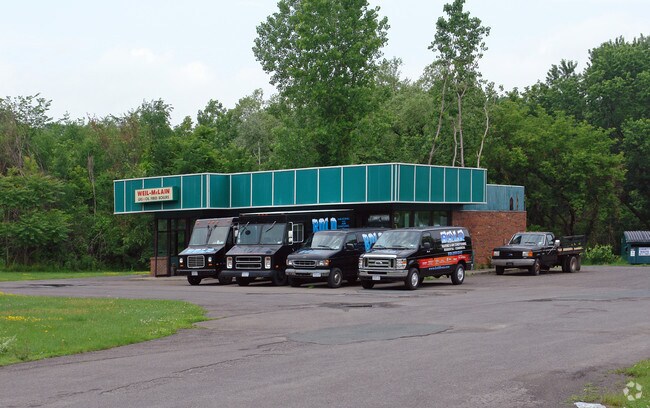
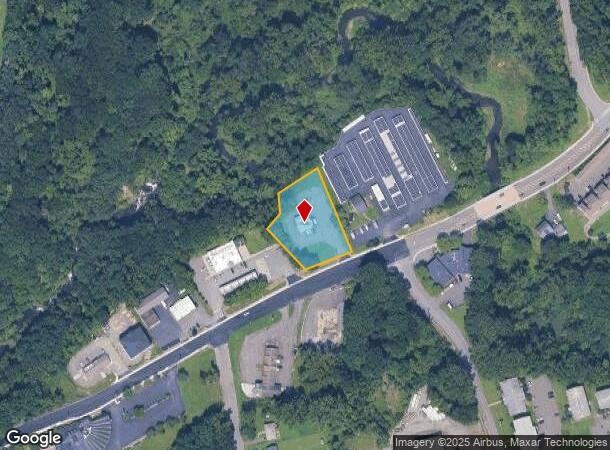
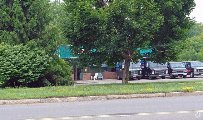
Property Record
509 Campbell Ave, Troy, NY 12180
NEARBY LISTINGS FOR SALE OR LEASE
Property Detail
509 Campbell Ave
1700-112-4-12.13
1 STY MAS BLDG
Storesoffices
Rensselaer
ARE
New York
36083C0233D
12.013
2025
1 AC
2024
Greater Troy
041102
Albany/Schenectady/Troy
1,800 SF
Albany-Schenectady-Troy, NY
DEMOGRAPHICS near 509 Campbell Ave
1 Mile
3 Mile
5 Mile
2024 Total Population
11,262
67,436
138,586
2029 Population
11,058
66,654
137,034
Pop Growth 2024-2029
(1.81%)
(1.16%)
(1.12%)
Average Age
37
38
39
2024 Total Households
4,496
28,023
58,874
HH Growth 2024-2029
(2.00%)
(1.23%)
(1.21%)
Median Household Inc
$61,504
$58,915
$66,772
Avg Household Size
2.20
2.10
2.20
2024 Avg HH Vehicles
1.00
1.00
1.00
Median Home Value
$169,727
$187,439
$234,467
Median Year Built
1961
1952
1960
Nearby Places
Map Layers
Map Styles
 Street
 Aerial
- Restaurants
- Banks
- Shops
- Fitness
- Groceries
PUBLIC TRANSPORTATION
COMMUTER RAIL
DRIVE
WALK
Distance
16 min
7.6 mi
AIRPORT
Albany International
DRIVE
WALK
Distance
Albany International
19 min
11.5 mi
Nearby Properties
Address
Land Use
TOTAL SIZE
Lot Size
Zoning
Address
Land Use
TOTAL SIZE
Lot Size
Zoning
34,971 SF
108.68 AC
CI
Address
Land Use
TOTAL SIZE
Lot Size
Zoning
313,907 SF
8.23 AC
CI
Address
Land Use
TOTAL SIZE
Lot Size
Zoning
120,579 SF
49.20 AC
CI
Address
Land Use
TOTAL SIZE
Lot Size
Zoning
9,643 SF
5.36 AC
CI
Address
Land Use
TOTAL SIZE
Lot Size
Zoning
Address
Land Use
TOTAL SIZE
Lot Size
Zoning
326,350 SF
11.11 AC
I
Address
Land Use
TOTAL SIZE
Lot Size
Zoning
35,392 SF
73.57 AC
CI
Address
Land Use
TOTAL SIZE
Lot Size
Zoning
413,006 SF
37.94 AC
CI
Address
Land Use
TOTAL SIZE
Lot Size
Zoning
67,335 SF
65.54 AC
CI
Address
Land Use
TOTAL SIZE
Lot Size
Zoning
38,176 SF
8.99 AC
06 - INDUS
Address
Land Use
TOTAL SIZE
Lot Size
Zoning
3,214 SF
412.83 AC
18
Address
Land Use
TOTAL SIZE
Lot Size
Zoning
70,548 SF
2.71 AC
DMU
Address
Land Use
TOTAL SIZE
Lot Size
Zoning
82,154 SF
3.62 AC
DMU
Address
Land Use
TOTAL SIZE
Lot Size
Zoning
11,264 SF
34.83 AC
MF
Address
Land Use
TOTAL SIZE
Lot Size
Zoning
353,510 SF
2.94 AC
WMU
Address
Land Use
TOTAL SIZE
Lot Size
Zoning
10,271 SF
11.22 AC
05 - COMME
Address
Land Use
TOTAL SIZE
Lot Size
Zoning
34.12 AC
Address
Land Use
TOTAL SIZE
Lot Size
Zoning
113,400 SF
3.40 AC
CI
Address
Land Use
TOTAL SIZE
Lot Size
Zoning
9,792 SF
7.98 AC
R3
Address
Land Use
TOTAL SIZE
Lot Size
Zoning
77,928 SF
2.25 AC
WMU
Address
Land Use
TOTAL SIZE
Lot Size
Zoning
87,427 SF
20.30 AC
R1A
Address
Land Use
TOTAL SIZE
Lot Size
Zoning
105,094 SF
3.38 AC
MF
Address
Land Use
TOTAL SIZE
Lot Size
Zoning
96,552 SF
0.67 AC
DMU
Address
Land Use
TOTAL SIZE
Lot Size
Zoning
136,218 SF
15.39 AC
CC
Address
Land Use
TOTAL SIZE
Lot Size
Zoning
93,657 SF
0.96 AC
DMU
Address
Land Use
TOTAL SIZE
Lot Size
Zoning
33.38 AC
Address
Land Use
TOTAL SIZE
Lot Size
Zoning
154,587 SF
3.79 AC
CC
Address
Land Use
TOTAL SIZE
Lot Size
Zoning
155,900 SF
1.30 AC
DMU
Address
Land Use
TOTAL SIZE
Lot Size
Zoning
3,600 SF
17.54 AC
MF
The World's #1 Commercial Real Estate Marketplace
Connect with us
© 2026 CoStar Group
The information above has been obtained from sources believed reliable. While we do not doubt its accuracy we have not verified it and make no guarantee, warranty or representation about it. It is your responsibility to independently confirm its accuracy and completeness. Any projections, opinions, assumptions, or estimates used are for example only and do not represent the current or future performance of the property. The value of this transaction to you depends on tax and other factors which should be evaluated by your tax, financial, and legal advisors. You and your advisors should conduct a careful, independent investigation of the property to determine to your satisfaction the suitability of the property for your needs.