Property Record
51 Knapp Ctr, Brockton, MA 02301
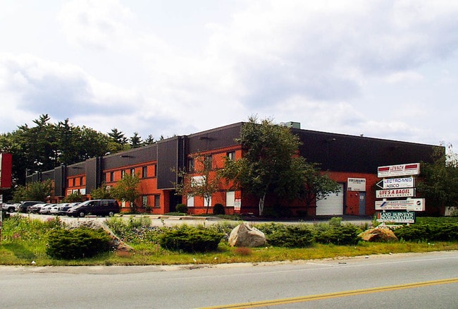
Property Detail
51 Knapp Ctr
Commercialcondominium
PLYMOUTH
I1
Massachusetts
B and X Area of moderate flood hazard, usually the area between the limits of the 100-year and 500-year floods.
Route 24
2025
Boston
2025
Boston-Cambridge-Newton, MA-NH
511702
BROC-000008-000501
2,904 SF
NEARBY LISTINGS FOR SALE OR LEASE
DEMOGRAPHICS near 51 Knapp Ctr
1 mile
3 mile
5 mile
2025 Total Population
3,390
73,190
143,082
2030 Population
3,412
73,200
143,641
Pop Growth 2025-2030
+ 0.65%
+ 0.01%
+ 0.39%
Average Age
43
39
40
2025 Total Households
1,144
24,536
48,706
HH Growth 2025-2030
+ 0.61%
+ 0.09%
+ 0.38%
Median Household Inc
$113,671
$84,285
$89,176
Avg Household Size
2.80
2.70
2.70
2025 Avg HH Vehicles
2.00
2.00
2.00
Median Home Value
$476,757
$473,901
$482,140
Median Year Built
1968
1956
1962
Nearby Places
Map Layers
Map Styles
 Street
 Aerial
Layers
 Traffic
 Biking
Places
Listings with unknown addresses are not visible on the map
- Restaurants
- Banks
- Shops
- Fitness
- Groceries
PUBLIC TRANSPORTATION
COMMUTER RAIL
Campello (Middleborough/Lakeville Line - Massachusetts Bay Transportation Authority Commuter Rail (Purple Line))
Drive
Walk
Distance
Campello (Middleborough/Lakeville Line - Massachusetts Bay Transportation Authority Commuter Rail (Purple Line))
7 min
2.8 mi
Brockton (Middleborough/Lakeville Line - Massachusetts Bay Transportation Authority Commuter Rail (Purple Line))
Drive
Walk
Distance
Brockton (Middleborough/Lakeville Line - Massachusetts Bay Transportation Authority Commuter Rail (Purple Line))
9 min
3.9 mi
AIRPORT
General Edward Lawrence Logan International
Drive
Walk
Distance
General Edward Lawrence Logan International
40 min
27.1 mi
Rhode Island Tf Green International
Drive
Walk
Distance
Rhode Island Tf Green International
65 min
37.3 mi
Freight Ports
Port of Boston
Drive
Walk
Distance
Port of Boston
37 min
24.9 mi
Nearby Properties
Address
Land Use
TOTAL SIZE
Lot Size
Zoning
Address
Land Use
TOTAL SIZE
Lot Size
Zoning
3,088 SF
1.42 AC
C3
Address
Land Use
TOTAL SIZE
Lot Size
Zoning
Address
Land Use
TOTAL SIZE
Lot Size
Zoning
1,352 SF
66.81 AC
R1B
Address
Land Use
TOTAL SIZE
Lot Size
Zoning
22.56 AC
Address
Land Use
TOTAL SIZE
Lot Size
Zoning
8.09 AC
R1C
Address
Land Use
TOTAL SIZE
Lot Size
Zoning
27,951 SF
1.19 AC
R3
Address
Land Use
TOTAL SIZE
Lot Size
Zoning
270,179 SF
51 AC
Address
Land Use
TOTAL SIZE
Lot Size
Zoning
3,088 SF
1.38 AC
C3
Address
Land Use
TOTAL SIZE
Lot Size
Zoning
4,524 SF
12.31 AC
R1C
Address
Land Use
TOTAL SIZE
Lot Size
Zoning
3,438 SF
1.15 AC
C2
Address
Land Use
TOTAL SIZE
Lot Size
Zoning
223,200 SF
5.26 AC
C2
Address
Land Use
TOTAL SIZE
Lot Size
Zoning
88,957 SF
0.57 AC
R2
Address
Land Use
TOTAL SIZE
Lot Size
Zoning
4,074 SF
3.82 AC
R3
Address
Land Use
TOTAL SIZE
Lot Size
Zoning
130,640 SF
10.27 AC
R1C
Address
Land Use
TOTAL SIZE
Lot Size
Zoning
3,812 SF
0.64 AC
C3
Address
Land Use
TOTAL SIZE
Lot Size
Zoning
1,660 SF
31.95 AC
R1B
Address
Land Use
TOTAL SIZE
Lot Size
Zoning
97,262 SF
6.46 AC
Address
Land Use
TOTAL SIZE
Lot Size
Zoning
6,110 SF
14.03 AC
R1A
Address
Land Use
TOTAL SIZE
Lot Size
Zoning
558,011 SF
82.11 AC
Address
Land Use
TOTAL SIZE
Lot Size
Zoning
254,946 SF
11.22 AC
R2
Address
Land Use
TOTAL SIZE
Lot Size
Zoning
3,255 SF
1 AC
C3
Address
Land Use
TOTAL SIZE
Lot Size
Zoning
2,884 SF
3.18 AC
R2
Address
Land Use
TOTAL SIZE
Lot Size
Zoning
1,217 SF
13.79 AC
R1C
Address
Land Use
TOTAL SIZE
Lot Size
Zoning
210,600 SF
19.86 AC
Address
Land Use
TOTAL SIZE
Lot Size
Zoning
1,871 SF
39.63 AC
C2
Address
Land Use
TOTAL SIZE
Lot Size
Zoning
647 SF
53.67 AC
I3
Address
Land Use
TOTAL SIZE
Lot Size
Zoning
1,576 SF
5.83 AC
C5
Address
Land Use
TOTAL SIZE
Lot Size
Zoning
10.58 AC
R3
Address
Land Use
TOTAL SIZE
Lot Size
Zoning
312,000 SF
30.61 AC
Address
Land Use
TOTAL SIZE
Lot Size
Zoning
2,574 SF
7.96 AC
I1
The World's #1 Commercial Real Estate Marketplace
Connect with us
© 2026 CoStar Group
The information above has been obtained from sources believed reliable. While we do not doubt its accuracy we have not verified it and make no guarantee, warranty or representation about it. It is your responsibility to independently confirm its accuracy and completeness. Any projections, opinions, assumptions, or estimates used are for example only and do not represent the current or future performance of the property. The value of this transaction to you depends on tax and other factors which should be evaluated by your tax, financial, and legal advisors. You and your advisors should conduct a careful, independent investigation of the property to determine to your satisfaction the suitability of the property for your needs.