Property Record
51061 Us 33 Bnd N, South Bend, IN 46637
NEARBY LISTINGS FOR SALE OR LEASE
Property Detail
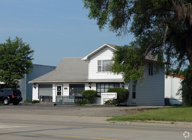
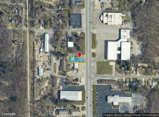
51061 Us 33 Bnd N
South Bend-Mishawaka, IN-MI
Mulligans Pro
71-03-13-102-006.000-003
LOT 5 MULLIGANS PRO 200 X 67 E SIDE NE NW NW
Storebuilding
St Joseph
X
Indiana
18141C0070D
5
2023
0.31 AC
2024
Outlying St Joseph County
011308
South Bend/Mishawaka
5,241 SF
DEMOGRAPHICS near 51061 Us 33 Bnd N
1 Mile
3 Mile
5 Mile
2024 Total Population
4,076
31,333
101,878
2029 Population
4,032
30,970
101,661
Pop Growth 2024-2029
(1.08%)
(1.16%)
(0.21%)
Average Age
42
42
38
2024 Total Households
1,650
13,151
39,337
HH Growth 2024-2029
(1.15%)
(1.19%)
(0.25%)
Median Household Inc
$79,320
$77,256
$62,100
Avg Household Size
2.40
2.30
2.30
2024 Avg HH Vehicles
2.00
2.00
2.00
Median Home Value
$160,769
$185,254
$176,282
Median Year Built
1967
1976
1973
Nearby Places
Map Layers
Map Styles
 Street
 Aerial
- Restaurants
- Banks
- Shops
- Fitness
- Groceries
PUBLIC TRANSPORTATION
COMMUTER RAIL
South Bend Airport Station (South Shore Line - Northern Indiana Commuter Transportation District (South Shore Line))
DRIVE
WALK
Distance
South Bend Airport Station (South Shore Line - Northern Indiana Commuter Transportation District (South Shore Line))
15 min
6.9 mi
South Bend Amtrak Station (Capitol Limited - Amtrak, Lake Shore Limited - Amtrak)
DRIVE
WALK
Distance
South Bend Amtrak Station (Capitol Limited - Amtrak, Lake Shore Limited - Amtrak)
15 min
7.0 mi
AIRPORT
South Bend International
DRIVE
WALK
Distance
South Bend International
25 min
9.9 mi
Freight Ports
Port Milwaukee
DRIVE
WALK
Distance
Port Milwaukee
219 min
180.9 mi
Nearby Properties
Address
Land Use
TOTAL SIZE
Lot Size
Zoning
Address
Land Use
TOTAL SIZE
Lot Size
Zoning
151,377 SF
0.01 AC
Address
Land Use
TOTAL SIZE
Lot Size
Zoning
799,664 SF
0.01 AC
Address
Land Use
TOTAL SIZE
Lot Size
Zoning
25,756 SF
337.40 AC
Address
Land Use
TOTAL SIZE
Lot Size
Zoning
356,520 SF
28.07 AC
Address
Land Use
TOTAL SIZE
Lot Size
Zoning
174,997 SF
0.70 AC
Address
Land Use
TOTAL SIZE
Lot Size
Zoning
128,298 SF
0.84 AC
Address
Land Use
TOTAL SIZE
Lot Size
Zoning
157,702 SF
44 SF
Address
Land Use
TOTAL SIZE
Lot Size
Zoning
114,844 SF
4.17 AC
Address
Land Use
TOTAL SIZE
Lot Size
Zoning
63,780 SF
44 SF
Address
Land Use
TOTAL SIZE
Lot Size
Zoning
178,316 SF
44 SF
Address
Land Use
TOTAL SIZE
Lot Size
Zoning
214,657 SF
131 SF
Address
Land Use
TOTAL SIZE
Lot Size
Zoning
203,750 SF
22.36 AC
Address
Land Use
TOTAL SIZE
Lot Size
Zoning
63,374 SF
1.99 AC
Address
Land Use
TOTAL SIZE
Lot Size
Zoning
33,936 SF
1.84 AC
GB
Address
Land Use
TOTAL SIZE
Lot Size
Zoning
58,213 SF
87 SF
Address
Land Use
TOTAL SIZE
Lot Size
Zoning
70,170 SF
4.01 AC
Address
Land Use
TOTAL SIZE
Lot Size
Zoning
266,881 SF
26.20 AC
Address
Land Use
TOTAL SIZE
Lot Size
Zoning
62,968 SF
2.66 AC
Address
Land Use
TOTAL SIZE
Lot Size
Zoning
74,400 SF
1.13 AC
Address
Land Use
TOTAL SIZE
Lot Size
Zoning
54,048 SF
2.11 AC
Address
Land Use
TOTAL SIZE
Lot Size
Zoning
164,768 SF
24.57 AC
GB
Address
Land Use
TOTAL SIZE
Lot Size
Zoning
215,252 SF
18.33 AC
Address
Land Use
TOTAL SIZE
Lot Size
Zoning
4,448 SF
174 SF
Address
Land Use
TOTAL SIZE
Lot Size
Zoning
80,666 SF
3.41 AC
Address
Land Use
TOTAL SIZE
Lot Size
Zoning
41,512 SF
1.37 AC
Address
Land Use
TOTAL SIZE
Lot Size
Zoning
40,244 SF
2.15 AC
Address
Land Use
TOTAL SIZE
Lot Size
Zoning
27,132 SF
174 SF
Address
Land Use
TOTAL SIZE
Lot Size
Zoning
135,152 SF
8.76 AC
GB
Address
Land Use
TOTAL SIZE
Lot Size
Zoning
35,651 SF
87 SF
Address
Land Use
TOTAL SIZE
Lot Size
Zoning
20,553 SF
44 SF
The World's #1 Commercial Real Estate Marketplace
Connect with us
© 2025 CoStar Group
The information above has been obtained from sources believed reliable. While we do not doubt its accuracy we have not verified it and make no guarantee, warranty or representation about it. It is your responsibility to independently confirm its accuracy and completeness. Any projections, opinions, assumptions, or estimates used are for example only and do not represent the current or future performance of the property. The value of this transaction to you depends on tax and other factors which should be evaluated by your tax, financial, and legal advisors. You and your advisors should conduct a careful, independent investigation of the property to determine to your satisfaction the suitability of the property for your needs.