Property Record
515 E 63Rd St, Savannah, GA 31405
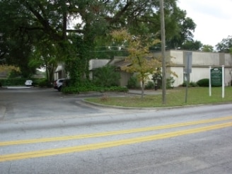

Property Detail
515 E 63Rd St
2010508017
PART OF POPLAR GROVE TCT GILL W D
Medicalbuilding
Chatham
RIP
Georgia
B and X Area of moderate flood hazard, usually the area between the limits of the 100-year and 500-year floods.
0.79 AC
2023
Greater Savannah
2025
Savannah
003400
Savannah, GA
8,872 SF
NEARBY LISTINGS FOR SALE OR LEASE
DEMOGRAPHICS near 515 E 63Rd St
1 mile
3 mile
5 mile
2025 Total Population
11,783
93,953
151,980
2030 Population
12,243
98,715
159,224
Pop Growth 2025-2030
+ 3.90%
+ 5.07%
+ 4.77%
Average Age
42
39
39
2025 Total Households
5,163
39,167
61,907
HH Growth 2025-2030
+ 4.01%
+ 5.34%
+ 5.08%
Median Household Inc
$73,485
$53,268
$57,013
Avg Household Size
2.10
2.20
2.20
2025 Avg HH Vehicles
2.00
1.00
2.00
Median Home Value
$391,430
$293,724
$289,329
Median Year Built
1953
1959
1969
Nearby Places
Map Layers
Map Styles
 Street
 Aerial
Transit
 Traffic
 Biking
Places
Listings with unknown addresses are not visible on the map
- Restaurants
- Banks
- Shops
- Fitness
- Groceries
PUBLIC TRANSPORTATION
COMMUTER RAIL
Drive
Walk
Distance
14 min
7.8 mi
AIRPORT
Savannah/Hilton Head International
Drive
Walk
Distance
Savannah/Hilton Head International
26 min
13.3 mi
Hilton Head
Drive
Walk
Distance
Hilton Head
67 min
40.7 mi
Freight Ports
Georgia Ports - Savannah
Drive
Walk
Distance
Georgia Ports - Savannah
23 min
12.0 mi
Nearby Properties
Address
Land Use
TOTAL SIZE
Lot Size
Zoning
Address
Land Use
TOTAL SIZE
Lot Size
Zoning
14,252 SF
52.91 AC
RIP
Address
Land Use
TOTAL SIZE
Lot Size
Zoning
1,400 SF
6.97 AC
D-X
Address
Land Use
TOTAL SIZE
Lot Size
Zoning
0.12 AC
R6
Address
Land Use
TOTAL SIZE
Lot Size
Zoning
559,705 SF
44.25 AC
BC
Address
Land Use
TOTAL SIZE
Lot Size
Zoning
6,245 SF
13.52 AC
PUDISB
Address
Land Use
TOTAL SIZE
Lot Size
Zoning
33,000 SF
1.92 AC
I-L
Address
Land Use
TOTAL SIZE
Lot Size
Zoning
199,424 SF
2.49 AC
BN
Address
Land Use
TOTAL SIZE
Lot Size
Zoning
77,610 SF
0.33 AC
BC1
Address
Land Use
TOTAL SIZE
Lot Size
Zoning
245,610 SF
1.10 AC
RIPC
Address
Land Use
TOTAL SIZE
Lot Size
Zoning
52,272 SF
82.59 AC
RIP
Address
Land Use
TOTAL SIZE
Lot Size
Zoning
100 SF
15.62 AC
RM25
Address
Land Use
TOTAL SIZE
Lot Size
Zoning
9 AC
RMF-2-35
Address
Land Use
TOTAL SIZE
Lot Size
Zoning
7,900 SF
1.98 AC
RIPB1
Address
Land Use
TOTAL SIZE
Lot Size
Zoning
8,480 SF
16.50 AC
PUDM25
Address
Land Use
TOTAL SIZE
Lot Size
Zoning
175,552 SF
1.12 AC
RM25
Address
Land Use
TOTAL SIZE
Lot Size
Zoning
14,249 SF
14.92 AC
BC
Address
Land Use
TOTAL SIZE
Lot Size
Zoning
59.65 AC
RIP
Address
Land Use
TOTAL SIZE
Lot Size
Zoning
128,061 SF
29.78 AC
R6
Address
Land Use
TOTAL SIZE
Lot Size
Zoning
85,606 SF
16.30 AC
BC
Address
Land Use
TOTAL SIZE
Lot Size
Zoning
2,226 SF
67.62 AC
IP
Address
Land Use
TOTAL SIZE
Lot Size
Zoning
115,859 SF
1.85 AC
Address
Land Use
TOTAL SIZE
Lot Size
Zoning
4,832 SF
6.43 AC
I-L
Address
Land Use
TOTAL SIZE
Lot Size
Zoning
34,945 SF
18.22 AC
I-P
Address
Land Use
TOTAL SIZE
Lot Size
Zoning
297,627 SF
28.63 AC
PUDIS
Address
Land Use
TOTAL SIZE
Lot Size
Zoning
302,600 SF
7.49 AC
R6
Address
Land Use
TOTAL SIZE
Lot Size
Zoning
15,792 SF
10.50 AC
I-P
Address
Land Use
TOTAL SIZE
Lot Size
Zoning
5,452 SF
5.81 AC
RM25
Address
Land Use
TOTAL SIZE
Lot Size
Zoning
20,668 SF
15.60 AC
R1
Address
Land Use
TOTAL SIZE
Lot Size
Zoning
73,301 SF
0.25 AC
BC1
Address
Land Use
TOTAL SIZE
Lot Size
Zoning
7,500 SF
0.92 AC
RIP
The World's #1 Commercial Real Estate Marketplace
Connect with us
© 2026 CoStar Group
The information above has been obtained from sources believed reliable. While we do not doubt its accuracy we have not verified it and make no guarantee, warranty or representation about it. It is your responsibility to independently confirm its accuracy and completeness. Any projections, opinions, assumptions, or estimates used are for example only and do not represent the current or future performance of the property. The value of this transaction to you depends on tax and other factors which should be evaluated by your tax, financial, and legal advisors. You and your advisors should conduct a careful, independent investigation of the property to determine to your satisfaction the suitability of the property for your needs.