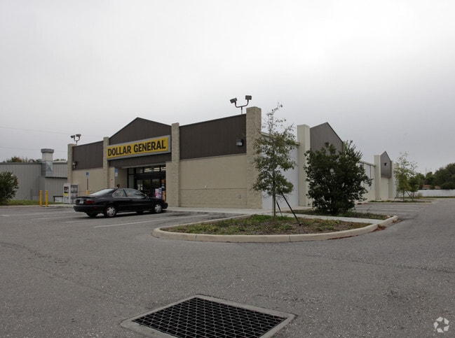
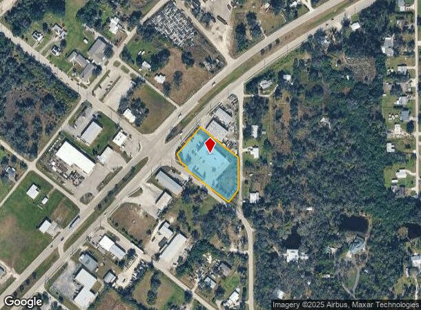
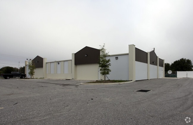
Property Record
5150 Duncan Rd, Punta Gorda, FL 33982

NEARBY LISTINGS FOR SALE OR LEASE
Property Detail
5150 Duncan Rd
Punta Gorda, FL
N Cleveland
402335114004
N CLEVELAND BLK 67 LT 1 & PRT OF LT 4 DESC AS BEG AT NW COR LT 4 BLK 67 N CLEVELAND SUB TH NE 100 FT SE 41.20 FT NE 109.67 FT SE 208 FT S 145 FT SW 95 FT NW 403 FT TO POB 464/32 782/1082 848/164 RE862/803 1080/1943 1080/1945 1283/787 2424/1742 3
Storebuilding
Charlotte
AE
Florida
12015C0253G
1,4
2024
1.46 AC
2025
Charlotte County
010200
Southwest Florida
9,086 SF
DEMOGRAPHICS near 5150 Duncan Rd
1 Mile
3 Mile
5 Mile
2024 Total Population
1,856
9,069
40,720
2029 Population
2,244
10,919
49,167
Pop Growth 2024-2029
+ 20.91%
+ 20.40%
+ 20.74%
Average Age
50
51
52
2024 Total Households
861
4,178
18,731
HH Growth 2024-2029
+ 21.14%
+ 20.66%
+ 21.07%
Median Household Inc
$46,764
$46,405
$49,380
Avg Household Size
2.10
2.10
2.10
2024 Avg HH Vehicles
2.00
2.00
2.00
Median Home Value
$142,272
$212,612
$239,101
Median Year Built
1988
1988
1993
Nearby Places
Map Layers
Map Styles
 Street
 Aerial
- Restaurants
- Banks
- Shops
- Fitness
- Groceries
PUBLIC TRANSPORTATION
AIRPORT
Punta Gorda
DRIVE
WALK
Distance
Punta Gorda
9 min
4.4 mi
Southwest Florida International
DRIVE
WALK
Distance
Southwest Florida International
48 min
38.8 mi
Nearby Properties
Address
Land Use
TOTAL SIZE
Lot Size
Zoning
Address
Land Use
TOTAL SIZE
Lot Size
Zoning
161,439 SF
171 AC
RE1
Address
Land Use
TOTAL SIZE
Lot Size
Zoning
121,585 SF
696.03 AC
RE1
Address
Land Use
TOTAL SIZE
Lot Size
Zoning
254.31 AC
PD
Address
Land Use
TOTAL SIZE
Lot Size
Zoning
385,350 SF
374.81 AC
ECAP
Address
Land Use
TOTAL SIZE
Lot Size
Zoning
134,308 SF
16 AC
RSF3.5
Address
Land Use
TOTAL SIZE
Lot Size
Zoning
125.54 AC
PD
Address
Land Use
TOTAL SIZE
Lot Size
Zoning
116,186 SF
20.02 AC
RMF10
Address
Land Use
TOTAL SIZE
Lot Size
Zoning
136.11 AC
ECAP
Address
Land Use
TOTAL SIZE
Lot Size
Zoning
60,000 SF
9.87 AC
ECAP
Address
Land Use
TOTAL SIZE
Lot Size
Zoning
66,461 SF
10.86 AC
CG
Address
Land Use
TOTAL SIZE
Lot Size
Zoning
54.25 AC
RMF10
Address
Land Use
TOTAL SIZE
Lot Size
Zoning
103,870 SF
17.06 AC
CG
Address
Land Use
TOTAL SIZE
Lot Size
Zoning
1,556 SF
23.08 AC
CG
Address
Land Use
TOTAL SIZE
Lot Size
Zoning
7,964 SF
7.86 AC
ECAP
Address
Land Use
TOTAL SIZE
Lot Size
Zoning
60,000 SF
1.44 AC
ECAP
Address
Land Use
TOTAL SIZE
Lot Size
Zoning
60.56 AC
PD
Address
Land Use
TOTAL SIZE
Lot Size
Zoning
46,912 SF
3.41 AC
CG
Address
Land Use
TOTAL SIZE
Lot Size
Zoning
30,719 SF
107.17 AC
PKR
Address
Land Use
TOTAL SIZE
Lot Size
Zoning
31,194 SF
7.93 AC
CG
Address
Land Use
TOTAL SIZE
Lot Size
Zoning
12,780 SF
86.57 AC
ECAP
Address
Land Use
TOTAL SIZE
Lot Size
Zoning
34,854 SF
655 AC
ES
Address
Land Use
TOTAL SIZE
Lot Size
Zoning
106.30 AC
PD
Address
Land Use
TOTAL SIZE
Lot Size
Zoning
7,128 SF
0.76 AC
ECAP
Address
Land Use
TOTAL SIZE
Lot Size
Zoning
37,150 SF
3.66 AC
ECAP
Address
Land Use
TOTAL SIZE
Lot Size
Zoning
28.40 AC
PD
Address
Land Use
TOTAL SIZE
Lot Size
Zoning
8,750 SF
21.19 AC
CG
Address
Land Use
TOTAL SIZE
Lot Size
Zoning
15,085 SF
2.90 AC
CG
Address
Land Use
TOTAL SIZE
Lot Size
Zoning
2,400 SF
1.65 AC
IG
Address
Land Use
TOTAL SIZE
Lot Size
Zoning
9.31 AC
RMF10
Address
Land Use
TOTAL SIZE
Lot Size
Zoning
29,800 SF
4.09 AC
CG
The World's #1 Commercial Real Estate Marketplace
Connect with us
© 2025 CoStar Group
The information above has been obtained from sources believed reliable. While we do not doubt its accuracy we have not verified it and make no guarantee, warranty or representation about it. It is your responsibility to independently confirm its accuracy and completeness. Any projections, opinions, assumptions, or estimates used are for example only and do not represent the current or future performance of the property. The value of this transaction to you depends on tax and other factors which should be evaluated by your tax, financial, and legal advisors. You and your advisors should conduct a careful, independent investigation of the property to determine to your satisfaction the suitability of the property for your needs.