Property Record
52 W State St, Granby, MA 01033
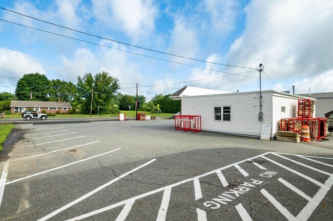

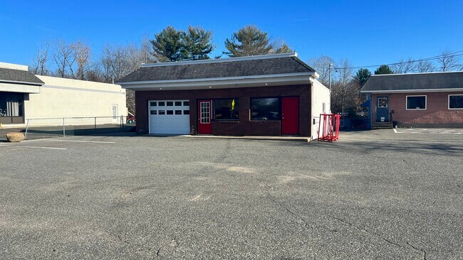
Property Detail
52 W State St
Amherst Town-Northampton, MA
Hampshire
GRAN-000004AA000000-000004
Massachusetts
Commercialnec
4
2025
0.69 AC
2025
Hampshire County
820900
Hartford
NEARBY LISTINGS FOR SALE OR LEASE
DEMOGRAPHICS near 52 W State St
1 mile
3 mile
5 mile
2025 Total Population
3,381
22,474
86,052
2030 Population
3,357
22,541
86,778
Pop Growth 2025-2030
(0.71%)
+ 0.30%
+ 0.84%
Average Age
37
41
41
2025 Total Households
953
8,481
34,813
HH Growth 2025-2030
(1.15%)
+ 0.38%
+ 0.95%
Median Household Inc
$110,488
$86,842
$65,807
Avg Household Size
2.40
2.30
2.30
2025 Avg HH Vehicles
2.00
2.00
2.00
Median Home Value
$334,732
$334,480
$297,646
Median Year Built
1960
1966
1974
Nearby Places
Map Layers
Map Styles
 Street
 Aerial
Layers
 Traffic
 Biking
Places
Listings with unknown addresses are not visible on the map
- Restaurants
- Banks
- Shops
- Fitness
- Groceries
PUBLIC TRANSPORTATION
COMMUTER RAIL
Holyoke Amtrak (Valley Flyer - Amtrak, Vermonter - Amtrak)
Drive
Walk
Distance
Holyoke Amtrak (Valley Flyer - Amtrak, Vermonter - Amtrak)
9 min
5.6 mi
AIRPORT
Bradley International
Drive
Walk
Distance
Bradley International
50 min
25.8 mi
Freight Ports
Albany, NY Port
Drive
Walk
Distance
Albany, NY Port
110 min
88.0 mi
SALE & LEASE HISTORY
LISTING DATE
SALE/LEASE

Nov 04, 2022
For Lease
Aug 29, 2022
For Lease
Nearby Properties
Address
Land Use
TOTAL SIZE
Lot Size
Zoning
Address
Land Use
TOTAL SIZE
Lot Size
Zoning
16.30 AC
RA2
Address
Land Use
TOTAL SIZE
Lot Size
Zoning
4.50 AC
RA2
Address
Land Use
TOTAL SIZE
Lot Size
Zoning
52 AC
RA1
Address
Land Use
TOTAL SIZE
Lot Size
Zoning
26.68 AC
110
Address
Land Use
TOTAL SIZE
Lot Size
Zoning
9 AC
RA2
Address
Land Use
TOTAL SIZE
Lot Size
Zoning
4.04 AC
107
Address
Land Use
TOTAL SIZE
Lot Size
Zoning
26.35 AC
RA2
Address
Land Use
TOTAL SIZE
Lot Size
Zoning
64,638 SF
9.26 AC
RA2
Address
Land Use
TOTAL SIZE
Lot Size
Zoning
80,393 SF
1.71 AC
111
Address
Land Use
TOTAL SIZE
Lot Size
Zoning
3.30 AC
RA2
Address
Land Use
TOTAL SIZE
Lot Size
Zoning
152,380 SF
11.36 AC
110
Address
Land Use
TOTAL SIZE
Lot Size
Zoning
61,808 SF
8.53 AC
RA2
Address
Land Use
TOTAL SIZE
Lot Size
Zoning
291,714 SF
35.75 AC
110
Address
Land Use
TOTAL SIZE
Lot Size
Zoning
144,384 SF
35.87 AC
RA2
Address
Land Use
TOTAL SIZE
Lot Size
Zoning
2.44 AC
RA2
Address
Land Use
TOTAL SIZE
Lot Size
Zoning
16.36 AC
RA1
Address
Land Use
TOTAL SIZE
Lot Size
Zoning
17.68 AC
IGD
Address
Land Use
TOTAL SIZE
Lot Size
Zoning
1.09 AC
RA2
Address
Land Use
TOTAL SIZE
Lot Size
Zoning
3 AC
107
Address
Land Use
TOTAL SIZE
Lot Size
Zoning
1,361.42 AC
Address
Land Use
TOTAL SIZE
Lot Size
Zoning
2.20 AC
RA2
Address
Land Use
TOTAL SIZE
Lot Size
Zoning
6.20 AC
RA2
Address
Land Use
TOTAL SIZE
Lot Size
Zoning
138,000 SF
11.17 AC
110
Address
Land Use
TOTAL SIZE
Lot Size
Zoning
55,376 SF
3.20 AC
RA1
Address
Land Use
TOTAL SIZE
Lot Size
Zoning
13.10 AC
RA1
Address
Land Use
TOTAL SIZE
Lot Size
Zoning
99,205 SF
12.30 AC
110
Address
Land Use
TOTAL SIZE
Lot Size
Zoning
40,600 SF
3.13 AC
107
Address
Land Use
TOTAL SIZE
Lot Size
Zoning
13.29 AC
IB
Address
Land Use
TOTAL SIZE
Lot Size
Zoning
89,410 SF
29.90 AC
Address
Land Use
TOTAL SIZE
Lot Size
Zoning
130,090 SF
5.61 AC
IA0
The World's #1 Commercial Real Estate Marketplace
Connect with us
© 2026 CoStar Group
The information above has been obtained from sources believed reliable. While we do not doubt its accuracy we have not verified it and make no guarantee, warranty or representation about it. It is your responsibility to independently confirm its accuracy and completeness. Any projections, opinions, assumptions, or estimates used are for example only and do not represent the current or future performance of the property. The value of this transaction to you depends on tax and other factors which should be evaluated by your tax, financial, and legal advisors. You and your advisors should conduct a careful, independent investigation of the property to determine to your satisfaction the suitability of the property for your needs.