Property Record
520 S Mill Ave, Tempe, AZ 85281
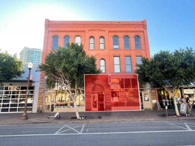

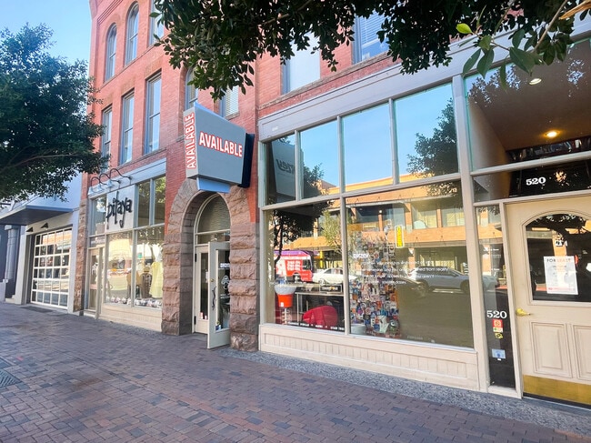

Current Lease Availabilities
Property Detail
520 S Mill Ave
Phoenix-Mesa-Chandler, AZ
TEMPE BLOCKS 68, 69, 70 MCR 2-26
132-30-007
Maricopa
Commercialnec
Arizona
C-C
10
C and X Area of minimal flood hazard, usually depicted on FIRMs as above the 500-year flood level.
0.07 AC
2025
Tempe
2025
Phoenix
318700
NEARBY LISTINGS FOR SALE OR LEASE
DEMOGRAPHICS near 520 S Mill Ave
1 mile
3 mile
5 mile
2025 Total Population
25,101
126,789
348,172
2030 Population
26,520
132,567
362,528
Pop Growth 2025-2030
+ 5.65%
+ 4.56%
+ 4.12%
Average Age
30
33
36
2025 Total Households
9,839
54,868
147,335
HH Growth 2025-2030
+ 6.88%
+ 5.01%
+ 4.39%
Median Household Inc
$59,752
$68,565
$72,965
Avg Household Size
1.90
2.10
2.20
2025 Avg HH Vehicles
1.00
2.00
2.00
Median Home Value
$472,661
$458,932
$445,676
Median Year Built
2003
1985
1981
Nearby Places
Map Layers
Map Styles
 Street
 Aerial
Layers
 Traffic
 Biking
Places
Listings with unknown addresses are not visible on the map
- Restaurants
- Banks
- Shops
- Fitness
- Groceries
PUBLIC TRANSPORTATION
TRANSIT/SUBWAY
Sixth St/Mill (Valley Metro Streetcar - Valley Metro (Phoenix Light Rail))
Drive
Walk
Distance
Sixth St/Mill (Valley Metro Streetcar - Valley Metro (Phoenix Light Rail))
0 min
2 min
0.1 mi
Fifth St/Ash (Valley Metro Streetcar - Valley Metro (Phoenix Light Rail))
Drive
Walk
Distance
Fifth St/Ash (Valley Metro Streetcar - Valley Metro (Phoenix Light Rail))
1 min
4 min
0.2 mi
Mill Ave/3Rd St (METRO Light Rail - Valley Metro (Phoenix Light Rail))
Drive
Walk
Distance
Mill Ave/3Rd St (METRO Light Rail - Valley Metro (Phoenix Light Rail))
1 min
5 min
0.3 mi
University Dr/Ash (Valley Metro Streetcar - Valley Metro (Phoenix Light Rail))
Drive
Walk
Distance
University Dr/Ash (Valley Metro Streetcar - Valley Metro (Phoenix Light Rail))
1 min
6 min
0.3 mi
Third St/Ash (Valley Metro Streetcar - Valley Metro (Phoenix Light Rail))
Drive
Walk
Distance
Third St/Ash (Valley Metro Streetcar - Valley Metro (Phoenix Light Rail))
1 min
6 min
0.3 mi
AIRPORT
Phoenix Sky Harbor International
Drive
Walk
Distance
Phoenix Sky Harbor International
11 min
5.0 mi
Phoenix-Mesa Gateway
Drive
Walk
Distance
Phoenix-Mesa Gateway
36 min
23.9 mi
Freight Ports
Port of San Diego
Drive
Walk
Distance
Port of San Diego
406 min
369.0 mi
Nearby Properties
Address
Land Use
TOTAL SIZE
Lot Size
Zoning
Address
Land Use
TOTAL SIZE
Lot Size
Zoning
4.59 AC
I-1
Address
Land Use
TOTAL SIZE
Lot Size
Zoning
75,000 SF
12.19 AC
I-1
Address
Land Use
TOTAL SIZE
Lot Size
Zoning
2.63 AC
I-1
Address
Land Use
TOTAL SIZE
Lot Size
Zoning
Address
Land Use
TOTAL SIZE
Lot Size
Zoning
401,544 SF
64.59 AC
GID
Address
Land Use
TOTAL SIZE
Lot Size
Zoning
2,089,643 SF
33.80 AC
MU-ED
Address
Land Use
TOTAL SIZE
Lot Size
Zoning
1,227,029 SF
7.39 AC
R-6
Address
Land Use
TOTAL SIZE
Lot Size
Zoning
106,575 SF
2.50 AC
I-1
Address
Land Use
TOTAL SIZE
Lot Size
Zoning
1,056,321 SF
35.93 AC
R1-6
Address
Land Use
TOTAL SIZE
Lot Size
Zoning
5.13 AC
Address
Land Use
TOTAL SIZE
Lot Size
Zoning
1,102,629 SF
12.33 AC
R-3
Address
Land Use
TOTAL SIZE
Lot Size
Zoning
2.54 AC
Address
Land Use
TOTAL SIZE
Lot Size
Zoning
571,804 SF
0.98 AC
CSS
Address
Land Use
TOTAL SIZE
Lot Size
Zoning
1,020,776 SF
11.33 AC
I-1
Address
Land Use
TOTAL SIZE
Lot Size
Zoning
331,050 SF
39 AC
I-1
Address
Land Use
TOTAL SIZE
Lot Size
Zoning
44,971 SF
2.06 AC
C-R
Address
Land Use
TOTAL SIZE
Lot Size
Zoning
58,061 SF
5.43 AC
C-C
Address
Land Use
TOTAL SIZE
Lot Size
Zoning
697,894 SF
8.43 AC
PAD
Address
Land Use
TOTAL SIZE
Lot Size
Zoning
32,968 SF
2.10 AC
I-P
Address
Land Use
TOTAL SIZE
Lot Size
Zoning
498,595 SF
9.01 AC
C-C
Address
Land Use
TOTAL SIZE
Lot Size
Zoning
511,014 SF
5.01 AC
I-1
Address
Land Use
TOTAL SIZE
Lot Size
Zoning
301,376 SF
8.77 AC
PAD
Address
Land Use
TOTAL SIZE
Lot Size
Zoning
548,227 SF
1.62 AC
C-G
Address
Land Use
TOTAL SIZE
Lot Size
Zoning
746,457 SF
20.95 AC
I-1
Address
Land Use
TOTAL SIZE
Lot Size
Zoning
776,898 SF
27.32 AC
C-R
Address
Land Use
TOTAL SIZE
Lot Size
Zoning
352,244 SF
5.55 AC
R-6
The World's #1 Commercial Real Estate Marketplace
Connect with us
© 2026 CoStar Group
The information above has been obtained from sources believed reliable. While we do not doubt its accuracy we have not verified it and make no guarantee, warranty or representation about it. It is your responsibility to independently confirm its accuracy and completeness. Any projections, opinions, assumptions, or estimates used are for example only and do not represent the current or future performance of the property. The value of this transaction to you depends on tax and other factors which should be evaluated by your tax, financial, and legal advisors. You and your advisors should conduct a careful, independent investigation of the property to determine to your satisfaction the suitability of the property for your needs.