Property Record
520 W Roosevelt Rd, Wheaton, IL 60187


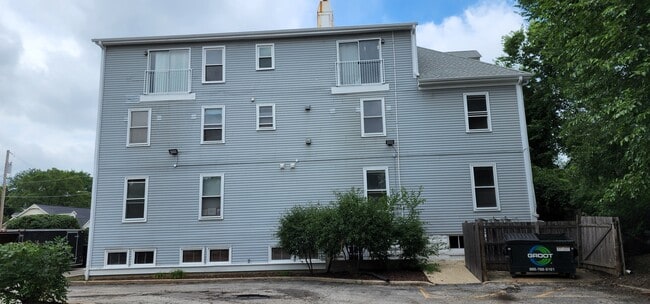

Property Detail
520 W Roosevelt Rd
05-20-205-048
SECKERS ADD LOTS 6 & 7 /EX HWY DESC 88-ED-212/ & /EX HWY DESC R2001-160418/
Commercialnec
DuPage
C
Illinois
B and X Area of moderate flood hazard, usually the area between the limits of the 100-year and 500-year floods.
6,7
2024
0.22 AC
2024
Western East/West Corr
842605
Chicago
6,467 SF
Chicago-Naperville-Elgin, IL-IN
NEARBY LISTINGS FOR SALE OR LEASE
DEMOGRAPHICS near 520 W Roosevelt Rd
1 mile
3 mile
5 mile
2025 Total Population
14,391
97,113
228,562
2030 Population
14,613
98,035
230,477
Pop Growth 2025-2030
+ 1.54%
+ 0.95%
+ 0.84%
Average Age
41
41
41
2025 Total Households
5,627
36,247
83,989
HH Growth 2025-2030
+ 1.69%
+ 0.98%
+ 0.92%
Median Household Inc
$113,281
$116,243
$109,263
Avg Household Size
2.40
2.50
2.60
2025 Avg HH Vehicles
2.00
2.00
2.00
Median Home Value
$458,788
$457,624
$385,122
Median Year Built
1968
1974
1976
Nearby Places
Map Layers
Map Styles
 Street
 Aerial
Layers
 Traffic
 Biking
Places
Listings with unknown addresses are not visible on the map
- Restaurants
- Banks
- Shops
- Fitness
- Groceries
PUBLIC TRANSPORTATION
TRANSIT/SUBWAY
Wheaton Station (Union Pacific West Line - Northeast Illinois Regional Commuter Railroad (Metra))
Drive
Walk
Distance
Wheaton Station (Union Pacific West Line - Northeast Illinois Regional Commuter Railroad (Metra))
2 min
11 min
0.6 mi
COMMUTER RAIL
Wheaton Station (Union Pacific West Line - Northeast Illinois Regional Commuter Railroad (Metra))
Drive
Walk
Distance
Wheaton Station (Union Pacific West Line - Northeast Illinois Regional Commuter Railroad (Metra))
2 min
11 min
0.5 mi
College Avenue Station (Union Pacific West Line - Northeast Illinois Regional Commuter Railroad (Metra))
Drive
Walk
Distance
College Avenue Station (Union Pacific West Line - Northeast Illinois Regional Commuter Railroad (Metra))
5 min
1.8 mi
AIRPORT
Chicago O'Hare International
Drive
Walk
Distance
Chicago O'Hare International
50 min
20.3 mi
Chicago Midway International
Drive
Walk
Distance
Chicago Midway International
47 min
24.3 mi
SALE & LEASE HISTORY
LISTING DATE
SALE/LEASE

Oct 17, 2022
For Lease
Jun 18, 2021
For Sale
Jan 25, 2025
For Sale
Dec 19, 2016
For Sale
Dec 14, 2018
For Lease
Aug 31, 2020
For Sale
Nearby Properties
Address
Land Use
TOTAL SIZE
Lot Size
Zoning
Address
Land Use
TOTAL SIZE
Lot Size
Zoning
818,262 SF
13.70 AC
M
Address
Land Use
TOTAL SIZE
Lot Size
Zoning
594,125 SF
2.60 AC
Address
Land Use
TOTAL SIZE
Lot Size
Zoning
545,570 SF
22.66 AC
C
Address
Land Use
TOTAL SIZE
Lot Size
Zoning
295,773 SF
17.45 AC
M
Address
Land Use
TOTAL SIZE
Lot Size
Zoning
264,227 SF
17.12 AC
M
Address
Land Use
TOTAL SIZE
Lot Size
Zoning
254,992 SF
14.21 AC
M
Address
Land Use
TOTAL SIZE
Lot Size
Zoning
300,104 SF
19.49 AC
M
Address
Land Use
TOTAL SIZE
Lot Size
Zoning
254,201 SF
27.84 AC
Address
Land Use
TOTAL SIZE
Lot Size
Zoning
26,302 SF
2.09 AC
C
Address
Land Use
TOTAL SIZE
Lot Size
Zoning
201,048 SF
20.24 AC
Address
Land Use
TOTAL SIZE
Lot Size
Zoning
Address
Land Use
TOTAL SIZE
Lot Size
Zoning
146,492 SF
0.42 AC
Address
Land Use
TOTAL SIZE
Lot Size
Zoning
235,131 SF
14.18 AC
I
Address
Land Use
TOTAL SIZE
Lot Size
Zoning
259,374 SF
27.66 AC
C
Address
Land Use
TOTAL SIZE
Lot Size
Zoning
216,720 SF
12.40 AC
M
Address
Land Use
TOTAL SIZE
Lot Size
Zoning
290,280 SF
14 AC
Address
Land Use
TOTAL SIZE
Lot Size
Zoning
162,819 SF
19.82 AC
C
Address
Land Use
TOTAL SIZE
Lot Size
Zoning
235,203 SF
1.28 AC
Address
Land Use
TOTAL SIZE
Lot Size
Zoning
162,815 SF
11.60 AC
M
Address
Land Use
TOTAL SIZE
Lot Size
Zoning
240,918 SF
8.13 AC
C
Address
Land Use
TOTAL SIZE
Lot Size
Zoning
149,460 SF
10.62 AC
M
Address
Land Use
TOTAL SIZE
Lot Size
Zoning
165,528 SF
16.08 AC
M
Address
Land Use
TOTAL SIZE
Lot Size
Zoning
311,052 SF
20.97 AC
M
Address
Land Use
TOTAL SIZE
Lot Size
Zoning
Address
Land Use
TOTAL SIZE
Lot Size
Zoning
302,986 SF
16.04 AC
Address
Land Use
TOTAL SIZE
Lot Size
Zoning
166,382 SF
10.50 AC
R-4
Address
Land Use
TOTAL SIZE
Lot Size
Zoning
95,008 SF
0.84 AC
Address
Land Use
TOTAL SIZE
Lot Size
Zoning
180,216 SF
6.57 AC
M
Address
Land Use
TOTAL SIZE
Lot Size
Zoning
103,000 SF
7.53 AC
C
Address
Land Use
TOTAL SIZE
Lot Size
Zoning
91,314 SF
3.65 AC
The World's #1 Commercial Real Estate Marketplace
Connect with us
© 2026 CoStar Group
The information above has been obtained from sources believed reliable. While we do not doubt its accuracy we have not verified it and make no guarantee, warranty or representation about it. It is your responsibility to independently confirm its accuracy and completeness. Any projections, opinions, assumptions, or estimates used are for example only and do not represent the current or future performance of the property. The value of this transaction to you depends on tax and other factors which should be evaluated by your tax, financial, and legal advisors. You and your advisors should conduct a careful, independent investigation of the property to determine to your satisfaction the suitability of the property for your needs.