Property Record
5203 Castroville Rd, San Antonio, TX 78227

This Property Is For Sale
Current Lease Availabilities
NEARBY LISTINGS FOR SALE OR LEASE
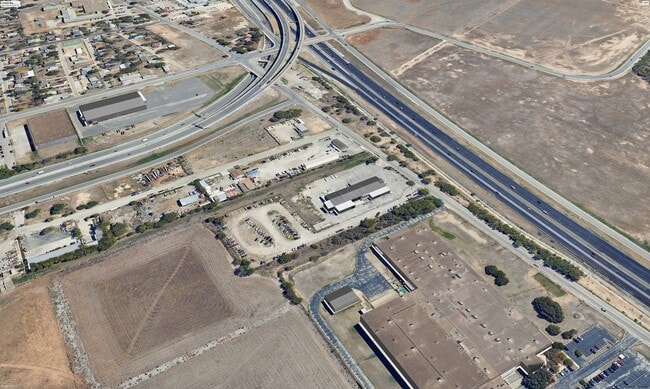
Property Detail
5203 Castroville Rd
San Antonio-New Braunfels, TX
Conv A/S Code
13940-000-0120
NCB 13940 BLK LOT 12 (RIVERWALK TOWING) 2015 NEW ACCT PER PLAT 9678/39-40 FILED 12/19/14
Miscellaneous
Bexar
X
Texas
48029C0390G
12
2024
2.41 AC
2025
Far West
171602
San Antonio
DEMOGRAPHICS near 5203 Castroville Rd
1 Mile
3 Mile
5 Mile
2024 Total Population
4,331
90,902
311,202
2029 Population
4,547
95,355
327,241
Pop Growth 2024-2029
+ 4.99%
+ 4.90%
+ 5.15%
Average Age
36
35
36
2024 Total Households
1,335
26,588
102,170
HH Growth 2024-2029
+ 5.02%
+ 5.13%
+ 5.34%
Median Household Inc
$37,418
$36,421
$40,373
Avg Household Size
3.10
3.00
2.90
2024 Avg HH Vehicles
2.00
2.00
2.00
Median Home Value
$99,298
$100,041
$121,653
Median Year Built
1969
1970
1971
Nearby Places
Map Layers
Map Styles
 Street
 Aerial
- Restaurants
- Banks
- Shops
- Fitness
- Groceries
PUBLIC TRANSPORTATION
COMMUTER RAIL
San Antonio Amtrak Station (Sunset Limited - Amtrak, Texas Eagle - Amtrak)
DRIVE
WALK
Distance
San Antonio Amtrak Station (Sunset Limited - Amtrak, Texas Eagle - Amtrak)
13 min
9.1 mi
AIRPORT
San Antonio International
DRIVE
WALK
Distance
San Antonio International
22 min
14.2 mi
Freight Ports
Port of Corpus Christi
DRIVE
WALK
Distance
Port of Corpus Christi
153 min
147.8 mi
Nearby Properties
Address
Land Use
TOTAL SIZE
Lot Size
Zoning
Address
Land Use
TOTAL SIZE
Lot Size
Zoning
180,980 SF
1,373.90 AC
Address
Land Use
TOTAL SIZE
Lot Size
Zoning
324,044 SF
16.87 AC
Address
Land Use
TOTAL SIZE
Lot Size
Zoning
326,820 SF
12.57 AC
Address
Land Use
TOTAL SIZE
Lot Size
Zoning
442,263 SF
37.97 AC
Address
Land Use
TOTAL SIZE
Lot Size
Zoning
726,948 SF
16.86 AC
Address
Land Use
TOTAL SIZE
Lot Size
Zoning
66,404 SF
44.45 AC
Address
Land Use
TOTAL SIZE
Lot Size
Zoning
352,890 SF
19.97 AC
Address
Land Use
TOTAL SIZE
Lot Size
Zoning
245,371 SF
20.50 AC
Address
Land Use
TOTAL SIZE
Lot Size
Zoning
248,405 SF
14.04 AC
Address
Land Use
TOTAL SIZE
Lot Size
Zoning
325,718 SF
38.35 AC
Address
Land Use
TOTAL SIZE
Lot Size
Zoning
223,148 SF
19.15 AC
Address
Land Use
TOTAL SIZE
Lot Size
Zoning
99,538 SF
11.89 AC
Address
Land Use
TOTAL SIZE
Lot Size
Zoning
247.88 AC
Address
Land Use
TOTAL SIZE
Lot Size
Zoning
195,120 SF
19.77 AC
Address
Land Use
TOTAL SIZE
Lot Size
Zoning
187,200 SF
17.85 AC
Address
Land Use
TOTAL SIZE
Lot Size
Zoning
9,109 SF
714.90 AC
Address
Land Use
TOTAL SIZE
Lot Size
Zoning
149,184 SF
7.42 AC
Address
Land Use
TOTAL SIZE
Lot Size
Zoning
132,291 SF
7 AC
Address
Land Use
TOTAL SIZE
Lot Size
Zoning
222,095 SF
10.01 AC
Address
Land Use
TOTAL SIZE
Lot Size
Zoning
249,640 SF
Address
Land Use
TOTAL SIZE
Lot Size
Zoning
197,650 SF
20.69 AC
Address
Land Use
TOTAL SIZE
Lot Size
Zoning
223,403 SF
15.98 AC
Address
Land Use
TOTAL SIZE
Lot Size
Zoning
127,500 SF
37.50 AC
Address
Land Use
TOTAL SIZE
Lot Size
Zoning
206,832 SF
31.78 AC
Address
Land Use
TOTAL SIZE
Lot Size
Zoning
197,298 SF
18.64 AC
Address
Land Use
TOTAL SIZE
Lot Size
Zoning
51.98 AC
Address
Land Use
TOTAL SIZE
Lot Size
Zoning
201,900 SF
13.77 AC
Address
Land Use
TOTAL SIZE
Lot Size
Zoning
247,258 SF
12.54 AC
Address
Land Use
TOTAL SIZE
Lot Size
Zoning
50,320 SF
5.47 AC
Address
Land Use
TOTAL SIZE
Lot Size
Zoning
91,799 SF
9.44 AC
The World's #1 Commercial Real Estate Marketplace
Connect with us
© 2026 CoStar Group
The information above has been obtained from sources believed reliable. While we do not doubt its accuracy we have not verified it and make no guarantee, warranty or representation about it. It is your responsibility to independently confirm its accuracy and completeness. Any projections, opinions, assumptions, or estimates used are for example only and do not represent the current or future performance of the property. The value of this transaction to you depends on tax and other factors which should be evaluated by your tax, financial, and legal advisors. You and your advisors should conduct a careful, independent investigation of the property to determine to your satisfaction the suitability of the property for your needs.