Property Record
5210 N Nebraska Ave, Tampa, FL 33603


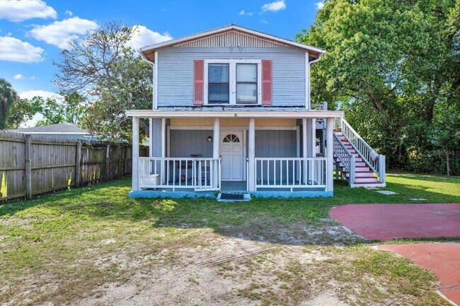
This Property Is For Sale
NEARBY LISTINGS FOR SALE OR LEASE
Property Detail
5210 N Nebraska Ave
Tampa-St. Petersburg-Clearwater, FL
Witchmere
A-01-29-18-4FY-000004-00004.3
WITCHMERE N 60 FT OF E 180 FT OF LOT 4 BLOCK 4
Multifamilydwelling
Hillsborough
X
Florida
12057C0352J
4
2024
0.25 AC
2024
Seminole Heights
002200
Tampa/St Petersburg
3,437 SF
DEMOGRAPHICS near 5210 N Nebraska Ave
1 Mile
3 Mile
5 Mile
2024 Total Population
15,276
143,514
334,704
2029 Population
16,714
157,431
366,561
Pop Growth 2024-2029
+ 9.41%
+ 9.70%
+ 9.52%
Average Age
40
39
38
2024 Total Households
6,644
57,816
136,492
HH Growth 2024-2029
+ 9.66%
+ 9.93%
+ 9.89%
Median Household Inc
$69,560
$46,107
$49,905
Avg Household Size
2.20
2.40
2.30
2024 Avg HH Vehicles
2.00
1.00
1.00
Median Home Value
$303,896
$251,974
$270,314
Median Year Built
1949
1970
1978
Nearby Places
Map Layers
Map Styles
 Street
 Aerial
- Restaurants
- Banks
- Shops
- Fitness
- Groceries
PUBLIC TRANSPORTATION
COMMUTER RAIL
DRIVE
WALK
Distance
7 min
3.0 mi
AIRPORT
Tampa International
DRIVE
WALK
Distance
Tampa International
18 min
10.2 mi
St Pete-Clearwater International
DRIVE
WALK
Distance
St Pete-Clearwater International
35 min
20.2 mi
Nearby Properties
Address
Land Use
TOTAL SIZE
Lot Size
Zoning
Address
Land Use
TOTAL SIZE
Lot Size
Zoning
1,083,666 SF
26.73 AC
OP-1
Address
Land Use
TOTAL SIZE
Lot Size
Zoning
625,694 SF
1 AC
CBD-2
Address
Land Use
TOTAL SIZE
Lot Size
Zoning
598,696 SF
6.75 AC
CD-3
Address
Land Use
TOTAL SIZE
Lot Size
Zoning
428,819 SF
5.24 AC
CBD-1
Address
Land Use
TOTAL SIZE
Lot Size
Zoning
399,394 SF
4.14 AC
PD-A
Address
Land Use
TOTAL SIZE
Lot Size
Zoning
598,902 SF
36.33 AC
PD
Address
Land Use
TOTAL SIZE
Lot Size
Zoning
1.57 AC
CD-3
Address
Land Use
TOTAL SIZE
Lot Size
Zoning
392,234 SF
2.17 AC
PD
Address
Land Use
TOTAL SIZE
Lot Size
Zoning
265,879 SF
3.48 AC
YC-4
Address
Land Use
TOTAL SIZE
Lot Size
Zoning
347,402 SF
16.65 AC
RM-24
Address
Land Use
TOTAL SIZE
Lot Size
Zoning
547,785 SF
65.86 AC
RMC-20
Address
Land Use
TOTAL SIZE
Lot Size
Zoning
293,988 SF
2.58 AC
PD-A
Address
Land Use
TOTAL SIZE
Lot Size
Zoning
257,380 SF
11.08 AC
IG
Address
Land Use
TOTAL SIZE
Lot Size
Zoning
292,677 SF
12.67 AC
RM-24
Address
Land Use
TOTAL SIZE
Lot Size
Zoning
241,414 SF
2.24 AC
YC-6
Address
Land Use
TOTAL SIZE
Lot Size
Zoning
403,225 SF
7.48 AC
PD
Address
Land Use
TOTAL SIZE
Lot Size
Zoning
215,647 SF
1.91 AC
PD
Address
Land Use
TOTAL SIZE
Lot Size
Zoning
237,021 SF
49.48 AC
RS-50
Address
Land Use
TOTAL SIZE
Lot Size
Zoning
207,493 SF
35.23 AC
PD
Address
Land Use
TOTAL SIZE
Lot Size
Zoning
137,721 SF
335.48 AC
IG
Address
Land Use
TOTAL SIZE
Lot Size
Zoning
245,050 SF
20.03 AC
RM-24
Address
Land Use
TOTAL SIZE
Lot Size
Zoning
34,253 SF
1.97 AC
PD-A
Address
Land Use
TOTAL SIZE
Lot Size
Zoning
209,328 SF
27.49 AC
RS-50
Address
Land Use
TOTAL SIZE
Lot Size
Zoning
289,382 SF
18.08 AC
RM-24
Address
Land Use
TOTAL SIZE
Lot Size
Zoning
232,191 SF
5.12 AC
PD
Address
Land Use
TOTAL SIZE
Lot Size
Zoning
236,403 SF
12.83 AC
RM-24
Address
Land Use
TOTAL SIZE
Lot Size
Zoning
124,896 SF
13.42 AC
PD
Address
Land Use
TOTAL SIZE
Lot Size
Zoning
41,060 SF
23.23 AC
RM-24
Address
Land Use
TOTAL SIZE
Lot Size
Zoning
152,426 SF
68.17 AC
PD
Address
Land Use
TOTAL SIZE
Lot Size
Zoning
161,622 SF
1.25 AC
OP-1
The World's #1 Commercial Real Estate Marketplace
Connect with us
© 2026 CoStar Group
The information above has been obtained from sources believed reliable. While we do not doubt its accuracy we have not verified it and make no guarantee, warranty or representation about it. It is your responsibility to independently confirm its accuracy and completeness. Any projections, opinions, assumptions, or estimates used are for example only and do not represent the current or future performance of the property. The value of this transaction to you depends on tax and other factors which should be evaluated by your tax, financial, and legal advisors. You and your advisors should conduct a careful, independent investigation of the property to determine to your satisfaction the suitability of the property for your needs.