Property Record
526 Packard St, Ann Arbor, MI 48104


Save to a Folder
{{folder.Name}}
{{folder.ListingIds.length}} Properties
{{folder.ListingIds.length}} Property
Create a New Folder
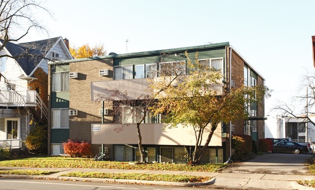
Property Detail
526 Packard St
09-29-420-021
BEG SE COR LOT 8 J S WELLERS ADDN TH S E ALG PACKARD ST 66 FT TH DEF 90 DEG RT 137.09 FT TH DEF 88 DEG 11 MIN RT 66.02 FT TH
Commercialnec
Washtenaw
R4C
Michigan
B and X Area of moderate flood hazard, usually the area between the limits of the 100-year and 500-year floods.
8
2025
0.20 AC
2026
Central Ann Arbor
400500
Detroit
7,230 SF
Ann Arbor, MI
NEARBY LISTINGS FOR SALE OR LEASE
DEMOGRAPHICS near 526 Packard St
1 mile
3 mile
5 mile
2025 Total Population
48,769
118,537
168,508
2030 Population
51,606
121,929
172,237
Pop Growth 2025-2030
+ 5.82%
+ 2.86%
+ 2.21%
Average Age
32
36
37
2025 Total Households
17,513
48,106
69,260
HH Growth 2025-2030
+ 6.66%
+ 2.97%
+ 2.25%
Median Household Inc
$66,155
$85,456
$87,382
Avg Household Size
2.20
2.10
2.20
2025 Avg HH Vehicles
1.00
1.00
2.00
Median Home Value
$487,431
$455,401
$451,026
Median Year Built
1975
1975
1977
Nearby Places
Map Layers
Map Styles
 Street
 Aerial
Layers
 Traffic
 Biking
Places
Listings with unknown addresses are not visible on the map
- Restaurants
- Banks
- Shops
- Fitness
- Groceries
PUBLIC TRANSPORTATION
COMMUTER RAIL
Drive
Walk
Distance
4 min
1.1 mi
AIRPORT
Detroit Metro Wayne County
Drive
Walk
Distance
Detroit Metro Wayne County
38 min
27.6 mi
Nearby Properties
Address
Land Use
TOTAL SIZE
Lot Size
Zoning
Address
Land Use
TOTAL SIZE
Lot Size
Zoning
1.19 AC
R4C
Address
Land Use
TOTAL SIZE
Lot Size
Zoning
235,070 SF
0.80 AC
D1
Address
Land Use
TOTAL SIZE
Lot Size
Zoning
358,683 SF
5.42 AC
PUD
Address
Land Use
TOTAL SIZE
Lot Size
Zoning
333,275 SF
0.65 AC
D1
Address
Land Use
TOTAL SIZE
Lot Size
Zoning
268,612 SF
0.74 AC
D1
Address
Land Use
TOTAL SIZE
Lot Size
Zoning
407,374 SF
35.17 AC
C3
Address
Land Use
TOTAL SIZE
Lot Size
Zoning
186,029 SF
2.06 AC
D2
Address
Land Use
TOTAL SIZE
Lot Size
Zoning
212,047 SF
1.15 AC
D1
Address
Land Use
TOTAL SIZE
Lot Size
Zoning
Address
Land Use
TOTAL SIZE
Lot Size
Zoning
189,221 SF
0.58 AC
D1
Address
Land Use
TOTAL SIZE
Lot Size
Zoning
222,126 SF
0.52 AC
D1
Address
Land Use
TOTAL SIZE
Lot Size
Zoning
315,108 SF
6.57 AC
C1B
Address
Land Use
TOTAL SIZE
Lot Size
Zoning
401,491 SF
3.12 AC
PUD
Address
Land Use
TOTAL SIZE
Lot Size
Zoning
211,670 SF
0.54 AC
D1
Address
Land Use
TOTAL SIZE
Lot Size
Zoning
249,612 SF
1.87 AC
PUD
Address
Land Use
TOTAL SIZE
Lot Size
Zoning
173,885 SF
0.43 AC
D1
Address
Land Use
TOTAL SIZE
Lot Size
Zoning
524,946 SF
10.43 AC
PUD
Address
Land Use
TOTAL SIZE
Lot Size
Zoning
323,630 SF
21.55 AC
UNKNOWN
Address
Land Use
TOTAL SIZE
Lot Size
Zoning
Address
Land Use
TOTAL SIZE
Lot Size
Zoning
334,077 SF
20.41 AC
R4B
Address
Land Use
TOTAL SIZE
Lot Size
Zoning
143,619 SF
0.20 AC
PUD
Address
Land Use
TOTAL SIZE
Lot Size
Zoning
303,524 SF
19.40 AC
R4B
Address
Land Use
TOTAL SIZE
Lot Size
Zoning
133,830 SF
0.59 AC
D1
Address
Land Use
TOTAL SIZE
Lot Size
Zoning
357,978 SF
19.32 AC
R4B
Address
Land Use
TOTAL SIZE
Lot Size
Zoning
140,840 SF
0.50 AC
D1
Address
Land Use
TOTAL SIZE
Lot Size
Zoning
8,670 SF
0.60 AC
D1
Address
Land Use
TOTAL SIZE
Lot Size
Zoning
177,763 SF
0.91 AC
D2
Address
Land Use
TOTAL SIZE
Lot Size
Zoning
99,982 SF
0.35 AC
D1
Address
Land Use
TOTAL SIZE
Lot Size
Zoning
140,670 SF
1.63 AC
C2B
Address
Land Use
TOTAL SIZE
Lot Size
Zoning
127,076 SF
0.39 AC
D1
The World's #1 Commercial Real Estate Marketplace
Connect with us
© 2026 CoStar Group
The information above has been obtained from sources believed reliable. While we do not doubt its accuracy we have not verified it and make no guarantee, warranty or representation about it. It is your responsibility to independently confirm its accuracy and completeness. Any projections, opinions, assumptions, or estimates used are for example only and do not represent the current or future performance of the property. The value of this transaction to you depends on tax and other factors which should be evaluated by your tax, financial, and legal advisors. You and your advisors should conduct a careful, independent investigation of the property to determine to your satisfaction the suitability of the property for your needs.