Property Record
526 Pine St, Spring Lake, MI 49456
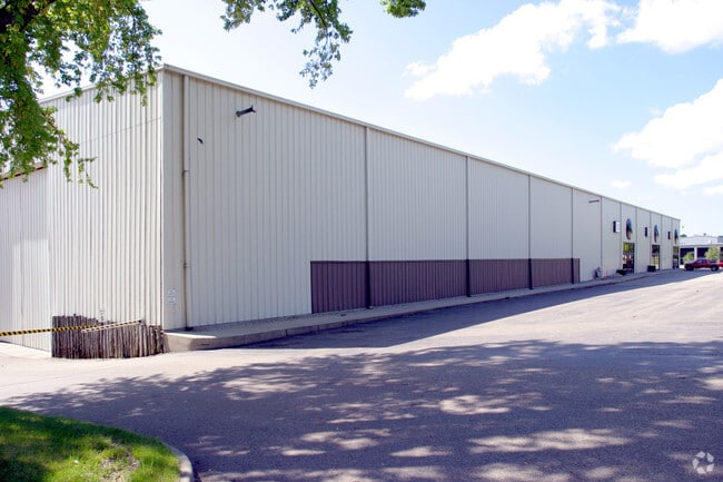

Property Detail
526 Pine St
70-03-16-275-009
LOTS 1 THRU 16 INCL, ALSO VAC LAKE PARK AVE & LAKE PARK BEACH ALL IN LAKE PARK SUB, ALSO PART OF GOV LOT 2 COM SW COR LAKE
Publicstorage
OTTAWA
CORECOM
Michigan
AE The base floodplain where base flood elevations are provided. AE Zones are now used on new format FIRMs instead of A1-A30 Zones.
1-16
2025
3.72 AC
2025
Grand Haven/Ferrysburg
020600
West Michigan
51,484 SF
Grand Rapids-Wyoming-Kentwood, MI
NEARBY LISTINGS FOR SALE OR LEASE
DEMOGRAPHICS near 526 Pine St
1 mile
3 mile
5 mile
2025 Total Population
3,069
32,466
53,433
2030 Population
3,217
33,714
55,213
Pop Growth 2025-2030
+ 4.82%
+ 3.84%
+ 3.33%
Average Age
47
44
44
2025 Total Households
1,380
14,296
22,720
HH Growth 2025-2030
+ 4.93%
+ 4.04%
+ 3.53%
Median Household Inc
$74,819
$73,466
$77,773
Avg Household Size
2.20
2.20
2.30
2025 Avg HH Vehicles
2.00
2.00
2.00
Median Home Value
$337,454
$328,811
$327,790
Median Year Built
1978
1977
1982
Nearby Places
Map Layers
Map Styles
 Street
 Aerial
Layers
 Traffic
 Biking
Places
Listings with unknown addresses are not visible on the map
- Restaurants
- Banks
- Shops
- Fitness
- Groceries
PUBLIC TRANSPORTATION
AIRPORT
Gerald R Ford International
Drive
Walk
Distance
Gerald R Ford International
61 min
46.3 mi
Nearby Properties
Address
Land Use
TOTAL SIZE
Lot Size
Zoning
Address
Land Use
TOTAL SIZE
Lot Size
Zoning
348,731 SF
40.52 AC
R-4
Address
Land Use
TOTAL SIZE
Lot Size
Zoning
381,476 SF
17.96 AC
I INDU
Address
Land Use
TOTAL SIZE
Lot Size
Zoning
188,314 SF
9.72 AC
Address
Land Use
TOTAL SIZE
Lot Size
Zoning
220,630 SF
10.34 AC
PUD
Address
Land Use
TOTAL SIZE
Lot Size
Zoning
184,312 SF
11.47 AC
PUD
Address
Land Use
TOTAL SIZE
Lot Size
Zoning
131,302 SF
4.70 AC
Address
Land Use
TOTAL SIZE
Lot Size
Zoning
191,144 SF
16.60 AC
Address
Land Use
TOTAL SIZE
Lot Size
Zoning
121,189 SF
8.73 AC
PUD
Address
Land Use
TOTAL SIZE
Lot Size
Zoning
192,833 SF
14.44 AC
I INDU
Address
Land Use
TOTAL SIZE
Lot Size
Zoning
40,251 SF
159.38 AC
PR
Address
Land Use
TOTAL SIZE
Lot Size
Zoning
192,641 SF
25.16 AC
Address
Land Use
TOTAL SIZE
Lot Size
Zoning
37,874 SF
20.27 AC
PORT IN
Address
Land Use
TOTAL SIZE
Lot Size
Zoning
242,746 SF
36.05 AC
I INDU
Address
Land Use
TOTAL SIZE
Lot Size
Zoning
112,745 SF
10.56 AC
PUD
Address
Land Use
TOTAL SIZE
Lot Size
Zoning
53,682 SF
0.99 AC
Address
Land Use
TOTAL SIZE
Lot Size
Zoning
90,701 SF
5.65 AC
Address
Land Use
TOTAL SIZE
Lot Size
Zoning
217,995 SF
40.96 AC
PUD
Address
Land Use
TOTAL SIZE
Lot Size
Zoning
125,088 SF
7.24 AC
CBD
Address
Land Use
TOTAL SIZE
Lot Size
Zoning
2,724 SF
56.50 AC
MHP
Address
Land Use
TOTAL SIZE
Lot Size
Zoning
143,083 SF
12.25 AC
Address
Land Use
TOTAL SIZE
Lot Size
Zoning
148,413 SF
38.08 AC
Address
Land Use
TOTAL SIZE
Lot Size
Zoning
960 SF
22.46 AC
Address
Land Use
TOTAL SIZE
Lot Size
Zoning
105,179 SF
20.81 AC
I INDU
Address
Land Use
TOTAL SIZE
Lot Size
Zoning
99,081 SF
11.66 AC
R-4
Address
Land Use
TOTAL SIZE
Lot Size
Zoning
27,006 SF
6.12 AC
MU
Address
Land Use
TOTAL SIZE
Lot Size
Zoning
127,211 SF
11.74 AC
I INDU
Address
Land Use
TOTAL SIZE
Lot Size
Zoning
50,969 SF
1.67 AC
Address
Land Use
TOTAL SIZE
Lot Size
Zoning
141,007 SF
12.86 AC
GI
Address
Land Use
TOTAL SIZE
Lot Size
Zoning
42,300 SF
3.12 AC
Address
Land Use
TOTAL SIZE
Lot Size
Zoning
61,612 SF
2.12 AC
PUD
The World's #1 Commercial Real Estate Marketplace
Connect with us
© 2026 CoStar Group
The information above has been obtained from sources believed reliable. While we do not doubt its accuracy we have not verified it and make no guarantee, warranty or representation about it. It is your responsibility to independently confirm its accuracy and completeness. Any projections, opinions, assumptions, or estimates used are for example only and do not represent the current or future performance of the property. The value of this transaction to you depends on tax and other factors which should be evaluated by your tax, financial, and legal advisors. You and your advisors should conduct a careful, independent investigation of the property to determine to your satisfaction the suitability of the property for your needs.