Property Record
529 Nw 5Th St, Corvallis, OR 97330
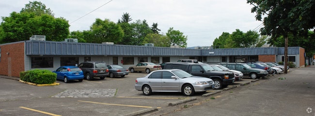


Property Detail
529 Nw 5Th St
121842
DIXONS 2ND LOT 11-12 BLK 15
Commercialbuilding
Benton
CB
Oregon
B and X Area of moderate flood hazard, usually the area between the limits of the 100-year and 500-year floods.
11-12
2024
0.22 AC
2025
Oregon West Area
010601
Other Market Areas
6,347 SF
Corvallis, OR
NEARBY LISTINGS FOR SALE OR LEASE
DEMOGRAPHICS near 529 Nw 5Th St
1 mile
3 mile
5 mile
2025 Total Population
20,946
65,559
75,621
2030 Population
22,727
68,255
78,528
Pop Growth 2025-2030
+ 8.50%
+ 4.11%
+ 3.84%
Average Age
30
36
38
2025 Total Households
8,260
26,269
30,326
HH Growth 2025-2030
+ 9.67%
+ 4.43%
+ 4.12%
Median Household Inc
$30,467
$61,518
$66,502
Avg Household Size
2.00
2.20
2.20
2025 Avg HH Vehicles
2.00
2.00
2.00
Median Home Value
$463,188
$498,546
$526,895
Median Year Built
1985
1979
1980
Nearby Places
Map Layers
Map Styles
 Street
 Aerial
Layers
 Traffic
 Biking
Places
Listings with unknown addresses are not visible on the map
- Restaurants
- Banks
- Shops
- Fitness
- Groceries
SALE & LEASE HISTORY
LISTING DATE
SALE/LEASE

Dec 04, 2017
For Sale
Nearby Properties
Address
Land Use
TOTAL SIZE
Lot Size
Zoning
Address
Land Use
TOTAL SIZE
Lot Size
Zoning
Address
Land Use
TOTAL SIZE
Lot Size
Zoning
Address
Land Use
TOTAL SIZE
Lot Size
Zoning
552,129 SF
25.99 AC
RS-12
Address
Land Use
TOTAL SIZE
Lot Size
Zoning
298,527 SF
32.61 AC
PD(RS-3.5)
Address
Land Use
TOTAL SIZE
Lot Size
Zoning
Address
Land Use
TOTAL SIZE
Lot Size
Zoning
339,006 SF
0.69 AC
RF
Address
Land Use
TOTAL SIZE
Lot Size
Zoning
330,693 SF
1.25 AC
MUE
Address
Land Use
TOTAL SIZE
Lot Size
Zoning
106,538 SF
4.38 AC
RS-12
Address
Land Use
TOTAL SIZE
Lot Size
Zoning
215,337 SF
16.20 AC
RS-20
Address
Land Use
TOTAL SIZE
Lot Size
Zoning
166,415 SF
3.04 AC
OSU
Address
Land Use
TOTAL SIZE
Lot Size
Zoning
81,113 SF
1.81 AC
PD(RS-20)
Address
Land Use
TOTAL SIZE
Lot Size
Zoning
Address
Land Use
TOTAL SIZE
Lot Size
Zoning
107,412 SF
9.16 AC
RTC
Address
Land Use
TOTAL SIZE
Lot Size
Zoning
129,103 SF
6.95 AC
PD(RS-12)
Address
Land Use
TOTAL SIZE
Lot Size
Zoning
85,211 SF
1.15 AC
PD(RS-3.5)
Address
Land Use
TOTAL SIZE
Lot Size
Zoning
146,932 SF
6.41 AC
MUCS
Address
Land Use
TOTAL SIZE
Lot Size
Zoning
235,104 SF
9.96 AC
PD(RS-20)
Address
Land Use
TOTAL SIZE
Lot Size
Zoning
67,925 SF
4.84 AC
RTC
Address
Land Use
TOTAL SIZE
Lot Size
Zoning
139,766 SF
6.41 AC
PD(RS-9)
Address
Land Use
TOTAL SIZE
Lot Size
Zoning
218,015 SF
11.69 AC
PD(RS-12)
Address
Land Use
TOTAL SIZE
Lot Size
Zoning
112,216 SF
11.30 AC
PD(NC-MAJO
Address
Land Use
TOTAL SIZE
Lot Size
Zoning
192,991 SF
10.19 AC
GI
Address
Land Use
TOTAL SIZE
Lot Size
Zoning
122,984 SF
2.56 AC
RS-20
Address
Land Use
TOTAL SIZE
Lot Size
Zoning
57,607 SF
29.70 AC
PD(RS-3.5)
Address
Land Use
TOTAL SIZE
Lot Size
Zoning
95,797 SF
6.03 AC
PD(P-AO)
Address
Land Use
TOTAL SIZE
Lot Size
Zoning
300,108 SF
11.08 AC
PD(GI)
Address
Land Use
TOTAL SIZE
Lot Size
Zoning
166,396 SF
4.96 AC
GI
Address
Land Use
TOTAL SIZE
Lot Size
Zoning
169.68 AC
PD(GI)
Address
Land Use
TOTAL SIZE
Lot Size
Zoning
165,589 SF
13.92 AC
RS-20
Address
Land Use
TOTAL SIZE
Lot Size
Zoning
139,752 SF
7.60 AC
RS-12
The World's #1 Commercial Real Estate Marketplace
Connect with us
© 2026 CoStar Group
The information above has been obtained from sources believed reliable. While we do not doubt its accuracy we have not verified it and make no guarantee, warranty or representation about it. It is your responsibility to independently confirm its accuracy and completeness. Any projections, opinions, assumptions, or estimates used are for example only and do not represent the current or future performance of the property. The value of this transaction to you depends on tax and other factors which should be evaluated by your tax, financial, and legal advisors. You and your advisors should conduct a careful, independent investigation of the property to determine to your satisfaction the suitability of the property for your needs.