Property Record
5310 W State St, Boise, ID 83703
NEARBY LISTINGS FOR SALE OR LEASE
Property Detail
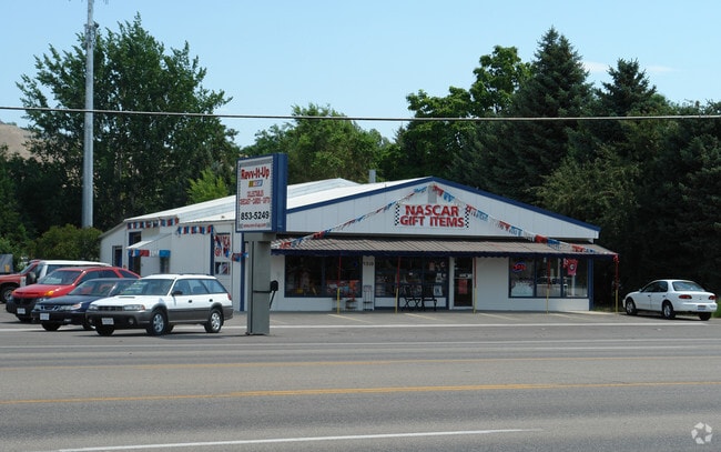
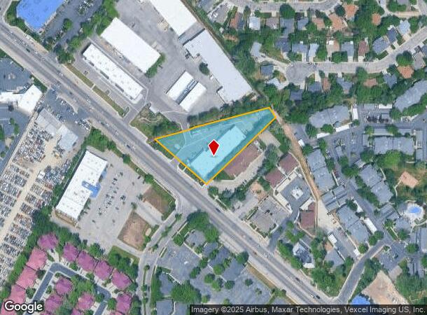
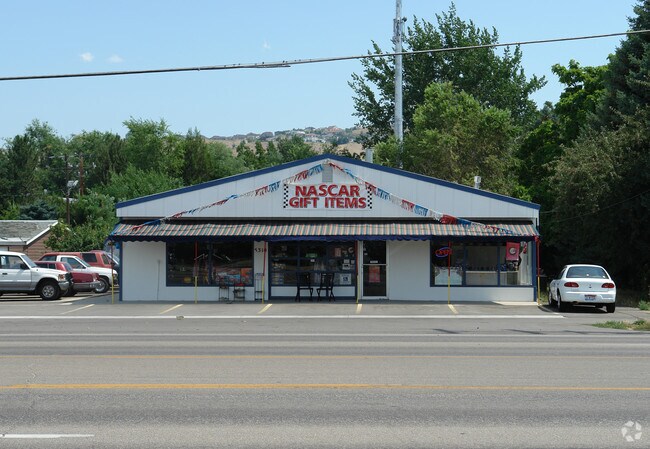
5310 W State St
S0630417242
PAR #7243 OF NE4SE4 SEC 30 4N 2E #417242-B
Commercialbuilding
Ada
X
Idaho
16001C0169J
1.50 AC
2023
North Boise
2025
Boise City/Nampa
000302
Boise City, ID
17,264 SF
DEMOGRAPHICS near 5310 W State St
1 Mile
3 Mile
5 Mile
2024 Total Population
11,765
82,514
195,961
2029 Population
13,272
93,119
221,836
Pop Growth 2024-2029
+ 12.81%
+ 12.85%
+ 13.20%
Average Age
43
42
40
2024 Total Households
5,401
35,671
82,041
HH Growth 2024-2029
+ 13.15%
+ 13.15%
+ 13.61%
Median Household Inc
$61,766
$68,770
$66,553
Avg Household Size
2.10
2.20
2.30
2024 Avg HH Vehicles
2.00
2.00
2.00
Median Home Value
$466,935
$446,427
$449,914
Median Year Built
1991
1984
1986
Nearby Places
Map Layers
Map Styles
 Street
 Aerial
- Restaurants
- Banks
- Shops
- Fitness
- Groceries
PUBLIC TRANSPORTATION
AIRPORT
Boise Air Trml/Gowen Field
DRIVE
WALK
Distance
Boise Air Trml/Gowen Field
22 min
9.3 mi
Nearby Properties
Address
Land Use
TOTAL SIZE
Lot Size
Zoning
Address
Land Use
TOTAL SIZE
Lot Size
Zoning
13.90 AC
R-2
Address
Land Use
TOTAL SIZE
Lot Size
Zoning
386,225 SF
13.46 AC
ZC-270
Address
Land Use
TOTAL SIZE
Lot Size
Zoning
4.02 AC
C-2/DA
Address
Land Use
TOTAL SIZE
Lot Size
Zoning
402,504 SF
5.78 AC
ZC-259
Address
Land Use
TOTAL SIZE
Lot Size
Zoning
207,033 SF
10.67 AC
ZC-243
Address
Land Use
TOTAL SIZE
Lot Size
Zoning
225,032 SF
12.75 AC
R-3
Address
Land Use
TOTAL SIZE
Lot Size
Zoning
245,000 SF
12.28 AC
R-2
Address
Land Use
TOTAL SIZE
Lot Size
Zoning
216,950 SF
9.03 AC
R-3
Address
Land Use
TOTAL SIZE
Lot Size
Zoning
151,285 SF
9.54 AC
R-1C
Address
Land Use
TOTAL SIZE
Lot Size
Zoning
222,379 SF
1.37 AC
M
Address
Land Use
TOTAL SIZE
Lot Size
Zoning
150,584 SF
6.77 AC
M
Address
Land Use
TOTAL SIZE
Lot Size
Zoning
211,039 SF
12.21 AC
ZC-243
Address
Land Use
TOTAL SIZE
Lot Size
Zoning
7.16 AC
ZC-251
Address
Land Use
TOTAL SIZE
Lot Size
Zoning
176,494 SF
10.16 AC
R-1C
Address
Land Use
TOTAL SIZE
Lot Size
Zoning
167,603 SF
6.60 AC
C-2DA
Address
Land Use
TOTAL SIZE
Lot Size
Zoning
10.32 AC
ZC-251
Address
Land Use
TOTAL SIZE
Lot Size
Zoning
292,885 SF
13.76 AC
C-1
Address
Land Use
TOTAL SIZE
Lot Size
Zoning
124,286 SF
5 AC
R-3
Address
Land Use
TOTAL SIZE
Lot Size
Zoning
106,155 SF
6.61 AC
R-2
Address
Land Use
TOTAL SIZE
Lot Size
Zoning
70,705 SF
0.63 AC
ZC-241
Address
Land Use
TOTAL SIZE
Lot Size
Zoning
102,272 SF
7.18 AC
R-20
Address
Land Use
TOTAL SIZE
Lot Size
Zoning
135,679 SF
3.11 AC
R-2
Address
Land Use
TOTAL SIZE
Lot Size
Zoning
92,243 SF
2.05 AC
R-3
Address
Land Use
TOTAL SIZE
Lot Size
Zoning
83,700 SF
6.48 AC
R-2
Address
Land Use
TOTAL SIZE
Lot Size
Zoning
204,033 SF
12.88 AC
C-1
Address
Land Use
TOTAL SIZE
Lot Size
Zoning
159,839 SF
16.94 AC
C-2
Address
Land Use
TOTAL SIZE
Lot Size
Zoning
91,294 SF
10.83 AC
ZC-269
Address
Land Use
TOTAL SIZE
Lot Size
Zoning
123,324 SF
2.22 AC
R-3
Address
Land Use
TOTAL SIZE
Lot Size
Zoning
84,070 SF
4.22 AC
R-3
Address
Land Use
TOTAL SIZE
Lot Size
Zoning
28,776 SF
3.30 AC
ZC-243
The World's #1 Commercial Real Estate Marketplace
Connect with us
© 2025 CoStar Group
The information above has been obtained from sources believed reliable. While we do not doubt its accuracy we have not verified it and make no guarantee, warranty or representation about it. It is your responsibility to independently confirm its accuracy and completeness. Any projections, opinions, assumptions, or estimates used are for example only and do not represent the current or future performance of the property. The value of this transaction to you depends on tax and other factors which should be evaluated by your tax, financial, and legal advisors. You and your advisors should conduct a careful, independent investigation of the property to determine to your satisfaction the suitability of the property for your needs.