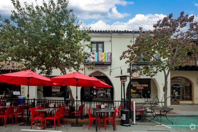
Property Record
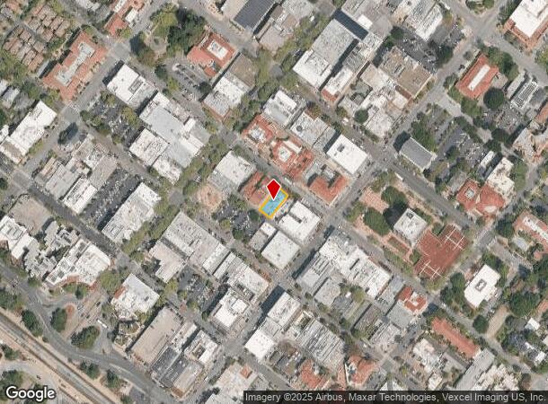
536 Ramona St, Palo Alto, CA 94301
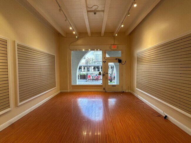
Current Lease Availabilities
NEARBY LISTINGS FOR SALE OR LEASE
Property Detail
536 Ramona St
120-26-071
Palo Alto
Storebuilding
Santa Clara
X
California
06081C0308E
0.11 AC
2024
Downtown Palo Alto
2025
South Bay/San Jose
511302
San Jose-Sunnyvale-Santa Clara, CA
3,510 SF
DEMOGRAPHICS near 536 Ramona St
1 Mile
3 Mile
5 Mile
2024 Total Population
17,795
150,732
276,327
2029 Population
17,256
145,132
266,744
Pop Growth 2024-2029
(3.03%)
(3.72%)
(3.47%)
Average Age
43
39
39
2024 Total Households
7,714
50,308
96,764
HH Growth 2024-2029
(3.11%)
(3.68%)
(3.39%)
Median Household Inc
$188,121
$160,107
$150,137
Avg Household Size
2.20
2.60
2.60
2024 Avg HH Vehicles
2.00
2.00
2.00
Median Home Value
$1,142,739
$1,135,558
$1,132,134
Median Year Built
1962
1964
1967
Nearby Places
- Restaurants
- Banks
- Shops
- Fitness
- Groceries
PUBLIC TRANSPORTATION
COMMUTER RAIL
Palo Alto (Caltrain - Caltrain (Caltrain))
DRIVE
WALK
Distance
Palo Alto (Caltrain - Caltrain (Caltrain))
2 min
7 min
0.3 mi
Stanford (Caltrain - Caltrain (Caltrain))
DRIVE
WALK
Distance
Stanford (Caltrain - Caltrain (Caltrain))
3 min
13 min
0.7 mi
AIRPORT
Norman Y Mineta San Jose International
DRIVE
WALK
Distance
Norman Y Mineta San Jose International
21 min
15.8 mi
San Francisco International
DRIVE
WALK
Distance
San Francisco International
26 min
20.3 mi
Metro Oakland International
DRIVE
WALK
Distance
Metro Oakland International
40 min
28.8 mi
Freight Ports
Port of Redwood City
DRIVE
WALK
Distance
Port of Redwood City
1 min
5.1 mi
Nearby Properties
Address
Land Use
TOTAL SIZE
Lot Size
Zoning
Address
Land Use
TOTAL SIZE
Lot Size
Zoning
719,052 SF
56.03 AC
Address
Land Use
TOTAL SIZE
Lot Size
Zoning
999,999 SF
56.91 AC
Address
Land Use
TOTAL SIZE
Lot Size
Zoning
1,395,540 SF
51.72 AC
C3
Address
Land Use
TOTAL SIZE
Lot Size
Zoning
22.07 AC
Address
Land Use
TOTAL SIZE
Lot Size
Zoning
Address
Land Use
TOTAL SIZE
Lot Size
Zoning
520,988 SF
8.88 AC
Address
Land Use
TOTAL SIZE
Lot Size
Zoning
78,277 SF
16.31 AC
RP
Address
Land Use
TOTAL SIZE
Lot Size
Zoning
265,341 SF
13.53 AC
RP
Address
Land Use
TOTAL SIZE
Lot Size
Zoning
918,926 SF
17.54 AC
PC442
Address
Land Use
TOTAL SIZE
Lot Size
Zoning
Address
Land Use
TOTAL SIZE
Lot Size
Zoning
210,000 SF
10.79 AC
Address
Land Use
TOTAL SIZE
Lot Size
Zoning
521,754 SF
46.72 AC
RP
Address
Land Use
TOTAL SIZE
Lot Size
Zoning
247,567 SF
3.52 AC
Address
Land Use
TOTAL SIZE
Lot Size
Zoning
212,924 SF
1.83 AC
Address
Land Use
TOTAL SIZE
Lot Size
Zoning
164,853 SF
3.89 AC
Address
Land Use
TOTAL SIZE
Lot Size
Zoning
110,384 SF
10.17 AC
RP
Address
Land Use
TOTAL SIZE
Lot Size
Zoning
169,391 SF
13.30 AC
EAC01C
Address
Land Use
TOTAL SIZE
Lot Size
Zoning
145,617 SF
8.24 AC
EA00C1
Address
Land Use
TOTAL SIZE
Lot Size
Zoning
328,024 SF
10.64 AC
Address
Land Use
TOTAL SIZE
Lot Size
Zoning
61.20 AC
R10000
Address
Land Use
TOTAL SIZE
Lot Size
Zoning
516,963 SF
36.46 AC
RP
Address
Land Use
TOTAL SIZE
Lot Size
Zoning
190,389 SF
11.20 AC
M20000
Address
Land Use
TOTAL SIZE
Lot Size
Zoning
143,429 SF
2.12 AC
Address
Land Use
TOTAL SIZE
Lot Size
Zoning
149,700 SF
2.28 AC
Address
Land Use
TOTAL SIZE
Lot Size
Zoning
113,964 SF
6.28 AC
RP
Address
Land Use
TOTAL SIZE
Lot Size
Zoning
222,234 SF
6.39 AC
Address
Land Use
TOTAL SIZE
Lot Size
Zoning
184,142 SF
10.29 AC
RP
Address
Land Use
TOTAL SIZE
Lot Size
Zoning
Address
Land Use
TOTAL SIZE
Lot Size
Zoning
16.43 AC
Address
Land Use
TOTAL SIZE
Lot Size
Zoning
190,000 SF
3.37 AC
The World's #1 Commercial Real Estate Marketplace
Connect with us
© 2025 CoStar Group
The information above has been obtained from sources believed reliable. While we do not doubt its accuracy we have not verified it and make no guarantee, warranty or representation about it. It is your responsibility to independently confirm its accuracy and completeness. Any projections, opinions, assumptions, or estimates used are for example only and do not represent the current or future performance of the property. The value of this transaction to you depends on tax and other factors which should be evaluated by your tax, financial, and legal advisors. You and your advisors should conduct a careful, independent investigation of the property to determine to your satisfaction the suitability of the property for your needs.