Property Record
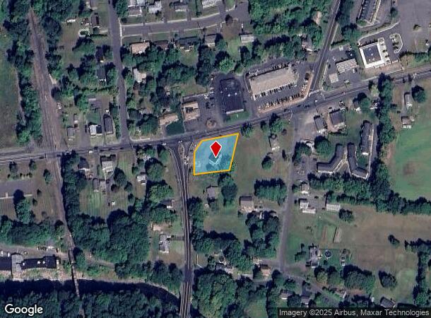
534 Hazard Ave, Enfield, CT 06082


NEARBY LISTINGS FOR SALE OR LEASE
Property Detail
534 Hazard Ave
ENFI-000101-000000-000206
Hartford
Commercialbuilding
Connecticut
X
206
09003C0232F
0.52 AC
2025
Enfield
2025
Hartford
480900
Hartford-West Hartford-East Hartford, CT
1,296 SF
DEMOGRAPHICS near 534 Hazard Ave
1 Mile
3 Mile
5 Mile
2024 Total Population
3,795
17,844
67,367
2029 Population
3,813
17,699
66,973
Pop Growth 2024-2029
+ 0.47%
(0.81%)
(0.58%)
Average Age
43
44
43
2024 Total Households
1,231
6,981
25,758
HH Growth 2024-2029
0.00%
(1.12%)
(0.75%)
Median Household Inc
$108,074
$100,493
$94,002
Avg Household Size
2.40
2.40
2.40
2024 Avg HH Vehicles
2.00
2.00
2.00
Median Home Value
$220,113
$244,513
$260,360
Median Year Built
1959
1965
1965
Nearby Places
Map Layers
Map Styles
 Street
 Aerial
- Restaurants
- Banks
- Shops
- Fitness
- Groceries
PUBLIC TRANSPORTATION
AIRPORT
Bradley International
DRIVE
WALK
Distance
Bradley International
26 min
11.8 mi
Freight Ports
Port of New Haven
DRIVE
WALK
Distance
Port of New Haven
79 min
60.3 mi
SALE & LEASE HISTORY
LISTING DATE
SALE/LEASE

May 30, 2024
For Lease
Nearby Properties
Address
Land Use
TOTAL SIZE
Lot Size
Zoning
Address
Land Use
TOTAL SIZE
Lot Size
Zoning
750,000 SF
405 AC
A-1
Address
Land Use
TOTAL SIZE
Lot Size
Zoning
226,545 SF
14 AC
A-1
Address
Land Use
TOTAL SIZE
Lot Size
Zoning
370.78 AC
R88
Address
Land Use
TOTAL SIZE
Lot Size
Zoning
283.30 AC
R88
Address
Land Use
TOTAL SIZE
Lot Size
Zoning
166,268 SF
36.70 AC
R44
Address
Land Use
TOTAL SIZE
Lot Size
Zoning
108.50 AC
A-1
Address
Land Use
TOTAL SIZE
Lot Size
Zoning
500,000 SF
71.20 AC
I-1
Address
Land Use
TOTAL SIZE
Lot Size
Zoning
121.07 AC
I-1
Address
Land Use
TOTAL SIZE
Lot Size
Zoning
49.16 AC
I-1
Address
Land Use
TOTAL SIZE
Lot Size
Zoning
319,054 SF
30.02 AC
I-P
Address
Land Use
TOTAL SIZE
Lot Size
Zoning
36.97 AC
I-1
Address
Land Use
TOTAL SIZE
Lot Size
Zoning
211,256 SF
41.58 AC
R33
Address
Land Use
TOTAL SIZE
Lot Size
Zoning
121 AC
A-1
Address
Land Use
TOTAL SIZE
Lot Size
Zoning
24.92 AC
BL
Address
Land Use
TOTAL SIZE
Lot Size
Zoning
1.87 AC
BP
Address
Land Use
TOTAL SIZE
Lot Size
Zoning
17.34 AC
R44
Address
Land Use
TOTAL SIZE
Lot Size
Zoning
54.05 AC
I-1
Address
Land Use
TOTAL SIZE
Lot Size
Zoning
15.91 AC
R44
Address
Land Use
TOTAL SIZE
Lot Size
Zoning
104,111 SF
11.16 AC
I-1
Address
Land Use
TOTAL SIZE
Lot Size
Zoning
55,096 SF
18.80 AC
R44
Address
Land Use
TOTAL SIZE
Lot Size
Zoning
70,659 SF
19.62 AC
R44
Address
Land Use
TOTAL SIZE
Lot Size
Zoning
53,850 SF
8.12 AC
R33
Address
Land Use
TOTAL SIZE
Lot Size
Zoning
90,776 SF
23.48 AC
I-1
Address
Land Use
TOTAL SIZE
Lot Size
Zoning
169,680 SF
11.49 AC
I-1
Address
Land Use
TOTAL SIZE
Lot Size
Zoning
10.37 AC
BL
Address
Land Use
TOTAL SIZE
Lot Size
Zoning
47,756 SF
6.17 AC
R33
Address
Land Use
TOTAL SIZE
Lot Size
Zoning
24,630 SF
3.72 AC
BP
Address
Land Use
TOTAL SIZE
Lot Size
Zoning
101,440 SF
19.07 AC
I-1
Address
Land Use
TOTAL SIZE
Lot Size
Zoning
32,438 SF
5.13 AC
BL
Address
Land Use
TOTAL SIZE
Lot Size
Zoning
67.24 AC
R88
The World's #1 Commercial Real Estate Marketplace
Connect with us
© 2026 CoStar Group
The information above has been obtained from sources believed reliable. While we do not doubt its accuracy we have not verified it and make no guarantee, warranty or representation about it. It is your responsibility to independently confirm its accuracy and completeness. Any projections, opinions, assumptions, or estimates used are for example only and do not represent the current or future performance of the property. The value of this transaction to you depends on tax and other factors which should be evaluated by your tax, financial, and legal advisors. You and your advisors should conduct a careful, independent investigation of the property to determine to your satisfaction the suitability of the property for your needs.