Property Record
5353 Manhattan Cir, Boulder, CO 80303


Current Lease Availabilities
Property Detail
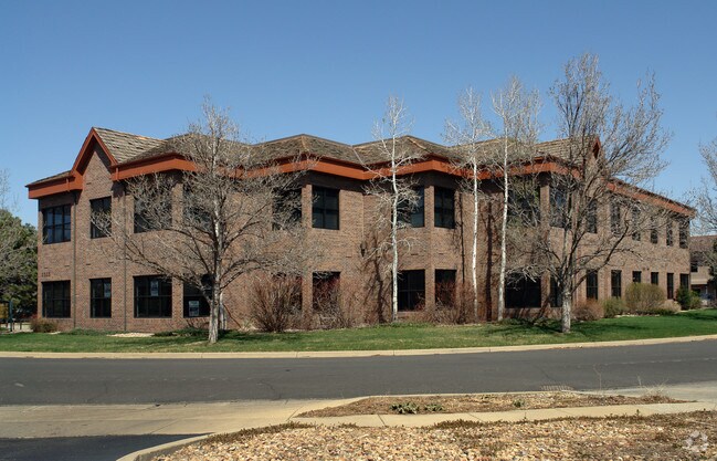
5353 Manhattan Cir
Boulder, CO
LOT 4 ETTER ADDITION
1577090-08-002
Boulder
Storesoffices
Colorado
C and X Area of minimal flood hazard, usually depicted on FIRMs as above the 500-year flood level.
4
2024
0.68 AC
2025
Boulder
012501
Denver
15,264 SF
NEARBY LISTINGS FOR SALE OR LEASE
DEMOGRAPHICS near 5353 Manhattan Cir
1 mile
3 mile
5 mile
2024 Total Population
7,939
58,930
124,255
2029 Population
7,803
58,851
123,936
Pop Growth 2024-2029
(1.71%)
(0.13%)
(0.26%)
Average Age
40
35
38
2024 Total Households
3,718
21,722
49,707
HH Growth 2024-2029
(1.75%)
(0.06%)
(0.22%)
Median Household Inc
$85,087
$76,429
$88,983
Avg Household Size
2.00
2.10
2.20
2024 Avg HH Vehicles
2.00
2.00
2.00
Median Home Value
$812,499
$990,974
$975,063
Median Year Built
1973
1975
1979
Nearby Places
Map Layers
Map Styles
 Street
 Aerial
Transit
 Traffic
 Biking
Places
Listings with unknown addresses are not visible on the map
- Restaurants
- Banks
- Shops
- Fitness
- Groceries
PUBLIC TRANSPORTATION
AIRPORT
Denver International
Drive
Walk
Distance
Denver International
48 min
41.0 mi
Nearby Properties
Address
Land Use
TOTAL SIZE
Lot Size
Zoning
Address
Land Use
TOTAL SIZE
Lot Size
Zoning
1,285,025 SF
17.46 AC
Address
Land Use
TOTAL SIZE
Lot Size
Zoning
30.08 AC
Address
Land Use
TOTAL SIZE
Lot Size
Zoning
14.66 AC
Address
Land Use
TOTAL SIZE
Lot Size
Zoning
171.91 AC
Address
Land Use
TOTAL SIZE
Lot Size
Zoning
1,892,750 SF
200 AC
Address
Land Use
TOTAL SIZE
Lot Size
Zoning
941,000 SF
44 SF
Address
Land Use
TOTAL SIZE
Lot Size
Zoning
155,000 SF
205.33 AC
Address
Land Use
TOTAL SIZE
Lot Size
Zoning
244,999 SF
2.24 AC
Address
Land Use
TOTAL SIZE
Lot Size
Zoning
599,605 SF
4.46 AC
Address
Land Use
TOTAL SIZE
Lot Size
Zoning
842,665 SF
59.42 AC
Address
Land Use
TOTAL SIZE
Lot Size
Zoning
520,605 SF
42.57 AC
C
Address
Land Use
TOTAL SIZE
Lot Size
Zoning
385,761 SF
19.07 AC
Address
Land Use
TOTAL SIZE
Lot Size
Zoning
161,616 SF
8 AC
Address
Land Use
TOTAL SIZE
Lot Size
Zoning
186.43 AC
RR
Address
Land Use
TOTAL SIZE
Lot Size
Zoning
518,974 SF
65.71 AC
Address
Land Use
TOTAL SIZE
Lot Size
Zoning
25.41 AC
GI
Address
Land Use
TOTAL SIZE
Lot Size
Zoning
63.88 AC
RR
Address
Land Use
TOTAL SIZE
Lot Size
Zoning
246.37 AC
Address
Land Use
TOTAL SIZE
Lot Size
Zoning
268.67 AC
Address
Land Use
TOTAL SIZE
Lot Size
Zoning
117,540 SF
Address
Land Use
TOTAL SIZE
Lot Size
Zoning
69.99 AC
ER
Address
Land Use
TOTAL SIZE
Lot Size
Zoning
161,761 SF
4.79 AC
Address
Land Use
TOTAL SIZE
Lot Size
Zoning
276,166 SF
2.98 AC
Address
Land Use
TOTAL SIZE
Lot Size
Zoning
173,205 SF
3.35 AC
Address
Land Use
TOTAL SIZE
Lot Size
Zoning
159,270 SF
9.52 AC
Address
Land Use
TOTAL SIZE
Lot Size
Zoning
165 SF
168.68 AC
A
Address
Land Use
TOTAL SIZE
Lot Size
Zoning
29.20 AC
RR
Address
Land Use
TOTAL SIZE
Lot Size
Zoning
234,050 SF
30.93 AC
Address
Land Use
TOTAL SIZE
Lot Size
Zoning
211,273 SF
14.81 AC
Address
Land Use
TOTAL SIZE
Lot Size
Zoning
1,002 SF
16.71 AC
The World's #1 Commercial Real Estate Marketplace
Connect with us
© 2026 CoStar Group
The information above has been obtained from sources believed reliable. While we do not doubt its accuracy we have not verified it and make no guarantee, warranty or representation about it. It is your responsibility to independently confirm its accuracy and completeness. Any projections, opinions, assumptions, or estimates used are for example only and do not represent the current or future performance of the property. The value of this transaction to you depends on tax and other factors which should be evaluated by your tax, financial, and legal advisors. You and your advisors should conduct a careful, independent investigation of the property to determine to your satisfaction the suitability of the property for your needs.