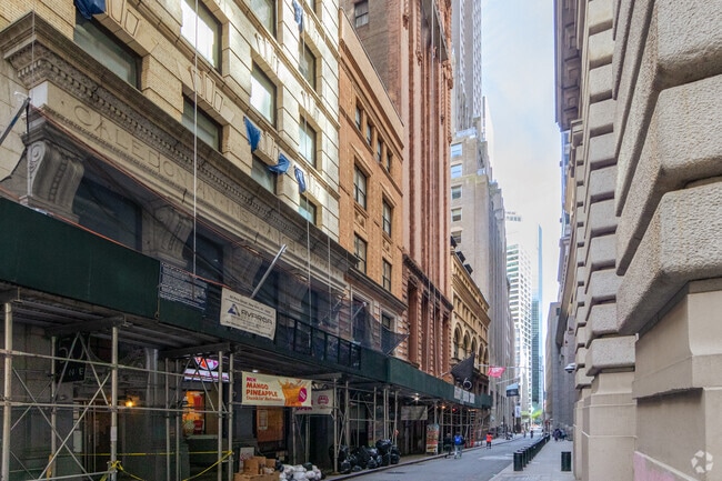
Property Record
54 Pine St, New York, NY 10005

Current Lease Availabilities
NEARBY LISTINGS FOR SALE OR LEASE
Property Detail
54 Pine St
0041-1101
Manhattan
Commercialcondominium
New York
X
1101
3604970184F
0.05 AC
2024
Financial District
2025
New York City
000700
New York-Jersey City-White Plains, NY-NJ
4,849 SF
DEMOGRAPHICS near 54 Pine St
1 mile
3 mile
5 mile
2024 Total Population
105,320
952,855
2,405,755
2029 Population
97,581
904,494
2,276,574
Pop Growth 2024-2029
(7.35%)
(5.08%)
(5.37%)
Average Age
39
38
38
2024 Total Households
48,527
444,385
1,054,119
HH Growth 2024-2029
(7.63%)
(5.46%)
(5.70%)
Median Household Inc
$139,414
$112,363
$94,256
Avg Household Size
2.00
2.00
2.20
2024 Avg HH Vehicles
.00
.00
.00
Median Home Value
$1,049,000
$977,612
$920,422
Median Year Built
1960
1955
1954
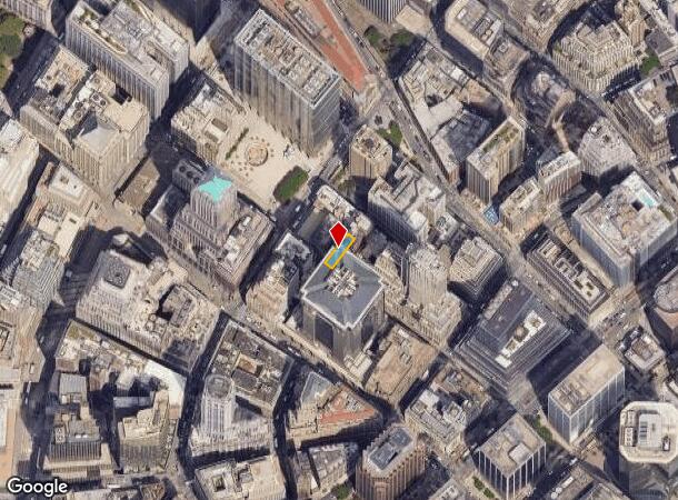
Nearby Places
Map Layers
Map Styles
 Street
 Aerial
Transit
 Traffic
 Biking
Places
Listings with unknown addresses are not visible on the map
- Restaurants
- Banks
- Shops
- Fitness
- Groceries
PUBLIC TRANSPORTATION
TRANSIT/SUBWAY
Wall Street (2,3 Line) (2 - New York MTA Subway (The Subway), 3 - New York MTA Subway (The Subway))
Drive
Walk
Distance
Wall Street (2,3 Line) (2 - New York MTA Subway (The Subway), 3 - New York MTA Subway (The Subway))
2 min
1 min
0.1 mi
Broad Street (J - New York MTA Subway (The Subway), M - New York MTA Subway (The Subway), Z - New York MTA Subway (The Subway))
Drive
Walk
Distance
Broad Street (J - New York MTA Subway (The Subway), M - New York MTA Subway (The Subway), Z - New York MTA Subway (The Subway))
1 min
4 min
0.2 mi
Wall Street (4,5 Line) (4 - New York MTA Subway (The Subway), 5 - New York MTA Subway (The Subway))
Drive
Walk
Distance
Wall Street (4,5 Line) (4 - New York MTA Subway (The Subway), 5 - New York MTA Subway (The Subway))
1 min
4 min
0.2 mi
Fulton Street (J,M,Z Line) (J - New York MTA Subway (The Subway), M - New York MTA Subway (The Subway), Z - New York MTA Subway (The Subway))
Drive
Walk
Distance
Fulton Street (J,M,Z Line) (J - New York MTA Subway (The Subway), M - New York MTA Subway (The Subway), Z - New York MTA Subway (The Subway))
1 min
6 min
0.3 mi
Rector Street (N,R Line) (N - New York MTA Subway (The Subway), R - New York MTA Subway (The Subway))
Drive
Walk
Distance
Rector Street (N,R Line) (N - New York MTA Subway (The Subway), R - New York MTA Subway (The Subway))
2 min
6 min
0.3 mi
COMMUTER RAIL
9 St (PATH) (Hoboken-33rd Street - Port Authority Trans-Hudson (PATH), Journal Square-33rd Street - Port Authority Trans-Hudson (PATH))
Drive
Walk
Distance
9 St (PATH) (Hoboken-33rd Street - Port Authority Trans-Hudson (PATH), Journal Square-33rd Street - Port Authority Trans-Hudson (PATH))
9 min
2.2 mi
Christopher St (Hoboken-33rd Street - Port Authority Trans-Hudson (PATH), Journal Square-33rd Street - Port Authority Trans-Hudson (PATH))
Drive
Walk
Distance
Christopher St (Hoboken-33rd Street - Port Authority Trans-Hudson (PATH), Journal Square-33rd Street - Port Authority Trans-Hudson (PATH))
8 min
2.4 mi
AIRPORT
LaGuardia
Drive
Walk
Distance
LaGuardia
24 min
11.6 mi
Newark Liberty International
Drive
Walk
Distance
Newark Liberty International
23 min
13.4 mi
John F Kennedy International
Drive
Walk
Distance
John F Kennedy International
35 min
19.8 mi
Freight Ports
NY - Red Hook Container Terminal
Drive
Walk
Distance
NY - Red Hook Container Terminal
9 min
3.5 mi
Nearby Properties
Address
Land Use
TOTAL SIZE
Lot Size
Zoning
Address
Land Use
TOTAL SIZE
Lot Size
Zoning
8,462,176 SF
61.41 AC
R7-2
Address
Land Use
TOTAL SIZE
Lot Size
Zoning
2,161,994 SF
3.79 AC
M1-5
Address
Land Use
TOTAL SIZE
Lot Size
Zoning
2,354,289 SF
3.96 AC
C6-4
Address
Land Use
TOTAL SIZE
Lot Size
Zoning
2,812,739 SF
2.10 AC
C5-3
Address
Land Use
TOTAL SIZE
Lot Size
Zoning
2.38 AC
Address
Land Use
TOTAL SIZE
Lot Size
Zoning
6,877 SF
27.74 AC
UD
Address
Land Use
TOTAL SIZE
Lot Size
Zoning
1.75 AC
Address
Land Use
TOTAL SIZE
Lot Size
Zoning
2,157,862 SF
2.23 AC
BPC
Address
Land Use
TOTAL SIZE
Lot Size
Zoning
1,009,855 SF
4.90 AC
C6-3
Address
Land Use
TOTAL SIZE
Lot Size
Zoning
2,255,659 SF
4.58 AC
BPC
Address
Land Use
TOTAL SIZE
Lot Size
Zoning
8.22 AC
R8
Address
Land Use
TOTAL SIZE
Lot Size
Zoning
8.22 AC
R8
Address
Land Use
TOTAL SIZE
Lot Size
Zoning
2,124,441 SF
17.29 AC
R8
Address
Land Use
TOTAL SIZE
Lot Size
Zoning
Address
Land Use
TOTAL SIZE
Lot Size
Zoning
1,009,855 SF
3.25 AC
C6-3
Address
Land Use
TOTAL SIZE
Lot Size
Zoning
6.42 AC
Address
Land Use
TOTAL SIZE
Lot Size
Zoning
2,233,692 SF
1.90 AC
BPC
Address
Land Use
TOTAL SIZE
Lot Size
Zoning
1,233,394 SF
1.78 AC
C5-3
Address
Land Use
TOTAL SIZE
Lot Size
Zoning
2.21 AC
Address
Land Use
TOTAL SIZE
Lot Size
Zoning
1,104,505 SF
2.32 AC
C4-7
Address
Land Use
TOTAL SIZE
Lot Size
Zoning
1,560,607 SF
2.69 AC
C6-6
Address
Land Use
TOTAL SIZE
Lot Size
Zoning
1,636,000 SF
1.09 AC
C6-4
Address
Land Use
TOTAL SIZE
Lot Size
Zoning
1,909,502 SF
2.37 AC
BPC
Address
Land Use
TOTAL SIZE
Lot Size
Zoning
940,000 SF
1.44 AC
C6-2
Address
Land Use
TOTAL SIZE
Lot Size
Zoning
5.12 AC
C6-1G
Address
Land Use
TOTAL SIZE
Lot Size
Zoning
5.12 AC
C6-1G
Address
Land Use
TOTAL SIZE
Lot Size
Zoning
5.12 AC
C6-1G
Address
Land Use
TOTAL SIZE
Lot Size
Zoning
5.12 AC
C6-1G
Address
Land Use
TOTAL SIZE
Lot Size
Zoning
5.12 AC
C6-1G
Address
Land Use
TOTAL SIZE
Lot Size
Zoning
5.12 AC
C6-1G
The World's #1 Commercial Real Estate Marketplace
Connect with us
© 2026 CoStar Group
The information above has been obtained from sources believed reliable. While we do not doubt its accuracy we have not verified it and make no guarantee, warranty or representation about it. It is your responsibility to independently confirm its accuracy and completeness. Any projections, opinions, assumptions, or estimates used are for example only and do not represent the current or future performance of the property. The value of this transaction to you depends on tax and other factors which should be evaluated by your tax, financial, and legal advisors. You and your advisors should conduct a careful, independent investigation of the property to determine to your satisfaction the suitability of the property for your needs.