Property Record
5405 Morrow Dr, San Pablo, CA 94806


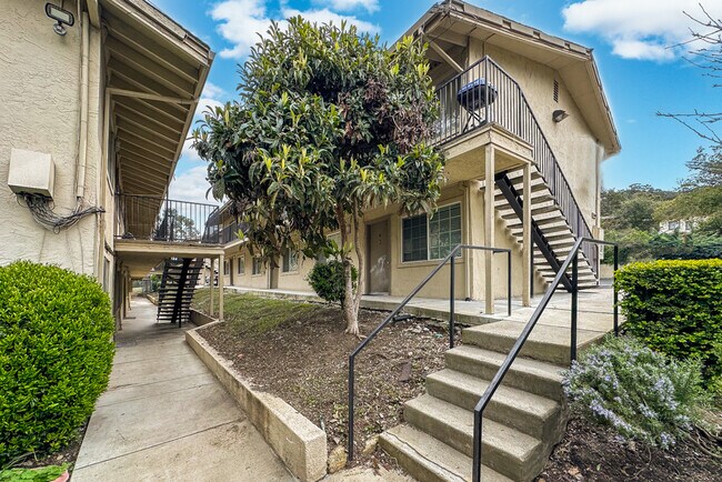

Property Detail
5405 Morrow Dr
Oakland-Fremont-Berkeley, CA
TRACT 2123 LOT 1 PCL B
420-054-014-6
Contra Costa
Apartment
California
B and X Area of moderate flood hazard, usually the area between the limits of the 100-year and 500-year floods.
1
2025
0.91 AC
2025
San Pablo
369002
East Bay/Oakland
2,688 SF
NEARBY LISTINGS FOR SALE OR LEASE
DEMOGRAPHICS near 5405 Morrow Dr
1 mile
3 mile
5 mile
2025 Total Population
23,501
173,148
257,390
2030 Population
23,702
174,280
258,975
Pop Growth 2025-2030
+ 0.86%
+ 0.65%
+ 0.62%
Average Age
40
39
41
2025 Total Households
7,710
55,115
87,816
HH Growth 2025-2030
+ 0.99%
+ 0.65%
+ 0.60%
Median Household Inc
$87,045
$89,767
$102,653
Avg Household Size
2.90
3.00
2.80
2025 Avg HH Vehicles
2.00
2.00
2.00
Median Home Value
$687,589
$710,861
$759,658
Median Year Built
1965
1963
1965
Nearby Places
Map Layers
Map Styles
 Street
 Aerial
Layers
 Traffic
 Biking
Places
Listings with unknown addresses are not visible on the map
- Restaurants
- Banks
- Shops
- Fitness
- Groceries
PUBLIC TRANSPORTATION
COMMUTER RAIL
Drive
Walk
Distance
10 min
7.3 mi
Drive
Walk
Distance
14 min
9.6 mi
AIRPORT
Metro Oakland International
Drive
Walk
Distance
Metro Oakland International
31 min
22.2 mi
San Francisco International
Drive
Walk
Distance
San Francisco International
43 min
29.8 mi
Freight Ports
Port of Richmond
Drive
Walk
Distance
Port of Richmond
17 min
8.3 mi
SALE & LEASE HISTORY
LISTING DATE
SALE/LEASE

Jun 07, 2022
For Sale
Aug 05, 2018
For Sale
Apr 19, 2023
For Sale
Nearby Properties
Address
Land Use
TOTAL SIZE
Lot Size
Zoning
Address
Land Use
TOTAL SIZE
Lot Size
Zoning
820,000 SF
6.36 AC
Address
Land Use
TOTAL SIZE
Lot Size
Zoning
892,224 SF
46.87 AC
Address
Land Use
TOTAL SIZE
Lot Size
Zoning
68,400 SF
5.13 AC
CM
Address
Land Use
TOTAL SIZE
Lot Size
Zoning
707,820 SF
44.29 AC
Address
Land Use
TOTAL SIZE
Lot Size
Zoning
481,487 SF
27.88 AC
P-1
Address
Land Use
TOTAL SIZE
Lot Size
Zoning
205,900 SF
20.70 AC
P1
Address
Land Use
TOTAL SIZE
Lot Size
Zoning
321,008 SF
47.36 AC
Address
Land Use
TOTAL SIZE
Lot Size
Zoning
252,714 SF
14.68 AC
C
Address
Land Use
TOTAL SIZE
Lot Size
Zoning
459,003 SF
21.30 AC
Address
Land Use
TOTAL SIZE
Lot Size
Zoning
581,157 SF
10.52 AC
Address
Land Use
TOTAL SIZE
Lot Size
Zoning
195,281 SF
0.96 AC
Address
Land Use
TOTAL SIZE
Lot Size
Zoning
163,721 SF
0.76 AC
Address
Land Use
TOTAL SIZE
Lot Size
Zoning
247,924 SF
14.36 AC
Address
Land Use
TOTAL SIZE
Lot Size
Zoning
245,680 SF
18.89 AC
Address
Land Use
TOTAL SIZE
Lot Size
Zoning
200,000 SF
14.95 AC
Address
Land Use
TOTAL SIZE
Lot Size
Zoning
70,250 SF
9.55 AC
Address
Land Use
TOTAL SIZE
Lot Size
Zoning
220,864 SF
11.10 AC
Address
Land Use
TOTAL SIZE
Lot Size
Zoning
190,471 SF
11.32 AC
Address
Land Use
TOTAL SIZE
Lot Size
Zoning
171,052 SF
12.06 AC
M3
Address
Land Use
TOTAL SIZE
Lot Size
Zoning
135,904 SF
7.12 AC
Address
Land Use
TOTAL SIZE
Lot Size
Zoning
113,346 SF
10.11 AC
Address
Land Use
TOTAL SIZE
Lot Size
Zoning
191,800 SF
1.09 AC
Address
Land Use
TOTAL SIZE
Lot Size
Zoning
124,257 SF
2.72 AC
Address
Land Use
TOTAL SIZE
Lot Size
Zoning
41,400 SF
6.32 AC
Address
Land Use
TOTAL SIZE
Lot Size
Zoning
69,949 SF
0.65 AC
C2 CD
Address
Land Use
TOTAL SIZE
Lot Size
Zoning
81,352 SF
5.06 AC
C2
Address
Land Use
TOTAL SIZE
Lot Size
Zoning
177,724 SF
63.32 AC
M-2
Address
Land Use
TOTAL SIZE
Lot Size
Zoning
118,658 SF
8.57 AC
Address
Land Use
TOTAL SIZE
Lot Size
Zoning
178,277 SF
58.72 AC
Address
Land Use
TOTAL SIZE
Lot Size
Zoning
131,693 SF
7.47 AC
The World's #1 Commercial Real Estate Marketplace
Connect with us
© 2026 CoStar Group
The information above has been obtained from sources believed reliable. While we do not doubt its accuracy we have not verified it and make no guarantee, warranty or representation about it. It is your responsibility to independently confirm its accuracy and completeness. Any projections, opinions, assumptions, or estimates used are for example only and do not represent the current or future performance of the property. The value of this transaction to you depends on tax and other factors which should be evaluated by your tax, financial, and legal advisors. You and your advisors should conduct a careful, independent investigation of the property to determine to your satisfaction the suitability of the property for your needs.