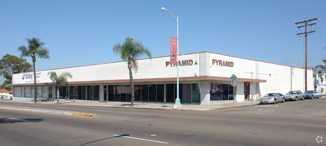
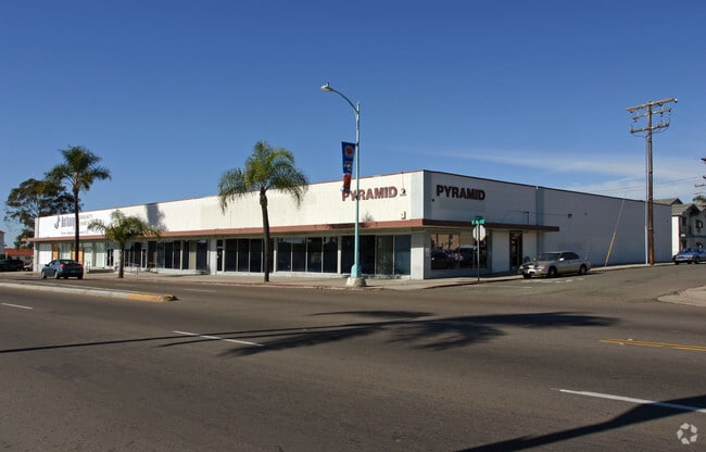
Property Record
5468 El Cajon Blvd, San Diego, CA 92115
NEARBY LISTINGS FOR SALE OR LEASE
Property Detail
5468 El Cajon Blvd
San Diego-Carlsbad, CA
Highland Garden
466-692-05
LOT 6&7 (EX ST) TR 1816
Multifamilydwelling
San Diego
X
California
06073C1639H
6,7
2025
0.32 AC
2025
Mid City/SE San Diego
002804
San Diego
99,999 SF
DEMOGRAPHICS near 5468 El Cajon Blvd
1 Mile
3 Mile
5 Mile
2024 Total Population
43,094
239,436
578,327
2029 Population
42,677
237,865
574,770
Pop Growth 2024-2029
(0.97%)
(0.66%)
(0.62%)
Average Age
35
37
38
2024 Total Households
14,740
88,574
215,911
HH Growth 2024-2029
(1.15%)
(0.75%)
(0.65%)
Median Household Inc
$56,299
$68,639
$75,961
Avg Household Size
2.60
2.50
2.50
2024 Avg HH Vehicles
2.00
2.00
2.00
Median Home Value
$679,408
$695,418
$689,967
Median Year Built
1968
1968
1971
Nearby Places
Map Layers
Map Styles
 Street
 Aerial
- Restaurants
- Banks
- Shops
- Fitness
- Groceries
PUBLIC TRANSPORTATION
COMMUTER RAIL
San Diego (Santa Fe Depot) (Coaster - San Diego North County Transit District (Coaster/Sprinter/Breeze))
DRIVE
WALK
Distance
San Diego (Santa Fe Depot) (Coaster - San Diego North County Transit District (Coaster/Sprinter/Breeze))
13 min
8.1 mi
Old Town Transit Center (Coaster - San Diego North County Transit District (Coaster/Sprinter/Breeze))
DRIVE
WALK
Distance
Old Town Transit Center (Coaster - San Diego North County Transit District (Coaster/Sprinter/Breeze))
15 min
8.7 mi
AIRPORT
San Diego International
DRIVE
WALK
Distance
San Diego International
15 min
7.4 mi
Freight Ports
Port of San Diego
DRIVE
WALK
Distance
Port of San Diego
14 min
8.8 mi
Nearby Properties
Address
Land Use
TOTAL SIZE
Lot Size
Zoning
Address
Land Use
TOTAL SIZE
Lot Size
Zoning
4,774 SF
74.75 AC
RM-2-5
Address
Land Use
TOTAL SIZE
Lot Size
Zoning
4.41 AC
CC-3-8
Address
Land Use
TOTAL SIZE
Lot Size
Zoning
8.23 AC
CUPD-CU-2-
Address
Land Use
TOTAL SIZE
Lot Size
Zoning
9.90 AC
RM-3-7
Address
Land Use
TOTAL SIZE
Lot Size
Zoning
18.70 AC
RS-1-7
Address
Land Use
TOTAL SIZE
Lot Size
Zoning
5.02 AC
CC-3-8
Address
Land Use
TOTAL SIZE
Lot Size
Zoning
54,240 SF
8.18 AC
MVPD-MVR-2
Address
Land Use
TOTAL SIZE
Lot Size
Zoning
3.97 AC
C
Address
Land Use
TOTAL SIZE
Lot Size
Zoning
6.68 AC
RM-3-7
Address
Land Use
TOTAL SIZE
Lot Size
Zoning
5.02 AC
RM-4-10
Address
Land Use
TOTAL SIZE
Lot Size
Zoning
8.65 AC
R3
Address
Land Use
TOTAL SIZE
Lot Size
Zoning
135,165 SF
12.24 AC
CC-5-3
Address
Land Use
TOTAL SIZE
Lot Size
Zoning
8.99 AC
IL-2-1
Address
Land Use
TOTAL SIZE
Lot Size
Zoning
1.19 AC
RM-3-9
Address
Land Use
TOTAL SIZE
Lot Size
Zoning
3.44 AC
CC-3-8
Address
Land Use
TOTAL SIZE
Lot Size
Zoning
1.54 AC
RM-3-9
Address
Land Use
TOTAL SIZE
Lot Size
Zoning
3.82 AC
RM-3-7
Address
Land Use
TOTAL SIZE
Lot Size
Zoning
6.14 AC
R3
Address
Land Use
TOTAL SIZE
Lot Size
Zoning
2.39 AC
RM-3-9
Address
Land Use
TOTAL SIZE
Lot Size
Zoning
98,463 SF
0.98 AC
RM-3-9
Address
Land Use
TOTAL SIZE
Lot Size
Zoning
60,480 SF
0.18 AC
RM-3-9
Address
Land Use
TOTAL SIZE
Lot Size
Zoning
89,332 SF
1.14 AC
C
Address
Land Use
TOTAL SIZE
Lot Size
Zoning
87,724 SF
0.77 AC
CC-3-8
Address
Land Use
TOTAL SIZE
Lot Size
Zoning
5.67 AC
RM-2-4
Address
Land Use
TOTAL SIZE
Lot Size
Zoning
4.73 AC
RM-4-10
Address
Land Use
TOTAL SIZE
Lot Size
Zoning
17.63 AC
RM-1-3
Address
Land Use
TOTAL SIZE
Lot Size
Zoning
53,219 SF
3.25 AC
CUPD-CU-2-
Address
Land Use
TOTAL SIZE
Lot Size
Zoning
53,790 SF
0.98 AC
RM-3-9
Address
Land Use
TOTAL SIZE
Lot Size
Zoning
53,798 SF
1 AC
RM-3-9
Address
Land Use
TOTAL SIZE
Lot Size
Zoning
97,270 SF
3.40 AC
RM-3-7
The World's #1 Commercial Real Estate Marketplace
Connect with us
© 2026 CoStar Group
The information above has been obtained from sources believed reliable. While we do not doubt its accuracy we have not verified it and make no guarantee, warranty or representation about it. It is your responsibility to independently confirm its accuracy and completeness. Any projections, opinions, assumptions, or estimates used are for example only and do not represent the current or future performance of the property. The value of this transaction to you depends on tax and other factors which should be evaluated by your tax, financial, and legal advisors. You and your advisors should conduct a careful, independent investigation of the property to determine to your satisfaction the suitability of the property for your needs.