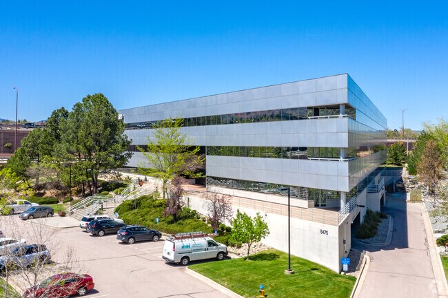
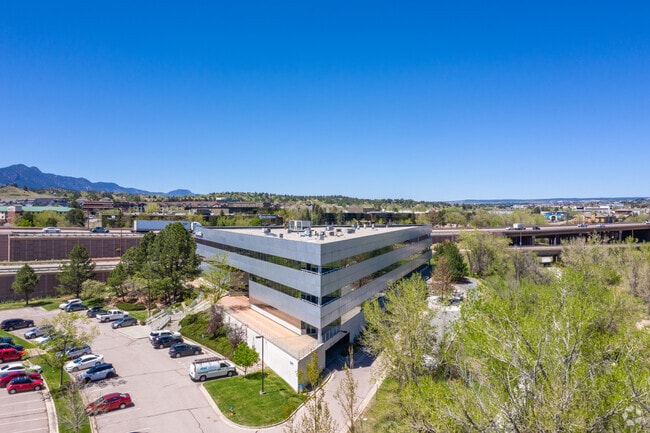
Property Record
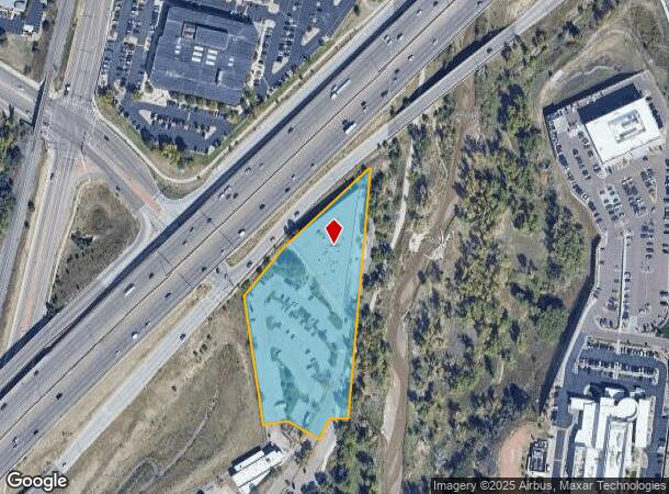
5475 Mark Dabling Blvd, Colorado Springs, CO 80918

Current Lease Availabilities
Office LEASE
$15.50 - $16.50 SF/YR
2,250 - 20,643 SF
NEARBY LISTINGS FOR SALE OR LEASE
Property Detail
5475 Mark Dabling Blvd
Colorado Springs, CO
Pikes Peak Research Park Fil No 2
63184-06-002
LOT 1 PIKES PEAK RESEARCH PARK FIL NO 2 COLO SPGS
Officebuilding
El Paso
AE
Colorado
08041C0512G
1
2024
3.69 AC
2025
North
000302
Colorado Springs
84,160 SF
DEMOGRAPHICS near 5475 Mark Dabling Blvd
1 Mile
3 Mile
5 Mile
2024 Total Population
5,790
76,970
206,522
2029 Population
5,985
80,177
214,721
Pop Growth 2024-2029
+ 3.37%
+ 4.17%
+ 3.97%
Average Age
38
41
40
2024 Total Households
2,466
32,681
85,800
HH Growth 2024-2029
+ 3.53%
+ 4.38%
+ 4.20%
Median Household Inc
$68,216
$74,292
$75,973
Avg Household Size
2.30
2.30
2.30
2024 Avg HH Vehicles
2.00
2.00
2.00
Median Home Value
$421,962
$405,884
$400,753
Median Year Built
1984
1983
1981
Nearby Places
Map Layers
Map Styles
 Street
 Aerial
- Restaurants
- Banks
- Shops
- Fitness
- Groceries
PUBLIC TRANSPORTATION
AIRPORT
City of Colorado Springs Municipal
DRIVE
WALK
Distance
City of Colorado Springs Municipal
30 min
14.1 mi
Nearby Properties
Address
Land Use
TOTAL SIZE
Lot Size
Zoning
Address
Land Use
TOTAL SIZE
Lot Size
Zoning
662,208 SF
14.96 AC
BP
Address
Land Use
TOTAL SIZE
Lot Size
Zoning
62,201 SF
5.68 AC
MX-N
Address
Land Use
TOTAL SIZE
Lot Size
Zoning
409,164 SF
19.26 AC
PUD
Address
Land Use
TOTAL SIZE
Lot Size
Zoning
117,227 SF
12.28 AC
PDZ HS
Address
Land Use
TOTAL SIZE
Lot Size
Zoning
80,802 SF
14.45 AC
PF NNA
Address
Land Use
TOTAL SIZE
Lot Size
Zoning
80,110 SF
2.61 AC
OR CU
Address
Land Use
TOTAL SIZE
Lot Size
Zoning
77,655 SF
8.39 AC
MX-N MX-N/
Address
Land Use
TOTAL SIZE
Lot Size
Zoning
113,069 SF
44.99 AC
R-E HS
Address
Land Use
TOTAL SIZE
Lot Size
Zoning
89,592 SF
7.60 AC
R-E CU
Address
Land Use
TOTAL SIZE
Lot Size
Zoning
71,542 SF
10.11 AC
PF
Address
Land Use
TOTAL SIZE
Lot Size
Zoning
134,592 SF
10.09 AC
MX-L LI CU
Address
Land Use
TOTAL SIZE
Lot Size
Zoning
131,696 SF
9.24 AC
MX-M
Address
Land Use
TOTAL SIZE
Lot Size
Zoning
100,930 SF
7.75 AC
BP CU
Address
Land Use
TOTAL SIZE
Lot Size
Zoning
99,488 SF
13.01 AC
PDZ
Address
Land Use
TOTAL SIZE
Lot Size
Zoning
30,757 SF
6.19 AC
MX-N CU HS
Address
Land Use
TOTAL SIZE
Lot Size
Zoning
34,443 SF
5.14 AC
PF
Address
Land Use
TOTAL SIZE
Lot Size
Zoning
49,023 SF
5.68 AC
MX-L NNA
Address
Land Use
TOTAL SIZE
Lot Size
Zoning
83,479 SF
0.03 AC
OC HS ??
Address
Land Use
TOTAL SIZE
Lot Size
Zoning
53,632 SF
3.42 AC
PF SS
Address
Land Use
TOTAL SIZE
Lot Size
Zoning
158,502 SF
5.73 AC
MX-N HS
Address
Land Use
TOTAL SIZE
Lot Size
Zoning
41,015 SF
0.62 AC
BP
Address
Land Use
TOTAL SIZE
Lot Size
Zoning
23,431 SF
0.17 AC
R-E MX-M P
Address
Land Use
TOTAL SIZE
Lot Size
Zoning
23,324 SF
7.84 AC
MX-N CU
Address
Land Use
TOTAL SIZE
Lot Size
Zoning
301,559 SF
46.67 AC
BP/CR CU H
Address
Land Use
TOTAL SIZE
Lot Size
Zoning
61,098 SF
5.93 AC
LI
Address
Land Use
TOTAL SIZE
Lot Size
Zoning
42,365 SF
3.86 AC
MX-M CU SS
Address
Land Use
TOTAL SIZE
Lot Size
Zoning
49,277 SF
7 AC
MX-L/CR
Address
Land Use
TOTAL SIZE
Lot Size
Zoning
88.37 AC
BP/CR HS C
Address
Land Use
TOTAL SIZE
Lot Size
Zoning
249,958 SF
21.03 AC
BP/CR HS C
Address
Land Use
TOTAL SIZE
Lot Size
Zoning
409,070 SF
17.15 AC
The World's #1 Commercial Real Estate Marketplace
Connect with us
© 2025 CoStar Group
The information above has been obtained from sources believed reliable. While we do not doubt its accuracy we have not verified it and make no guarantee, warranty or representation about it. It is your responsibility to independently confirm its accuracy and completeness. Any projections, opinions, assumptions, or estimates used are for example only and do not represent the current or future performance of the property. The value of this transaction to you depends on tax and other factors which should be evaluated by your tax, financial, and legal advisors. You and your advisors should conduct a careful, independent investigation of the property to determine to your satisfaction the suitability of the property for your needs.