Property Record
549 E 234Th St, Bronx, NY 10470
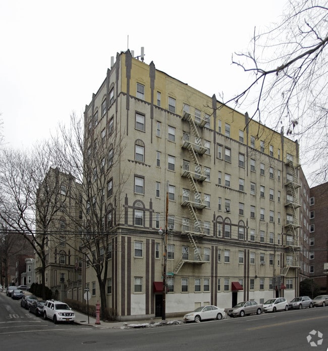

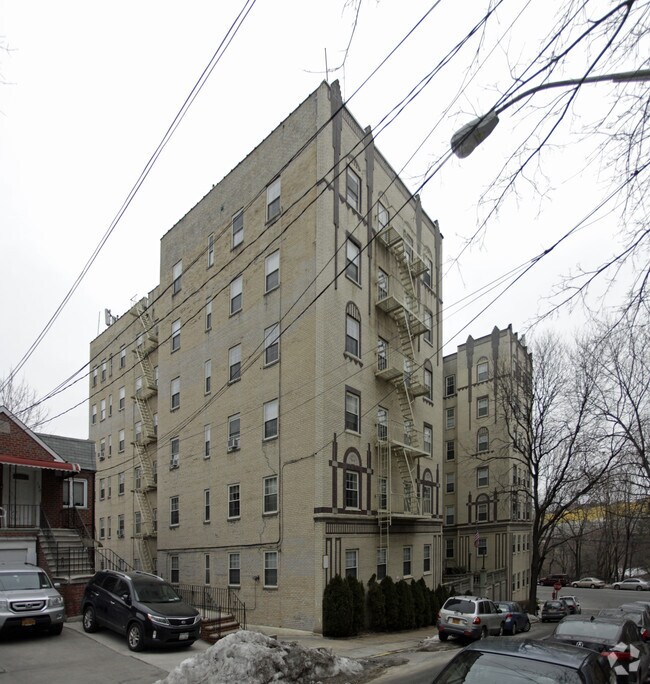
Property Detail
549 E 234Th St
03396-0030
Bronx
Apartment
New York
R7A
30
B and X Area of moderate flood hazard, usually the area between the limits of the 100-year and 500-year floods.
0.35 AC
2024
Woodlawn Heights
2025
Westchester/So Connecticut
045101
New York-Jersey City-White Plains, NY-NJ
61,917 SF
NEARBY LISTINGS FOR SALE OR LEASE
DEMOGRAPHICS near 549 E 234Th St
1 mile
3 mile
5 mile
2024 Total Population
59,985
615,799
1,452,127
2029 Population
56,519
601,693
1,430,845
Pop Growth 2024-2029
(5.78%)
(2.29%)
(1.47%)
Average Age
40
40
40
2024 Total Households
21,903
224,953
524,809
HH Growth 2024-2029
(6.20%)
(2.52%)
(1.61%)
Median Household Inc
$67,304
$62,900
$58,771
Avg Household Size
2.60
2.60
2.60
2024 Avg HH Vehicles
1.00
1.00
1.00
Median Home Value
$603,257
$485,831
$542,562
Median Year Built
1948
1951
1951
Nearby Places
Map Layers
Map Styles
 Street
 Aerial
Transit
 Traffic
 Biking
Places
Listings with unknown addresses are not visible on the map
- Restaurants
- Banks
- Shops
- Fitness
- Groceries
PUBLIC TRANSPORTATION
TRANSIT/SUBWAY
233 Street (2 - New York MTA Subway (The Subway), 5 - New York MTA Subway (The Subway))
Drive
Walk
Distance
233 Street (2 - New York MTA Subway (The Subway), 5 - New York MTA Subway (The Subway))
1 min
10 min
0.5 mi
Nereid Avenue (2 - New York MTA Subway (The Subway), 5 - New York MTA Subway (The Subway))
Drive
Walk
Distance
Nereid Avenue (2 - New York MTA Subway (The Subway), 5 - New York MTA Subway (The Subway))
1 min
12 min
0.7 mi
225 Street (2 - New York MTA Subway (The Subway), 5 - New York MTA Subway (The Subway))
Drive
Walk
Distance
225 Street (2 - New York MTA Subway (The Subway), 5 - New York MTA Subway (The Subway))
2 min
17 min
0.9 mi
Wakefield-241 Street (2 - New York MTA Subway (The Subway))
Drive
Walk
Distance
Wakefield-241 Street (2 - New York MTA Subway (The Subway))
2 min
20 min
1.1 mi
COMMUTER RAIL
Woodlawn Station (Harlem Line - Metro-North Commuter Railroad Company (Metro-North))
Drive
Walk
Distance
Woodlawn Station (Harlem Line - Metro-North Commuter Railroad Company (Metro-North))
0 min
9 min
0.2 mi
Wakefield Station (Harlem Line - Metro-North Commuter Railroad Company (Metro-North))
Drive
Walk
Distance
Wakefield Station (Harlem Line - Metro-North Commuter Railroad Company (Metro-North))
3 min
15 min
0.8 mi
AIRPORT
LaGuardia
Drive
Walk
Distance
LaGuardia
24 min
13.3 mi
Westchester County
Drive
Walk
Distance
Westchester County
29 min
19.1 mi
John F Kennedy International
Drive
Walk
Distance
John F Kennedy International
31 min
21.3 mi
Freight Ports
NY - Red Hook Container Terminal
Drive
Walk
Distance
NY - Red Hook Container Terminal
36 min
21.5 mi
Nearby Properties
Address
Land Use
TOTAL SIZE
Lot Size
Zoning
Address
Land Use
TOTAL SIZE
Lot Size
Zoning
1,743,584 SF
77.87 AC
R6
Address
Land Use
TOTAL SIZE
Lot Size
Zoning
481,172 SF
205.58 AC
PARK
Address
Land Use
TOTAL SIZE
Lot Size
Zoning
1,132,500 SF
62.44 AC
R6
Address
Land Use
TOTAL SIZE
Lot Size
Zoning
895,256 SF
8.32 AC
R7-1
Address
Land Use
TOTAL SIZE
Lot Size
Zoning
1,237,424 SF
21.25 AC
R6
Address
Land Use
TOTAL SIZE
Lot Size
Zoning
204,200 SF
1.68 AC
R7-1
Address
Land Use
TOTAL SIZE
Lot Size
Zoning
4,000 SF
19.83 AC
BUS
Address
Land Use
TOTAL SIZE
Lot Size
Zoning
617,567 SF
3.19 AC
R7-1
Address
Land Use
TOTAL SIZE
Lot Size
Zoning
537,208 SF
4.73 AC
C4-3
Address
Land Use
TOTAL SIZE
Lot Size
Zoning
545,388 SF
29.07 AC
C4-3
Address
Land Use
TOTAL SIZE
Lot Size
Zoning
707,353 SF
29.34 AC
R6
Address
Land Use
TOTAL SIZE
Lot Size
Zoning
Address
Land Use
TOTAL SIZE
Lot Size
Zoning
Address
Land Use
TOTAL SIZE
Lot Size
Zoning
269,100 SF
1.63 AC
R4
Address
Land Use
TOTAL SIZE
Lot Size
Zoning
87,000 SF
455.70 AC
PARK
Address
Land Use
TOTAL SIZE
Lot Size
Zoning
450,784 SF
42.36 AC
R4
Address
Land Use
TOTAL SIZE
Lot Size
Zoning
18,445 SF
510.83 AC
PARK
Address
Land Use
TOTAL SIZE
Lot Size
Zoning
251,884 SF
21.53 AC
R6
Address
Land Use
TOTAL SIZE
Lot Size
Zoning
165,529 SF
7.05 AC
RA3
Address
Land Use
TOTAL SIZE
Lot Size
Zoning
1,028,976 SF
23.03 AC
R5
Address
Land Use
TOTAL SIZE
Lot Size
Zoning
406,549 SF
3.22 AC
C4-4
Address
Land Use
TOTAL SIZE
Lot Size
Zoning
191,800 SF
13.39 AC
C4-3
Address
Land Use
TOTAL SIZE
Lot Size
Zoning
614,887 SF
14.77 AC
R4
Address
Land Use
TOTAL SIZE
Lot Size
Zoning
1,038,034 SF
23.41 AC
R5
Address
Land Use
TOTAL SIZE
Lot Size
Zoning
244,650 SF
2 AC
R7-1
Address
Land Use
TOTAL SIZE
Lot Size
Zoning
280,539 SF
3.11 AC
R6
Address
Land Use
TOTAL SIZE
Lot Size
Zoning
61,055 SF
343.42 AC
R6
Address
Land Use
TOTAL SIZE
Lot Size
Zoning
285,373 SF
2.66 AC
R4
Address
Land Use
TOTAL SIZE
Lot Size
Zoning
493,000 SF
3.02 AC
R5
Address
Land Use
TOTAL SIZE
Lot Size
Zoning
203,837 SF
1.92 AC
R6
The World's #1 Commercial Real Estate Marketplace
Connect with us
© 2026 CoStar Group
The information above has been obtained from sources believed reliable. While we do not doubt its accuracy we have not verified it and make no guarantee, warranty or representation about it. It is your responsibility to independently confirm its accuracy and completeness. Any projections, opinions, assumptions, or estimates used are for example only and do not represent the current or future performance of the property. The value of this transaction to you depends on tax and other factors which should be evaluated by your tax, financial, and legal advisors. You and your advisors should conduct a careful, independent investigation of the property to determine to your satisfaction the suitability of the property for your needs.