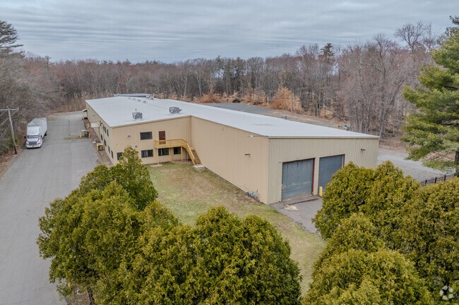
Property Record
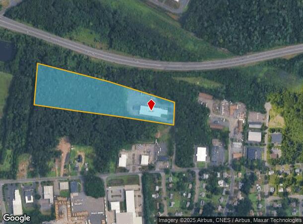
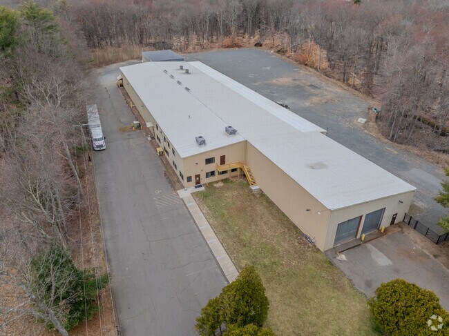
55 Corneau Way, South Windsor, CT 06074
NEARBY LISTINGS FOR SALE OR LEASE
Property Detail
55 Corneau Way
Industrialgeneral
Hartford
X
Connecticut
09003C0386F
14.50 AC
2024
South Windsor
2025
Hartford
487500
Hartford-West Hartford-East Hartford, CT
31,404 SF
SWIN-000006-000000-000007
DEMOGRAPHICS near 55 Corneau Way
1 Mile
3 Mile
5 Mile
2024 Total Population
3,700
44,027
174,174
2029 Population
3,676
43,895
173,788
Pop Growth 2024-2029
(0.65%)
(0.30%)
(0.22%)
Average Age
43
39
39
2024 Total Households
1,355
17,501
70,830
HH Growth 2024-2029
(0.74%)
(0.29%)
(0.13%)
Median Household Inc
$103,178
$68,026
$65,368
Avg Household Size
2.70
2.50
2.40
2024 Avg HH Vehicles
2.00
2.00
1.00
Median Home Value
$238,812
$211,676
$209,122
Median Year Built
1966
1966
1963
Nearby Places
Map Layers
Map Styles
 Street
 Aerial
- Restaurants
- Banks
- Shops
- Fitness
- Groceries
PUBLIC TRANSPORTATION
COMMUTER RAIL
DRIVE
WALK
Distance
10 min
5.5 mi
DRIVE
WALK
Distance
13 min
5.6 mi
AIRPORT
Bradley International
DRIVE
WALK
Distance
Bradley International
33 min
17.4 mi
Freight Ports
Port of New Haven
DRIVE
WALK
Distance
Port of New Haven
57 min
42.7 mi
SALE & LEASE HISTORY
LISTING DATE
SALE/LEASE

Sep 25, 2016
For Lease
Jun 20, 2023
For Sale
Jun 20, 2023
For Lease
Jul 18, 2022
For Lease
Feb 07, 2017
For Sale
Nearby Properties
Address
Land Use
TOTAL SIZE
Lot Size
Zoning
Address
Land Use
TOTAL SIZE
Lot Size
Zoning
2,500 SF
74.98 AC
I-2
Address
Land Use
TOTAL SIZE
Lot Size
Zoning
194,971 SF
162.43 AC
IND
Address
Land Use
TOTAL SIZE
Lot Size
Zoning
36.69 AC
R-5
Address
Land Use
TOTAL SIZE
Lot Size
Zoning
20,384 SF
40 AC
PRD
Address
Land Use
TOTAL SIZE
Lot Size
Zoning
10.74 AC
ID-1
Address
Land Use
TOTAL SIZE
Lot Size
Zoning
238.11 AC
GD
Address
Land Use
TOTAL SIZE
Lot Size
Zoning
58,778 SF
9.26 AC
R-4
Address
Land Use
TOTAL SIZE
Lot Size
Zoning
10.59 AC
GD
Address
Land Use
TOTAL SIZE
Lot Size
Zoning
175,936 SF
18.28 AC
GD
Address
Land Use
TOTAL SIZE
Lot Size
Zoning
26.65 AC
GB
Address
Land Use
TOTAL SIZE
Lot Size
Zoning
421,152 SF
45.95 AC
CD
Address
Land Use
TOTAL SIZE
Lot Size
Zoning
356,062 SF
23.10 AC
ID-2
Address
Land Use
TOTAL SIZE
Lot Size
Zoning
35.05 AC
FP
Address
Land Use
TOTAL SIZE
Lot Size
Zoning
29.90 AC
PRD
Address
Land Use
TOTAL SIZE
Lot Size
Zoning
38.80 AC
R-3
Address
Land Use
TOTAL SIZE
Lot Size
Zoning
498,105 SF
29.55 AC
IND
Address
Land Use
TOTAL SIZE
Lot Size
Zoning
101,317 SF
24.91 AC
RR
Address
Land Use
TOTAL SIZE
Lot Size
Zoning
209,744 SF
25.67 AC
CD
Address
Land Use
TOTAL SIZE
Lot Size
Zoning
259,600 SF
25.58 AC
CD
Address
Land Use
TOTAL SIZE
Lot Size
Zoning
122.44 AC
OS
Address
Land Use
TOTAL SIZE
Lot Size
Zoning
111,800 SF
5.80 AC
GD
Address
Land Use
TOTAL SIZE
Lot Size
Zoning
182,628 SF
15.94 AC
CD
Address
Land Use
TOTAL SIZE
Lot Size
Zoning
156,929 SF
43 AC
GD
Address
Land Use
TOTAL SIZE
Lot Size
Zoning
19.60 AC
GB
Address
Land Use
TOTAL SIZE
Lot Size
Zoning
416,640 SF
30 AC
I
Address
Land Use
TOTAL SIZE
Lot Size
Zoning
36 AC
RR
Address
Land Use
TOTAL SIZE
Lot Size
Zoning
424,627 SF
26 AC
ID-1
Address
Land Use
TOTAL SIZE
Lot Size
Zoning
13,056 SF
17.43 AC
RB
Address
Land Use
TOTAL SIZE
Lot Size
Zoning
76,768 SF
6.03 AC
R-2
Address
Land Use
TOTAL SIZE
Lot Size
Zoning
62,487 SF
14.35 AC
CD
The World's #1 Commercial Real Estate Marketplace
Connect with us
© 2025 CoStar Group
The information above has been obtained from sources believed reliable. While we do not doubt its accuracy we have not verified it and make no guarantee, warranty or representation about it. It is your responsibility to independently confirm its accuracy and completeness. Any projections, opinions, assumptions, or estimates used are for example only and do not represent the current or future performance of the property. The value of this transaction to you depends on tax and other factors which should be evaluated by your tax, financial, and legal advisors. You and your advisors should conduct a careful, independent investigation of the property to determine to your satisfaction the suitability of the property for your needs.