Property Record
550 Roe Center Ct, Travelers Rest, SC 29690
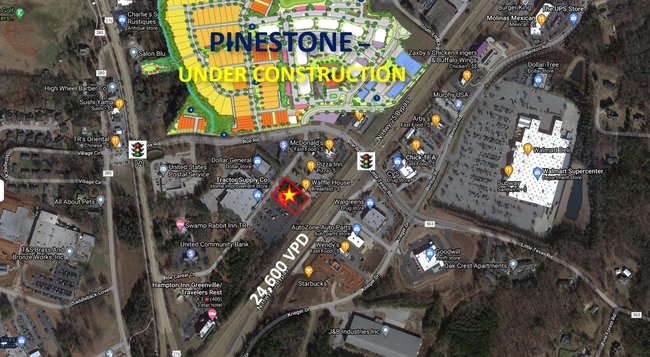


NEARBY LISTINGS FOR SALE OR LEASE
Property Detail
550 Roe Center Ct
Greenville-Anderson-Greer, SC
MAP 0485.00; 6
0485.00-01-013.13
Greenville
Stripcommercialcenter
South Carolina
X
013.13
45045C0304E
7.27 AC
2025
Travelers Rest
2024
Greenville/Spartanburg
003906
DEMOGRAPHICS near 550 Roe Center Ct
1 Mile
3 Mile
5 Mile
2024 Total Population
3,667
18,675
48,348
2029 Population
4,066
20,515
53,226
Pop Growth 2024-2029
+ 10.88%
+ 9.85%
+ 10.09%
Average Age
39
40
40
2024 Total Households
1,440
6,624
18,896
HH Growth 2024-2029
+ 11.04%
+ 10.61%
+ 10.41%
Median Household Inc
$38,033
$64,598
$59,496
Avg Household Size
2.50
2.40
2.40
2024 Avg HH Vehicles
2.00
2.00
2.00
Median Home Value
$260,774
$280,371
$243,419
Median Year Built
1994
1994
1989
Nearby Places
Map Layers
Map Styles
 Street
 Aerial
- Restaurants
- Banks
- Shops
- Fitness
- Groceries
PUBLIC TRANSPORTATION
COMMUTER RAIL
Greenville Amtrak Station (Crescent - Amtrak)
DRIVE
WALK
Distance
Greenville Amtrak Station (Crescent - Amtrak)
14 min
8.0 mi
AIRPORT
Greenville Spartanburg International
DRIVE
WALK
Distance
Greenville Spartanburg International
36 min
21.4 mi
Freight Ports
North Charleston Terminal
DRIVE
WALK
Distance
North Charleston Terminal
243 min
212.0 mi
SALE & LEASE HISTORY
LISTING DATE
SALE/LEASE

Sep 24, 2016
For Sale
Nearby Properties
Address
Land Use
TOTAL SIZE
Lot Size
Zoning
Address
Land Use
TOTAL SIZE
Lot Size
Zoning
703.30 AC
RS
Address
Land Use
TOTAL SIZE
Lot Size
Zoning
10.17 AC
RM
Address
Land Use
TOTAL SIZE
Lot Size
Zoning
3.93 AC
R10
Address
Land Use
TOTAL SIZE
Lot Size
Zoning
19.25 AC
R15
Address
Land Use
TOTAL SIZE
Lot Size
Zoning
14.40 AC
I1
Address
Land Use
TOTAL SIZE
Lot Size
Zoning
7.56 AC
C2
Address
Land Use
TOTAL SIZE
Lot Size
Zoning
Address
Land Use
TOTAL SIZE
Lot Size
Zoning
Address
Land Use
TOTAL SIZE
Lot Size
Zoning
37 AC
S1
Address
Land Use
TOTAL SIZE
Lot Size
Zoning
149.88 AC
ESDPM
Address
Land Use
TOTAL SIZE
Lot Size
Zoning
159 AC
UNZONED
Address
Land Use
TOTAL SIZE
Lot Size
Zoning
6.22 AC
I1
Address
Land Use
TOTAL SIZE
Lot Size
Zoning
55.70 AC
UNZONED
Address
Land Use
TOTAL SIZE
Lot Size
Zoning
4.97 AC
C2
Address
Land Use
TOTAL SIZE
Lot Size
Zoning
9.60 AC
I1
Address
Land Use
TOTAL SIZE
Lot Size
Zoning
1,491 SF
27.82 AC
R15
Address
Land Use
TOTAL SIZE
Lot Size
Zoning
11.56 AC
I1
Address
Land Use
TOTAL SIZE
Lot Size
Zoning
34.67 AC
I1
Address
Land Use
TOTAL SIZE
Lot Size
Zoning
24.45 AC
I1
Address
Land Use
TOTAL SIZE
Lot Size
Zoning
63.70 AC
RS
Address
Land Use
TOTAL SIZE
Lot Size
Zoning
58.29 AC
PD
Address
Land Use
TOTAL SIZE
Lot Size
Zoning
2.58 AC
PDR
Address
Land Use
TOTAL SIZE
Lot Size
Zoning
273.14 AC
ESDPM
Address
Land Use
TOTAL SIZE
Lot Size
Zoning
15.31 AC
UNZONED
Address
Land Use
TOTAL SIZE
Lot Size
Zoning
4.40 AC
I1
Address
Land Use
TOTAL SIZE
Lot Size
Zoning
58.70 AC
R75
Address
Land Use
TOTAL SIZE
Lot Size
Zoning
19.10 AC
NZ
Address
Land Use
TOTAL SIZE
Lot Size
Zoning
30.60 AC
I1
Address
Land Use
TOTAL SIZE
Lot Size
Zoning
19.60 AC
NZ
Address
Land Use
TOTAL SIZE
Lot Size
Zoning
19.96 AC
PD
The World's #1 Commercial Real Estate Marketplace
Connect with us
© 2026 CoStar Group
The information above has been obtained from sources believed reliable. While we do not doubt its accuracy we have not verified it and make no guarantee, warranty or representation about it. It is your responsibility to independently confirm its accuracy and completeness. Any projections, opinions, assumptions, or estimates used are for example only and do not represent the current or future performance of the property. The value of this transaction to you depends on tax and other factors which should be evaluated by your tax, financial, and legal advisors. You and your advisors should conduct a careful, independent investigation of the property to determine to your satisfaction the suitability of the property for your needs.