Property Record
5502 S 7Th St, Abilene, TX 79605
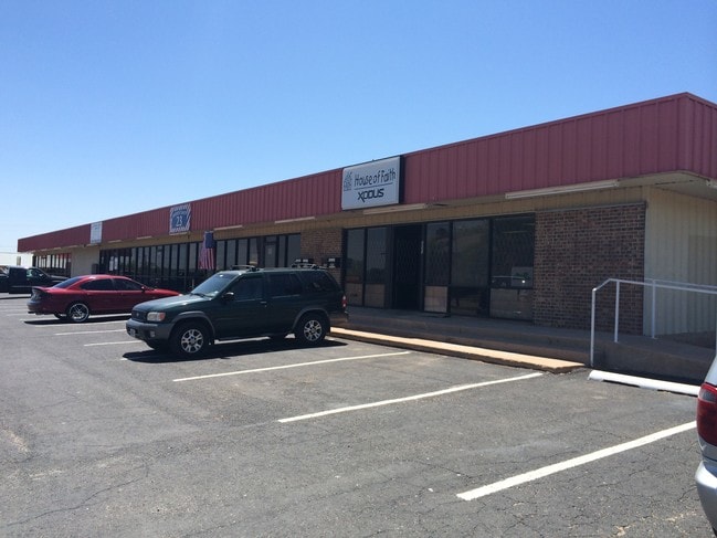

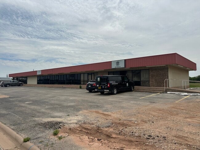
Property Detail
5502 S 7Th St
27610
DEL MAR, BLOCK 5
Multipleuses
Taylor
AE The base floodplain where base flood elevations are provided. AE Zones are now used on new format FIRMs instead of A1-A30 Zones.
Texas
2024
0.80 AC
2025
Abilene
013100
Other Market Areas
8,000 SF
Abilene, TX
NEARBY LISTINGS FOR SALE OR LEASE
DEMOGRAPHICS near 5502 S 7Th St
1 mile
3 mile
5 mile
2024 Total Population
6,795
53,024
92,664
2029 Population
7,053
55,269
96,377
Pop Growth 2024-2029
+ 3.80%
+ 4.23%
+ 4.01%
Average Age
35
36
37
2024 Total Households
2,656
20,456
35,836
HH Growth 2024-2029
+ 3.95%
+ 4.43%
+ 4.16%
Median Household Inc
$51,950
$58,017
$56,814
Avg Household Size
2.40
2.50
2.40
2024 Avg HH Vehicles
2.00
2.00
2.00
Median Home Value
$98,462
$165,506
$157,947
Median Year Built
1967
1965
1967
Nearby Places
Map Layers
Map Styles
 Street
 Aerial
Transit
 Traffic
 Biking
Places
Listings with unknown addresses are not visible on the map
- Restaurants
- Banks
- Shops
- Fitness
- Groceries
PUBLIC TRANSPORTATION
AIRPORT
Abilene Regional
Drive
Walk
Distance
Abilene Regional
17 min
8.8 mi
Freight Ports
Calhoun Port
Drive
Walk
Distance
Calhoun Port
436 min
375.5 mi
SALE & LEASE HISTORY
LISTING DATE
SALE/LEASE

Sep 23, 2016
For Sale
Dec 18, 2019
For Lease
Nearby Properties
Address
Land Use
TOTAL SIZE
Lot Size
Zoning
Address
Land Use
TOTAL SIZE
Lot Size
Zoning
227.42 AC
Address
Land Use
TOTAL SIZE
Lot Size
Zoning
600,001 SF
39.40 AC
Address
Land Use
TOTAL SIZE
Lot Size
Zoning
183,321 SF
11.67 AC
Address
Land Use
TOTAL SIZE
Lot Size
Zoning
117,207 SF
17.41 AC
Address
Land Use
TOTAL SIZE
Lot Size
Zoning
162,480 SF
9.88 AC
Address
Land Use
TOTAL SIZE
Lot Size
Zoning
95,893 SF
15.89 AC
Address
Land Use
TOTAL SIZE
Lot Size
Zoning
143,845 SF
11.47 AC
Address
Land Use
TOTAL SIZE
Lot Size
Zoning
166,901 SF
14.71 AC
Address
Land Use
TOTAL SIZE
Lot Size
Zoning
342,750 SF
34.54 AC
Address
Land Use
TOTAL SIZE
Lot Size
Zoning
176,378 SF
36.99 AC
Address
Land Use
TOTAL SIZE
Lot Size
Zoning
73,947 SF
9.89 AC
Address
Land Use
TOTAL SIZE
Lot Size
Zoning
161,050 SF
12.18 AC
Address
Land Use
TOTAL SIZE
Lot Size
Zoning
155,780 SF
18.80 AC
Address
Land Use
TOTAL SIZE
Lot Size
Zoning
121,816 SF
3.06 AC
Address
Land Use
TOTAL SIZE
Lot Size
Zoning
9.55 AC
Address
Land Use
TOTAL SIZE
Lot Size
Zoning
150,552 SF
9.72 AC
Address
Land Use
TOTAL SIZE
Lot Size
Zoning
210,556 SF
24.67 AC
Address
Land Use
TOTAL SIZE
Lot Size
Zoning
78,522 SF
41.23 AC
Address
Land Use
TOTAL SIZE
Lot Size
Zoning
140,297 SF
7.99 AC
Address
Land Use
TOTAL SIZE
Lot Size
Zoning
143,931 SF
13.21 AC
Address
Land Use
TOTAL SIZE
Lot Size
Zoning
104,728 SF
17.56 AC
Address
Land Use
TOTAL SIZE
Lot Size
Zoning
115,042 SF
7.68 AC
Address
Land Use
TOTAL SIZE
Lot Size
Zoning
115,808 SF
5.21 AC
Address
Land Use
TOTAL SIZE
Lot Size
Zoning
241,784 SF
24.28 AC
Address
Land Use
TOTAL SIZE
Lot Size
Zoning
177,960 SF
8.56 AC
Address
Land Use
TOTAL SIZE
Lot Size
Zoning
38,955 SF
6.64 AC
Address
Land Use
TOTAL SIZE
Lot Size
Zoning
114,420 SF
6.90 AC
Address
Land Use
TOTAL SIZE
Lot Size
Zoning
117,126 SF
7.22 AC
Address
Land Use
TOTAL SIZE
Lot Size
Zoning
162,536 SF
10.79 AC
Address
Land Use
TOTAL SIZE
Lot Size
Zoning
120,789 SF
2.41 AC
The World's #1 Commercial Real Estate Marketplace
Connect with us
© 2026 CoStar Group
The information above has been obtained from sources believed reliable. While we do not doubt its accuracy we have not verified it and make no guarantee, warranty or representation about it. It is your responsibility to independently confirm its accuracy and completeness. Any projections, opinions, assumptions, or estimates used are for example only and do not represent the current or future performance of the property. The value of this transaction to you depends on tax and other factors which should be evaluated by your tax, financial, and legal advisors. You and your advisors should conduct a careful, independent investigation of the property to determine to your satisfaction the suitability of the property for your needs.