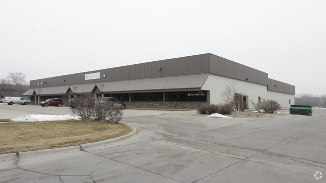
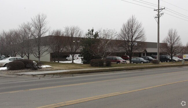
Property Record
5503 F St, Omaha, NE 68117

NEARBY LISTINGS FOR SALE OR LEASE
Property Detail
5503 F St
Omaha, NE-IA
Spring Valley Industrial Park
4310-2659-22
SPRING VALLEY INDUSTRIAL PARK LOT 7 BLOCK 0 -EX E 140.71 FT-LOT 6 & ALL LOT
Industrialgeneral
Douglas
X
Nebraska
31153C0060G
7,6
2024
2.76 AC
2025
South Central Omaha
007003
Omaha/Council Bluffs
29,875 SF
DEMOGRAPHICS near 5503 F St
1 Mile
3 Mile
5 Mile
2024 Total Population
8,536
102,518
284,834
2029 Population
8,594
104,326
292,561
Pop Growth 2024-2029
+ 0.68%
+ 1.76%
+ 2.71%
Average Age
39
37
37
2024 Total Households
3,439
41,222
116,172
HH Growth 2024-2029
+ 0.70%
+ 1.87%
+ 2.81%
Median Household Inc
$58,981
$57,890
$59,736
Avg Household Size
2.40
2.40
2.30
2024 Avg HH Vehicles
2.00
2.00
2.00
Median Home Value
$152,166
$170,376
$195,274
Median Year Built
1961
1959
1964
Nearby Places
Map Layers
Map Styles
 Street
 Aerial
- Restaurants
- Banks
- Shops
- Fitness
- Groceries
PUBLIC TRANSPORTATION
COMMUTER RAIL
DRIVE
WALK
Distance
10 min
5.9 mi
DRIVE
WALK
Distance
10 min
6.1 mi
AIRPORT
Eppley Airfield
DRIVE
WALK
Distance
Eppley Airfield
18 min
10.0 mi
SALE & LEASE HISTORY
LISTING DATE
SALE/LEASE

Sep 25, 2016
For Lease
Sep 23, 2016
For Sale
Oct 17, 2016
For Sale
Nearby Properties
Address
Land Use
TOTAL SIZE
Lot Size
Zoning
Address
Land Use
TOTAL SIZE
Lot Size
Zoning
255,351 SF
0.79 AC
Address
Land Use
TOTAL SIZE
Lot Size
Zoning
326,069 SF
4.88 AC
Address
Land Use
TOTAL SIZE
Lot Size
Zoning
370,431 SF
8.57 AC
Address
Land Use
TOTAL SIZE
Lot Size
Zoning
341,667 SF
24.15 AC
Address
Land Use
TOTAL SIZE
Lot Size
Zoning
687,804 SF
23.14 AC
Address
Land Use
TOTAL SIZE
Lot Size
Zoning
387,860 SF
7.20 AC
Address
Land Use
TOTAL SIZE
Lot Size
Zoning
282,688 SF
18.71 AC
Address
Land Use
TOTAL SIZE
Lot Size
Zoning
389,488 SF
4.30 AC
Address
Land Use
TOTAL SIZE
Lot Size
Zoning
145,190 SF
5.45 AC
Address
Land Use
TOTAL SIZE
Lot Size
Zoning
256,558 SF
7 AC
GI
Address
Land Use
TOTAL SIZE
Lot Size
Zoning
120,078 SF
1.24 AC
MU
Address
Land Use
TOTAL SIZE
Lot Size
Zoning
114,936 SF
1.93 AC
Address
Land Use
TOTAL SIZE
Lot Size
Zoning
405,820 SF
2.10 AC
Address
Land Use
TOTAL SIZE
Lot Size
Zoning
129,910 SF
0.92 AC
Address
Land Use
TOTAL SIZE
Lot Size
Zoning
646,213 SF
37.22 AC
Address
Land Use
TOTAL SIZE
Lot Size
Zoning
354,615 SF
18.13 AC
R6
Address
Land Use
TOTAL SIZE
Lot Size
Zoning
271,344 SF
9.78 AC
Address
Land Use
TOTAL SIZE
Lot Size
Zoning
112,933 SF
1.23 AC
MU
Address
Land Use
TOTAL SIZE
Lot Size
Zoning
97,617 SF
49.05 AC
Address
Land Use
TOTAL SIZE
Lot Size
Zoning
249,902 SF
13.02 AC
CC
Address
Land Use
TOTAL SIZE
Lot Size
Zoning
407,410 SF
4.03 AC
Address
Land Use
TOTAL SIZE
Lot Size
Zoning
199,734 SF
3.10 AC
Address
Land Use
TOTAL SIZE
Lot Size
Zoning
215,353 SF
1.77 AC
Address
Land Use
TOTAL SIZE
Lot Size
Zoning
198,375 SF
5.09 AC
GO
Address
Land Use
TOTAL SIZE
Lot Size
Zoning
247,802 SF
0.98 AC
Address
Land Use
TOTAL SIZE
Lot Size
Zoning
199,586 SF
2.93 AC
Address
Land Use
TOTAL SIZE
Lot Size
Zoning
316,432 SF
2.13 AC
Address
Land Use
TOTAL SIZE
Lot Size
Zoning
108,554 SF
4.85 AC
Address
Land Use
TOTAL SIZE
Lot Size
Zoning
173,179 SF
3.05 AC
Address
Land Use
TOTAL SIZE
Lot Size
Zoning
204,275 SF
18.14 AC
The World's #1 Commercial Real Estate Marketplace
Connect with us
© 2026 CoStar Group
The information above has been obtained from sources believed reliable. While we do not doubt its accuracy we have not verified it and make no guarantee, warranty or representation about it. It is your responsibility to independently confirm its accuracy and completeness. Any projections, opinions, assumptions, or estimates used are for example only and do not represent the current or future performance of the property. The value of this transaction to you depends on tax and other factors which should be evaluated by your tax, financial, and legal advisors. You and your advisors should conduct a careful, independent investigation of the property to determine to your satisfaction the suitability of the property for your needs.