Property Record
5505 Rowlett Rd, Rowlett, TX 75089

NEARBY LISTINGS FOR SALE OR LEASE
-
-
-
-
-
-
-
-
-
-
-
No Photo
-
-
-
-
-
-
-
-
-
-
-
-
-
-
-
View all Rowlett listings for lease on LoopNet.com
Property Detail
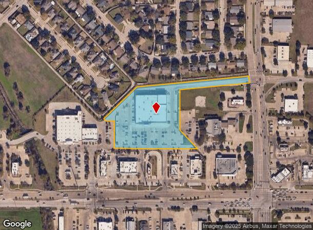
5505 Rowlett Rd
Dallas-Fort Worth-Arlington, TX
Briarwood Armstrong
440620600A0070000
BRIARWOOD ARMSTRONG BLK A LT 7R ACS 4.3369 INT 201500012724 DD01152015 CO-DC 0620600A00700 2CW0620600A
Stripcommercialcenter
Dallas
X
Texas
48113C0240K
7r
2024
4.34 AC
2025
Garland
018156
Dallas/Ft Worth
36,360 SF
DEMOGRAPHICS near 5505 Rowlett Rd
1 Mile
3 Mile
5 Mile
2024 Total Population
9,772
69,973
219,787
2029 Population
9,755
69,453
221,248
Pop Growth 2024-2029
(0.17%)
(0.74%)
+ 0.66%
Average Age
39
39
38
2024 Total Households
3,437
22,844
72,381
HH Growth 2024-2029
(0.29%)
(0.88%)
+ 0.63%
Median Household Inc
$92,318
$89,272
$76,900
Avg Household Size
2.80
3.00
3.00
2024 Avg HH Vehicles
2.00
2.00
2.00
Median Home Value
$259,664
$261,616
$246,725
Median Year Built
1987
1991
1985
Nearby Places
Map Layers
Map Styles
 Street
 Aerial
- Restaurants
- Banks
- Shops
- Fitness
- Groceries
PUBLIC TRANSPORTATION
TRANSIT/SUBWAY
Downtown Rowlett (Blue Line - Dallas Area Rapid Transit (DART))
DRIVE
WALK
Distance
Downtown Rowlett (Blue Line - Dallas Area Rapid Transit (DART))
3 min
16 min
0.8 mi
AIRPORT
Dallas Love Field
DRIVE
WALK
Distance
Dallas Love Field
39 min
24.6 mi
Dallas-Fort Worth International
DRIVE
WALK
Distance
Dallas-Fort Worth International
47 min
33.5 mi
SALE & LEASE HISTORY
LISTING DATE
SALE/LEASE

Sep 24, 2016
For Sale
Jun 07, 2017
For Lease
Nearby Properties
Address
Land Use
TOTAL SIZE
Lot Size
Zoning
Address
Land Use
TOTAL SIZE
Lot Size
Zoning
231,434 SF
11.27 AC
Z06
Address
Land Use
TOTAL SIZE
Lot Size
Zoning
250,602 SF
4.99 AC
Z01
Address
Land Use
TOTAL SIZE
Lot Size
Zoning
261,164 SF
32.58 AC
Address
Land Use
TOTAL SIZE
Lot Size
Zoning
260,782 SF
16.30 AC
Z77
Address
Land Use
TOTAL SIZE
Lot Size
Zoning
228,458 SF
5.56 AC
Z236
Address
Land Use
TOTAL SIZE
Lot Size
Zoning
427,231 SF
9.96 AC
Z38
Address
Land Use
TOTAL SIZE
Lot Size
Zoning
313,217 SF
3.61 AC
Z205
Address
Land Use
TOTAL SIZE
Lot Size
Zoning
65,595 SF
19.22 AC
Z239
Address
Land Use
TOTAL SIZE
Lot Size
Zoning
259,280 SF
5.15 AC
Z01
Address
Land Use
TOTAL SIZE
Lot Size
Zoning
178,125 SF
10.50 AC
Z77
Address
Land Use
TOTAL SIZE
Lot Size
Zoning
77,102 SF
27.47 AC
Z144
Address
Land Use
TOTAL SIZE
Lot Size
Zoning
60,593 SF
35.93 AC
Z06
Address
Land Use
TOTAL SIZE
Lot Size
Zoning
0.12 AC
Z63
Address
Land Use
TOTAL SIZE
Lot Size
Zoning
43,600 SF
62.86 AC
Z306
Address
Land Use
TOTAL SIZE
Lot Size
Zoning
420,500 SF
33.25 AC
Address
Land Use
TOTAL SIZE
Lot Size
Zoning
261,000 SF
1 AC
Z318
Address
Land Use
TOTAL SIZE
Lot Size
Zoning
271,051 SF
10.28 AC
Z01
Address
Land Use
TOTAL SIZE
Lot Size
Zoning
145,203 SF
12.86 AC
Z239
Address
Land Use
TOTAL SIZE
Lot Size
Zoning
76,812 SF
9.22 AC
Z144
Address
Land Use
TOTAL SIZE
Lot Size
Zoning
226,800 SF
4.98 AC
Z340
Address
Land Use
TOTAL SIZE
Lot Size
Zoning
82,847 SF
4.87 AC
Z236
Address
Land Use
TOTAL SIZE
Lot Size
Zoning
78,017 SF
1.75 AC
Z236
Address
Land Use
TOTAL SIZE
Lot Size
Zoning
140,000 SF
12.76 AC
Address
Land Use
TOTAL SIZE
Lot Size
Zoning
141,200 SF
10.81 AC
Address
Land Use
TOTAL SIZE
Lot Size
Zoning
150,926 SF
9.33 AC
Address
Land Use
TOTAL SIZE
Lot Size
Zoning
52,797 SF
5.41 AC
Z92
Address
Land Use
TOTAL SIZE
Lot Size
Zoning
147.23 AC
Z114
Address
Land Use
TOTAL SIZE
Lot Size
Zoning
0.02 AC
Z236
Address
Land Use
TOTAL SIZE
Lot Size
Zoning
203,983 SF
31.19 AC
Z92
Address
Land Use
TOTAL SIZE
Lot Size
Zoning
61,782 SF
2.50 AC
Z01
The World's #1 Commercial Real Estate Marketplace
Connect with us
© 2026 CoStar Group
The information above has been obtained from sources believed reliable. While we do not doubt its accuracy we have not verified it and make no guarantee, warranty or representation about it. It is your responsibility to independently confirm its accuracy and completeness. Any projections, opinions, assumptions, or estimates used are for example only and do not represent the current or future performance of the property. The value of this transaction to you depends on tax and other factors which should be evaluated by your tax, financial, and legal advisors. You and your advisors should conduct a careful, independent investigation of the property to determine to your satisfaction the suitability of the property for your needs.