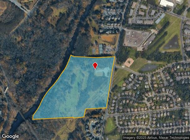
Property Record
551 Milltown Rd, Bridgewater, NJ 08807

NEARBY LISTINGS FOR SALE OR LEASE
Property Detail
551 Milltown Rd
Lakewood-New Brunswick, NJ
FACILITY NAME: OPEN SPACE
06-00168-0000-00018
Somerset
Governmentalpublicusegeneral
New Jersey
AE
18
34035C0133E
28.80 AC
0
Route 22 West
2025
Northern New Jersey
050704
DEMOGRAPHICS near 551 Milltown Rd
1 Mile
3 Mile
5 Mile
2024 Total Population
8,385
40,164
84,875
2029 Population
8,431
40,314
85,388
Pop Growth 2024-2029
+ 0.55%
+ 0.37%
+ 0.60%
Average Age
41
42
42
2024 Total Households
3,014
14,634
32,282
HH Growth 2024-2029
+ 0.43%
+ 0.33%
+ 0.63%
Median Household Inc
$164,846
$138,791
$129,599
Avg Household Size
2.70
2.70
2.60
2024 Avg HH Vehicles
2.00
2.00
2.00
Median Home Value
$525,291
$488,193
$473,258
Median Year Built
1991
1984
1981
Nearby Places
Map Layers
Map Styles
 Street
 Aerial
- Restaurants
- Banks
- Shops
- Fitness
- Groceries
PUBLIC TRANSPORTATION
COMMUTER RAIL
North Branch (Raritan Valley Line - NJ Transit Commuter Rail (NJ Transit))
DRIVE
WALK
Distance
North Branch (Raritan Valley Line - NJ Transit Commuter Rail (NJ Transit))
4 min
1.5 mi
Raritan (Raritan Valley Line - NJ Transit Commuter Rail (NJ Transit))
DRIVE
WALK
Distance
Raritan (Raritan Valley Line - NJ Transit Commuter Rail (NJ Transit))
7 min
3.4 mi
AIRPORT
Trenton Mercer
DRIVE
WALK
Distance
Trenton Mercer
52 min
31.9 mi
Newark Liberty International
DRIVE
WALK
Distance
Newark Liberty International
46 min
37.0 mi
Freight Ports
New York Container Terminal
DRIVE
WALK
Distance
New York Container Terminal
46 min
35.8 mi
Nearby Properties
Address
Land Use
TOTAL SIZE
Lot Size
Zoning
Address
Land Use
TOTAL SIZE
Lot Size
Zoning
63.86 AC
I2
Address
Land Use
TOTAL SIZE
Lot Size
Zoning
108.74 AC
OM-3
Address
Land Use
TOTAL SIZE
Lot Size
Zoning
236.88 AC
CF
Address
Land Use
TOTAL SIZE
Lot Size
Zoning
47.50 AC
M1
Address
Land Use
TOTAL SIZE
Lot Size
Zoning
4,397 SF
26.86 AC
I-1
Address
Land Use
TOTAL SIZE
Lot Size
Zoning
28.76 AC
I-IP
Address
Land Use
TOTAL SIZE
Lot Size
Zoning
54.31 AC
P-2
Address
Land Use
TOTAL SIZE
Lot Size
Zoning
25.70 AC
PACD
Address
Land Use
TOTAL SIZE
Lot Size
Zoning
81.89 AC
M1
Address
Land Use
TOTAL SIZE
Lot Size
Zoning
66.08 AC
M3
Address
Land Use
TOTAL SIZE
Lot Size
Zoning
34.80 AC
OM-3
Address
Land Use
TOTAL SIZE
Lot Size
Zoning
19.34 AC
M1
Address
Land Use
TOTAL SIZE
Lot Size
Zoning
19.36 AC
M1
Address
Land Use
TOTAL SIZE
Lot Size
Zoning
33.16 AC
M3
Address
Land Use
TOTAL SIZE
Lot Size
Zoning
10.31 AC
PDRD
Address
Land Use
TOTAL SIZE
Lot Size
Zoning
8.26 AC
R40
Address
Land Use
TOTAL SIZE
Lot Size
Zoning
1,056 SF
0.07 AC
Address
Land Use
TOTAL SIZE
Lot Size
Zoning
34.26 AC
Address
Land Use
TOTAL SIZE
Lot Size
Zoning
12.53 AC
M1
Address
Land Use
TOTAL SIZE
Lot Size
Zoning
18.99 AC
M1
Address
Land Use
TOTAL SIZE
Lot Size
Zoning
28.44 AC
C2
Address
Land Use
TOTAL SIZE
Lot Size
Zoning
25 SF
10.43 AC
M2
Address
Land Use
TOTAL SIZE
Lot Size
Zoning
19.96 AC
GCM
Address
Land Use
TOTAL SIZE
Lot Size
Zoning
18.46 AC
I
Address
Land Use
TOTAL SIZE
Lot Size
Zoning
10.33 AC
I-2
Address
Land Use
TOTAL SIZE
Lot Size
Zoning
20 AC
I-1
Address
Land Use
TOTAL SIZE
Lot Size
Zoning
19.22 AC
AH-3
Address
Land Use
TOTAL SIZE
Lot Size
Zoning
12.58 AC
I-2
Address
Land Use
TOTAL SIZE
Lot Size
Zoning
10.43 AC
Address
Land Use
TOTAL SIZE
Lot Size
Zoning
2.52 AC
The World's #1 Commercial Real Estate Marketplace
Connect with us
© 2026 CoStar Group
The information above has been obtained from sources believed reliable. While we do not doubt its accuracy we have not verified it and make no guarantee, warranty or representation about it. It is your responsibility to independently confirm its accuracy and completeness. Any projections, opinions, assumptions, or estimates used are for example only and do not represent the current or future performance of the property. The value of this transaction to you depends on tax and other factors which should be evaluated by your tax, financial, and legal advisors. You and your advisors should conduct a careful, independent investigation of the property to determine to your satisfaction the suitability of the property for your needs.