Property Record
5510 W Highway 290, Austin, TX 78735


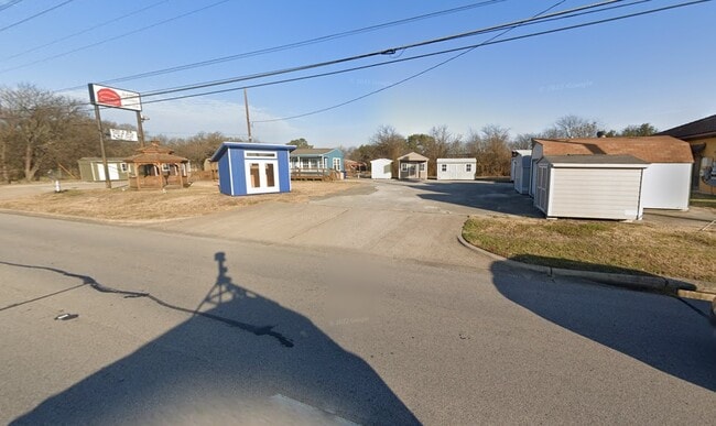
This Property Is For Sale
NEARBY LISTINGS FOR SALE OR LEASE
Property Detail
5510 W Highway 290
553374
Anderson T
Commercialbuilding
ABS 2 SUR 17 ANDERSON T ACR .555
X
Travis
48453C0580H
Texas
2025
0.56 AC
2025
Southwest
001915
Austin
345 SF
Austin-Round Rock-San Marcos, TX
DEMOGRAPHICS near 5510 W Highway 290
1 mile
3 mile
5 mile
2024 Total Population
8,290
69,991
207,364
2029 Population
8,865
75,135
223,740
Pop Growth 2024-2029
+ 6.94%
+ 7.35%
+ 7.90%
Average Age
38
39
39
2024 Total Households
3,846
31,112
91,187
HH Growth 2024-2029
+ 7.62%
+ 8.13%
+ 8.70%
Median Household Inc
$95,933
$99,255
$96,635
Avg Household Size
2.10
2.20
2.20
2024 Avg HH Vehicles
2.00
2.00
2.00
Median Home Value
$629,121
$479,018
$519,173
Median Year Built
1994
1993
1992
Nearby Places
Map Layers
Map Styles
 Street
 Aerial
Transit
 Traffic
 Biking
Places
Listings with unknown addresses are not visible on the map
- Restaurants
- Banks
- Shops
- Fitness
- Groceries
PUBLIC TRANSPORTATION
COMMUTER RAIL
Drive
Walk
Distance
13 min
7.9 mi
AIRPORT
Austin-Bergstrom International
Drive
Walk
Distance
Austin-Bergstrom International
28 min
14.9 mi
Nearby Properties
Address
Land Use
TOTAL SIZE
Lot Size
Zoning
Address
Land Use
TOTAL SIZE
Lot Size
Zoning
632.50 AC
Address
Land Use
TOTAL SIZE
Lot Size
Zoning
Address
Land Use
TOTAL SIZE
Lot Size
Zoning
881,940 SF
80.11 AC
Address
Land Use
TOTAL SIZE
Lot Size
Zoning
881,498 SF
58.79 AC
Address
Land Use
TOTAL SIZE
Lot Size
Zoning
617,120 SF
53.40 AC
Address
Land Use
TOTAL SIZE
Lot Size
Zoning
551,881 SF
34.85 AC
Address
Land Use
TOTAL SIZE
Lot Size
Zoning
456,600 SF
44.89 AC
Address
Land Use
TOTAL SIZE
Lot Size
Zoning
474,907 SF
36.94 AC
Address
Land Use
TOTAL SIZE
Lot Size
Zoning
422,810 SF
46.50 AC
Address
Land Use
TOTAL SIZE
Lot Size
Zoning
359,339 SF
23.59 AC
Address
Land Use
TOTAL SIZE
Lot Size
Zoning
398,436 SF
30.81 AC
Address
Land Use
TOTAL SIZE
Lot Size
Zoning
432,404 SF
37.29 AC
Address
Land Use
TOTAL SIZE
Lot Size
Zoning
392,093 SF
24.02 AC
Address
Land Use
TOTAL SIZE
Lot Size
Zoning
267,224 SF
56.90 AC
Address
Land Use
TOTAL SIZE
Lot Size
Zoning
401,771 SF
59.77 AC
Address
Land Use
TOTAL SIZE
Lot Size
Zoning
324,860 SF
8.36 AC
Address
Land Use
TOTAL SIZE
Lot Size
Zoning
400,301 SF
22.65 AC
Address
Land Use
TOTAL SIZE
Lot Size
Zoning
425,720 SF
28.49 AC
Address
Land Use
TOTAL SIZE
Lot Size
Zoning
404,812 SF
31.32 AC
Address
Land Use
TOTAL SIZE
Lot Size
Zoning
286,988 SF
27.73 AC
Address
Land Use
TOTAL SIZE
Lot Size
Zoning
290,107 SF
18.62 AC
Address
Land Use
TOTAL SIZE
Lot Size
Zoning
258,600 SF
36.81 AC
Address
Land Use
TOTAL SIZE
Lot Size
Zoning
324,135 SF
53.12 AC
Address
Land Use
TOTAL SIZE
Lot Size
Zoning
399,828 SF
50.10 AC
Address
Land Use
TOTAL SIZE
Lot Size
Zoning
233,943 SF
39.66 AC
Address
Land Use
TOTAL SIZE
Lot Size
Zoning
327,886 SF
23.91 AC
Address
Land Use
TOTAL SIZE
Lot Size
Zoning
267,928 SF
18.13 AC
Address
Land Use
TOTAL SIZE
Lot Size
Zoning
253,902 SF
28.21 AC
Address
Land Use
TOTAL SIZE
Lot Size
Zoning
345,632 SF
25.21 AC
Address
Land Use
TOTAL SIZE
Lot Size
Zoning
220,688 SF
21.85 AC
The World's #1 Commercial Real Estate Marketplace
Connect with us
© 2026 CoStar Group
The information above has been obtained from sources believed reliable. While we do not doubt its accuracy we have not verified it and make no guarantee, warranty or representation about it. It is your responsibility to independently confirm its accuracy and completeness. Any projections, opinions, assumptions, or estimates used are for example only and do not represent the current or future performance of the property. The value of this transaction to you depends on tax and other factors which should be evaluated by your tax, financial, and legal advisors. You and your advisors should conduct a careful, independent investigation of the property to determine to your satisfaction the suitability of the property for your needs.