Property Record
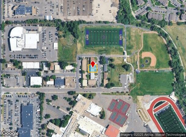
5547 S Grant St, Littleton, CO 80121
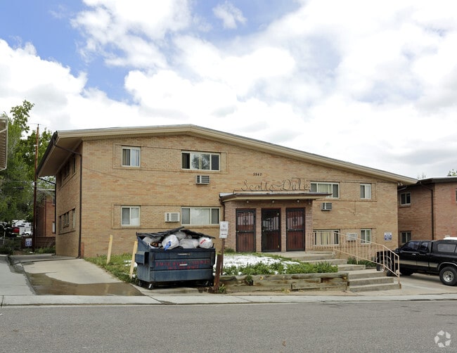
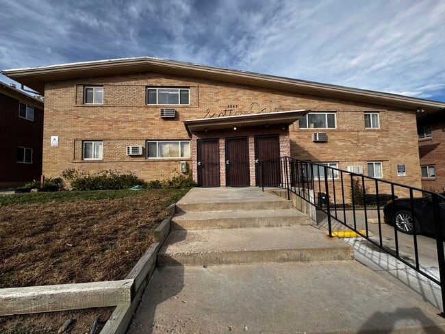
This Property Is For Sale
NEARBY LISTINGS FOR SALE OR LEASE
Property Detail
5547 S Grant St
Denver-Aurora-Lakewood, CO
Drobnick-Tucker Sub
2077-15-4-04-006
SUBDIVISIONCD 020750 SUBDIVISIONNAME DROBNICK-TUCKER SUB BLOCK 001 LOT 007 LOT 7 BLK 1 DROBNICK-TUCKER SUB
Apartment
Arapahoe
X
Colorado
08005C0451M
007,7
2023
0.15 AC
2024
Littleton
005612
Denver
4,094 SF
DEMOGRAPHICS near 5547 S Grant St
1 Mile
3 Mile
5 Mile
2024 Total Population
14,844
97,277
288,590
2029 Population
15,066
97,638
293,404
Pop Growth 2024-2029
+ 1.50%
+ 0.37%
+ 1.67%
Average Age
39
42
41
2024 Total Households
6,429
42,109
122,193
HH Growth 2024-2029
+ 1.71%
+ 0.44%
+ 1.81%
Median Household Inc
$63,216
$86,871
$96,240
Avg Household Size
2.20
2.20
2.30
2024 Avg HH Vehicles
2.00
2.00
2.00
Median Home Value
$557,917
$584,846
$636,545
Median Year Built
1968
1972
1977
Nearby Places
Map Layers
Map Styles
 Street
 Aerial
- Restaurants
- Banks
- Shops
- Fitness
- Groceries
PUBLIC TRANSPORTATION
AIRPORT
Denver International
DRIVE
WALK
Distance
Denver International
42 min
31.5 mi
Freight Ports
Tulsa Port Of Catoosa
DRIVE
WALK
Distance
Tulsa Port Of Catoosa
739 min
714.2 mi
Nearby Properties
Address
Land Use
TOTAL SIZE
Lot Size
Zoning
Address
Land Use
TOTAL SIZE
Lot Size
Zoning
390,078 SF
38.27 AC
Address
Land Use
TOTAL SIZE
Lot Size
Zoning
214,192 SF
0.03 AC
Address
Land Use
TOTAL SIZE
Lot Size
Zoning
251,583 SF
38.03 AC
Address
Land Use
TOTAL SIZE
Lot Size
Zoning
167,287 SF
13.65 AC
Address
Land Use
TOTAL SIZE
Lot Size
Zoning
458,000 SF
5.85 AC
Address
Land Use
TOTAL SIZE
Lot Size
Zoning
177,772 SF
16 AC
Address
Land Use
TOTAL SIZE
Lot Size
Zoning
139,858 SF
2.36 AC
Address
Land Use
TOTAL SIZE
Lot Size
Zoning
163,695 SF
22.90 AC
Address
Land Use
TOTAL SIZE
Lot Size
Zoning
572,657 SF
0.21 AC
LPD-C
Address
Land Use
TOTAL SIZE
Lot Size
Zoning
221,025 SF
8.45 AC
PUD
Address
Land Use
TOTAL SIZE
Lot Size
Zoning
192,108 SF
20.03 AC
Address
Land Use
TOTAL SIZE
Lot Size
Zoning
118,881 SF
107.83 AC
Address
Land Use
TOTAL SIZE
Lot Size
Zoning
47.24 AC
Address
Land Use
TOTAL SIZE
Lot Size
Zoning
7,035 SF
12.90 AC
LPD-R
Address
Land Use
TOTAL SIZE
Lot Size
Zoning
110,016 SF
1.29 AC
Address
Land Use
TOTAL SIZE
Lot Size
Zoning
250,402 SF
21 AC
Address
Land Use
TOTAL SIZE
Lot Size
Zoning
206,632 SF
33.68 AC
Address
Land Use
TOTAL SIZE
Lot Size
Zoning
61,607 SF
11.60 AC
LPD-C
Address
Land Use
TOTAL SIZE
Lot Size
Zoning
299,772 SF
14.19 AC
Address
Land Use
TOTAL SIZE
Lot Size
Zoning
39.44 AC
Address
Land Use
TOTAL SIZE
Lot Size
Zoning
157,145 SF
15.70 AC
Address
Land Use
TOTAL SIZE
Lot Size
Zoning
133,594 SF
25.03 AC
Address
Land Use
TOTAL SIZE
Lot Size
Zoning
146,156 SF
4.61 AC
Address
Land Use
TOTAL SIZE
Lot Size
Zoning
248,058 SF
12.24 AC
Address
Land Use
TOTAL SIZE
Lot Size
Zoning
677,688 SF
2.97 AC
Address
Land Use
TOTAL SIZE
Lot Size
Zoning
255,868 SF
35.96 AC
Address
Land Use
TOTAL SIZE
Lot Size
Zoning
146,877 SF
11.52 AC
Address
Land Use
TOTAL SIZE
Lot Size
Zoning
280,912 SF
10.98 AC
Address
Land Use
TOTAL SIZE
Lot Size
Zoning
2.67 AC
EB2
Address
Land Use
TOTAL SIZE
Lot Size
Zoning
195,179 SF
5.54 AC
EI1
The World's #1 Commercial Real Estate Marketplace
Connect with us
© 2025 CoStar Group
The information above has been obtained from sources believed reliable. While we do not doubt its accuracy we have not verified it and make no guarantee, warranty or representation about it. It is your responsibility to independently confirm its accuracy and completeness. Any projections, opinions, assumptions, or estimates used are for example only and do not represent the current or future performance of the property. The value of this transaction to you depends on tax and other factors which should be evaluated by your tax, financial, and legal advisors. You and your advisors should conduct a careful, independent investigation of the property to determine to your satisfaction the suitability of the property for your needs.