Property Record
555 Highway 40 W, Inglis, FL 34449


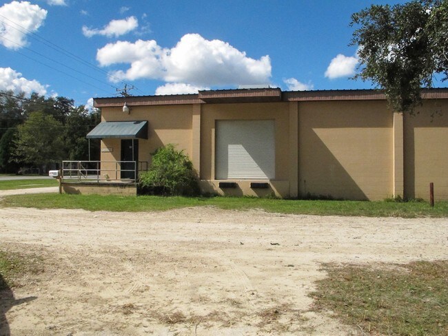
Property Detail
555 Highway 40 W
Gainesville, FL
34-16-16 0000.76 ACRES E 200 FT OF W 240 FT OF S 150 FT LYING N OF SR 40, OF SW1/4 OF SW1/4 OR BOOK 227 PAGE 174 -E 100 FT BEING A PART OF LOT 13 BLK A CASONS INGLIS ACRES UNIT 1- OR BOOK 521 PAGE 274 OR BOOK 1418 PAGE 406
02988-000-00
Levy
Vehiclerentalsvehiclesales
Florida
AE The base floodplain where base flood elevations are provided. AE Zones are now used on new format FIRMs instead of A1-A30 Zones.
13
2024
0.76 AC
2025
Florida Central North Area
970700
Other Market Areas
5,480 SF
NEARBY LISTINGS FOR SALE OR LEASE
DEMOGRAPHICS near 555 Highway 40 W
1 mile
3 mile
5 mile
2025 Total Population
1,111
4,338
5,189
2030 Population
1,231
4,847
5,781
Pop Growth 2025-2030
+ 10.80%
+ 11.73%
+ 11.41%
Average Age
52
51
51
2025 Total Households
544
2,004
2,390
HH Growth 2025-2030
+ 10.85%
+ 11.78%
+ 11.51%
Median Household Inc
$63,955
$58,825
$58,155
Avg Household Size
2.00
2.10
2.20
2025 Avg HH Vehicles
2.00
2.00
2.00
Median Home Value
$209,420
$224,570
$238,563
Median Year Built
1991
1988
1989
Nearby Places
Map Layers
Map Styles
 Street
 Aerial
Layers
 Traffic
 Biking
Places
Listings with unknown addresses are not visible on the map
- Restaurants
- Banks
- Shops
- Fitness
- Groceries
SALE & LEASE HISTORY
LISTING DATE
SALE/LEASE

Oct 24, 2016
For Sale
Nov 14, 2016
For Sale
Nearby Properties
Address
Land Use
TOTAL SIZE
Lot Size
Zoning
Address
Land Use
TOTAL SIZE
Lot Size
Zoning
759.70 AC
CON
Address
Land Use
TOTAL SIZE
Lot Size
Zoning
5,934 SF
44 AC
Address
Land Use
TOTAL SIZE
Lot Size
Zoning
390.83 AC
CON
Address
Land Use
TOTAL SIZE
Lot Size
Zoning
3,532 SF
24.48 AC
RVP
Address
Land Use
TOTAL SIZE
Lot Size
Zoning
514.79 AC
CON
Address
Land Use
TOTAL SIZE
Lot Size
Zoning
740 SF
24.31 AC
MHP
Address
Land Use
TOTAL SIZE
Lot Size
Zoning
7,490 SF
267.98 AC
CON
Address
Land Use
TOTAL SIZE
Lot Size
Zoning
19,252 SF
9 AC
Address
Land Use
TOTAL SIZE
Lot Size
Zoning
3,725 SF
413 AC
Address
Land Use
TOTAL SIZE
Lot Size
Zoning
5,444 SF
2.45 AC
RVP
Address
Land Use
TOTAL SIZE
Lot Size
Zoning
28,460 SF
10 AC
Address
Land Use
TOTAL SIZE
Lot Size
Zoning
2,548 SF
8.43 AC
Address
Land Use
TOTAL SIZE
Lot Size
Zoning
1,632 SF
2.04 AC
Address
Land Use
TOTAL SIZE
Lot Size
Zoning
169.26 AC
RVP
Address
Land Use
TOTAL SIZE
Lot Size
Zoning
25,699 SF
7.60 AC
Address
Land Use
TOTAL SIZE
Lot Size
Zoning
1,590 SF
2 AC
Address
Land Use
TOTAL SIZE
Lot Size
Zoning
3,785 SF
23.25 AC
CLR
Address
Land Use
TOTAL SIZE
Lot Size
Zoning
7,426 SF
5.05 AC
Address
Land Use
TOTAL SIZE
Lot Size
Zoning
16,500 SF
9.79 AC
Address
Land Use
TOTAL SIZE
Lot Size
Zoning
3,996 SF
375.65 AC
5500
Address
Land Use
TOTAL SIZE
Lot Size
Zoning
8,947 SF
4.32 AC
Address
Land Use
TOTAL SIZE
Lot Size
Zoning
10,960 SF
1.50 AC
Address
Land Use
TOTAL SIZE
Lot Size
Zoning
11,530 SF
40 AC
Address
Land Use
TOTAL SIZE
Lot Size
Zoning
8,208 SF
0.33 AC
Address
Land Use
TOTAL SIZE
Lot Size
Zoning
10,150 SF
1.15 AC
Address
Land Use
TOTAL SIZE
Lot Size
Zoning
11,080 SF
7.66 AC
Address
Land Use
TOTAL SIZE
Lot Size
Zoning
6,806 SF
1.77 AC
Address
Land Use
TOTAL SIZE
Lot Size
Zoning
8,664 SF
4.40 AC
RVP
Address
Land Use
TOTAL SIZE
Lot Size
Zoning
3,684 SF
2.15 AC
Address
Land Use
TOTAL SIZE
Lot Size
Zoning
5.28 AC
The World's #1 Commercial Real Estate Marketplace
Connect with us
© 2026 CoStar Group
The information above has been obtained from sources believed reliable. While we do not doubt its accuracy we have not verified it and make no guarantee, warranty or representation about it. It is your responsibility to independently confirm its accuracy and completeness. Any projections, opinions, assumptions, or estimates used are for example only and do not represent the current or future performance of the property. The value of this transaction to you depends on tax and other factors which should be evaluated by your tax, financial, and legal advisors. You and your advisors should conduct a careful, independent investigation of the property to determine to your satisfaction the suitability of the property for your needs.